Free UK postage
Nottinghamshire 12ne, 6". Woodhouse, 1899/1921, black outline and contours, blue geology. Geological Survey of England & Wales.
Nottinghamshire 12nw, 6". Healey, 1899/1921, black outline and contours, blue geology. Geological Survey of England & Wales.
Nottinghamshire 12sw, 6". Norton, 1899/1921, black outline and contours, blue geology. Geological Survey of England & Wales.
Nottinghamshire 45ne, 6". New Brinsley, 1921/1910 (sic), black outline, red geology. Geological Survey of England & Wales.
Nottinghamshire 50ne, 6". Stanley, 1901/1910, black outline, blue geology. Geological Survey of England & Wales.
Nottinghamshire 50ne, 6". Stanley, 1919/1910 (sic), black outline, blue geology. Geological Survey of England & Wales.
Nottinghamshire 50nw, 6". Breadsall, 1919/1910, black outline, blue geology. Geological Survey of England & Wales.
Odell, N.D. (1925). ‘Preliminary Notes on the Geology of the Eastern Parts of Central Spitzbergen: with special reference to Hecla Hook extract from the QJGS. Geological Society of London.
Old Series Ordnance Survey [reproduced] Maps, Volume 3 (1981). South-central England (Hampshire and the Isle of Wight and. Harry Margary.
Old Series Ordnance Survey [reproduced] Maps, Volume 6 (1989). Wales (except for small parts of Flintshire, Radnorshire, and . Harry Margary.
Old Series Ordnance Survey [reproduced]Maps, Volume 8 (1992). Northern England and the Isle of Man (Cumberland, Durham, Isle of Man,. Harry Margary.
Oldroyd, David (1998). Sciences of the Earth; Studies in the History of Mineralogy and Geology. Aldershott: Ashgate Variorum. 1st edition. Ashgate.
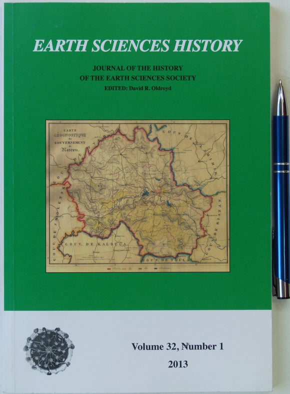
Oldroyd, David (ed).(2013). Earth Sciences History, v32, n1, 155pp. PB. See contents list in accompanying photo. Clean, unmarked and in new condition. Earth Sciences History.
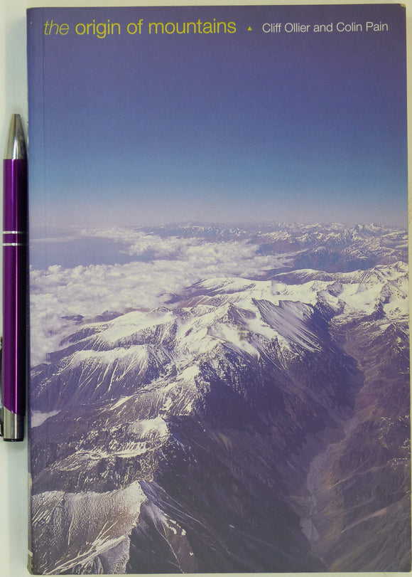
Ollier, Cliff & Pain, Colin. (2000). The Origin of Mountains. Cambridge University Press, 1st edn. 345 + xvii pp. PB. Cambridge University Press.
Oodnadatta, Sheet SG 53-15, zone 5, 1967, scale 1:250,000.
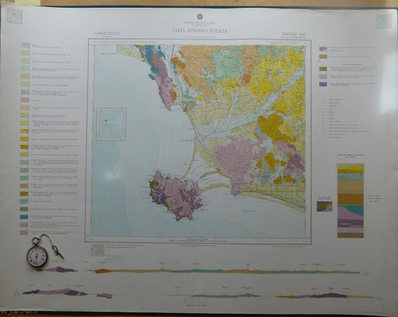
Orbitello, sheet 135, Carta Geologicad’Italia, 1968. 135 Orbitello.
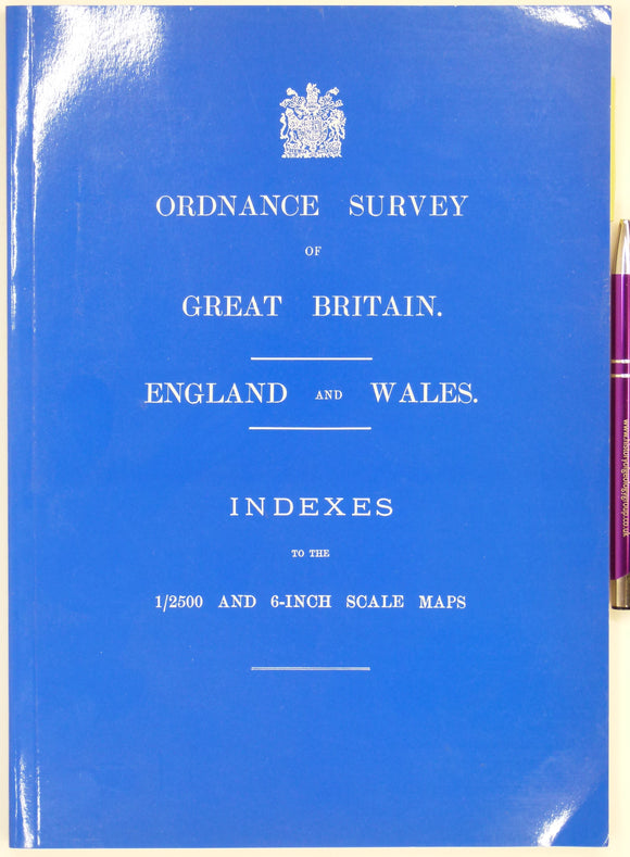
Ordnance Survey of Great Britain, England & Wales, Indexes to the 1/2500 and 6-inch Scale Maps. Newtown: David Archer (2002),. David Archer.
Orkneys. Flett, JS. (1900). ‘The Trap Dykes of the Orkneys’, offprint from Transactions of the Royal Society of Edinburgh, v39,. Royal Society of Edinburgh.
Osborne, Roger (1998). The Floating Egg: Episodes in the Making of Geology. London: Jonathan Cape. First Hardback edition. 372pp. Jonathan Cape.
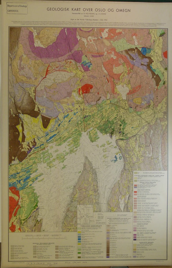
Oslo. 1952. Geologisk Kart Over Oslo of Omegn (geological map of Oslo & Region)
Oswald, Felix (1914). A Geological Map of the Caucasus, 1:1,000,000 scale. Colour lithograph, includes parts of Ukraine, Georgia, Armenia and Azerbaijan. self published.
Owen, D. Dale (1846). ‘Geological Chart of the Ohio Valley to accompany Dr. Dale Owen’s Paper’ in ‘On the Geology of the Western States of North America’, extract from QJGS. Geological Society of London.
Owen, Richard (1847). ‘On the fossil remains of mammalia . . . from the Eocene Sand formation of Hordle, New Hampshire, extract from QJGS, v.3, pt.1, pp.17-46 + fold-out fossil plate. Geological Society of London.
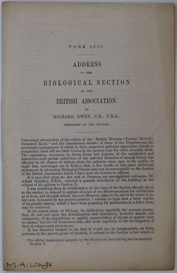
Owen, Richard (1881). ‘Address to the Biological Section of the British Association’ reprint from the BAAS. British Association.


![Old Series Ordnance Survey [reproduced] Maps, Volume 3 (1981). South-central England (Hampshire and the Isle of Wight and](http://geolmaps.com/cdn/shop/files/OldSeriesAtlasv3_1_{width}x.jpg?v=1710259664)
![Old Series Ordnance Survey [reproduced] Maps, Volume 3 (1981). South-central England (Hampshire and the Isle of Wight and](http://geolmaps.com/cdn/shop/files/OldSeriesAtlasv3_1_580x.jpg?v=1710259664)
![Old Series Ordnance Survey [reproduced] Maps, Volume 6 (1989). Wales (except for small parts of Flintshire, Radnorshire, and </em>](http://geolmaps.com/cdn/shop/files/OldSeriesAtlasv6_1_{width}x.jpg?v=1710259966)
![Old Series Ordnance Survey [reproduced] Maps, Volume 6 (1989). Wales (except for small parts of Flintshire, Radnorshire, and </em>](http://geolmaps.com/cdn/shop/files/OldSeriesAtlasv6_1_580x.jpg?v=1710259966)
![Old Series Ordnance Survey [reproduced]Maps, </em>Volume 8 (1992). Northern England and the Isle of Man (Cumberland, Durham, Isle of Man,](http://geolmaps.com/cdn/shop/files/OldSeriesAtlasv8_1_{width}x.jpg?v=1710260724)
![Old Series Ordnance Survey [reproduced]Maps, </em>Volume 8 (1992). Northern England and the Isle of Man (Cumberland, Durham, Isle of Man,](http://geolmaps.com/cdn/shop/files/OldSeriesAtlasv8_1_580x.jpg?v=1710260724)