Free UK postage
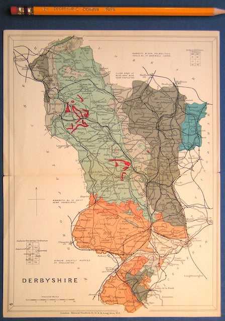
Derbyshire (1913) county geological map from Stanford’s Geological Atlas of Great Britain and Ireland, 3rd edition. Stanford's and Reynolds' Atlases.
Derbyshire (1913) county geological map from Stanford’s Geological Atlas of Great Britain and Ireland, 3rd edition. Approx. 1:480,000 scale. Colour printed map 16.5 x 25cm with centre fold, in good...
Regular price £1000 £10.00
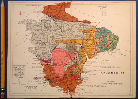
Devon (1913) county geological map from Stanford’s Geological Atlas of Great Britain and Ireland, 3rd edition. Stanford's and Reynolds' Atlases.
Devon (1913) county geological map from Stanford’s Geological Atlas of Great Britain and Ireland, 3rd edition. Approx. 1:640,000 scale. Colour printed map 16.5 x 25cm with centre fold, in good...
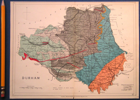
Durham (1913) county geological map from Stanford’s Geological Atlas of Great Britain and Ireland, 3rd edition. Stanford's and Reynolds' Atlases.
Durham (1913) county geological map from Stanford’s Geological Atlas of Great Britain and Ireland, 3rd edition. Approx. 1:350,000 scale. Colour printed map 16.5 x 25cm with centre fold, in good...
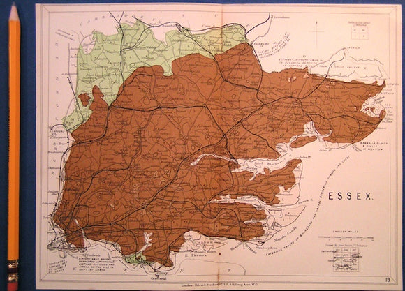
Essex (1913) county geological map from Stanford’s Geological Atlas of Great Britain and Ireland, 3rd edition. Stanford's and Reynolds' Atlases.
Essex (1913) county geological map from Stanford’s Geological Atlas of Great Britain and Ireland, 3rd edition. Approx. 1:480,000 scale. Colour printed map 16.5 x 25cm with centre fold, in good...
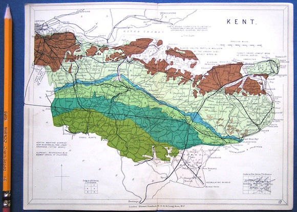
Kent (1913) county geological map from Stanford’s Geological Atlas of Great Britain and Ireland, 3rd edition. Stanford's and Reynolds' Atlases.
Kent (1913) county geological map from Stanford’s Geological Atlas of Great Britain and Ireland, 3rd edition. Approx. 1:480,000 scale. Colour printed map 16.5 x 25cm with centre fold, in good...
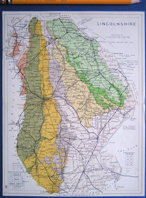
Lincolnshire (1913) county geological map from Stanford’s Geological Atlas of Great Britain and Ireland, 3rd edition. Stanford's and Reynolds' Atlases.
Lincolnshire (1913) county geological map from Stanford’s Geological Atlas of Great Britain and Ireland, 3rd edition. Approx. 1:480,000 scale. Colour printed map 16.5 x 25cm with centre fold, in good...
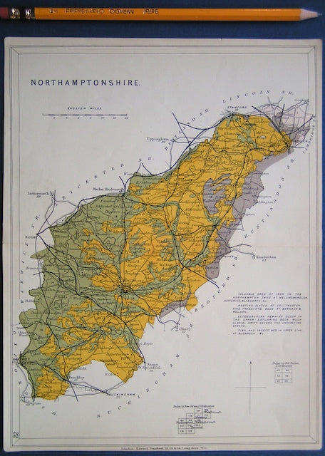
Northamptonshire (1913) county geological map from Stanford’s Geological Atlas of Great Britain and Ireland, 3rd edition. Stanford's and Reynolds' Atlases.
Northamptonshire (1913) county geological map from Stanford’s Geological Atlas of Great Britain and Ireland, 3rd edition. Approx. 1:480,000 scale. Colour printed map 16.5 x 25cm with centre fold, in good...
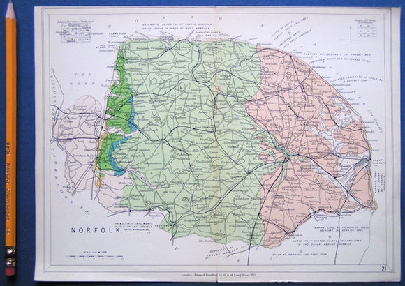
NorfolkNorfolk (1913) county geological map from Stanford’s Geological Atlas of Great Britain and Ireland, 3rd edition. Stanford's and Reynolds' Atlases.
Norfolk (1913) county geological map from Stanford’s Geological Atlas of Great Britain and Ireland, 3rd edition. Approx. 1:480,000 scale. Colour printed map 16.5 x 25cm with centre fold, in good...
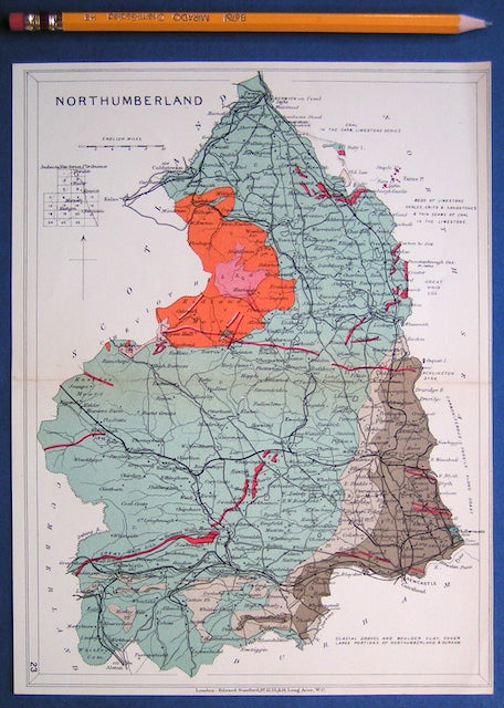
Northumberland (1913) county geological map from Stanford’s Geological Atlas of Great Britain and Ireland, 3rd edition. Stanford's and Reynolds' Atlases.
Northumberland (1913) county geological map from Stanford’s Geological Atlas of Great Britain and Ireland, 3rd edition. Approx. 1:350,000 scale. Colour printed map 16.5 x 25cm with centre fold, in good...
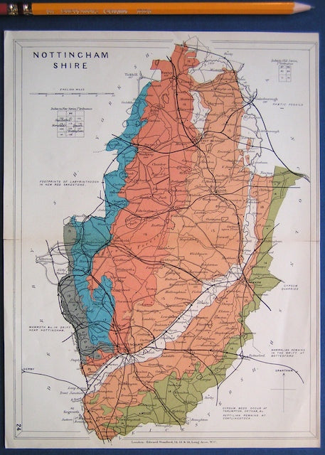
Nottinghamshire (1913) county geological map from Stanford’s Geological Atlas of Great Britain and Ireland, 3rd edition. Stanford's and Reynolds' Atlases.
Nottinghamshire (1913) county geological map from Stanford’s Geological Atlas of Great Britain and Ireland, 3rd edition. Approx. 1:350,000 scale. Colour printed map 16.5 x 25cm with centre fold, in good...
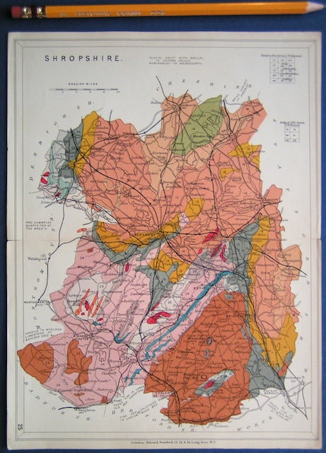
Shropshire (1913) county geological map from Stanford’s Geological Atlas of Great Britain and Ireland, 3rd edition. Stanford's and Reynolds' Atlases.
Shropshire (1913) county geological map from Stanford’s Geological Atlas of Great Britain and Ireland, 3rd edition. Approx. 1:480,000 scale. Colour printed map 16.5 x 25cm with centre fold, in good...
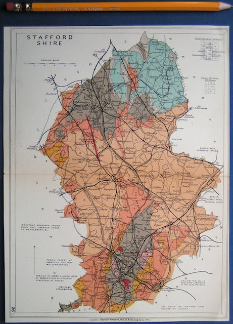
Staffordshire (1913) county geological map from Stanford’s Geological Atlas of Great Britain and Ireland, 3rd edition. Stanford's and Reynolds' Atlases.
Staffordshire (1913) county geological map from Stanford’s Geological Atlas of Great Britain and Ireland, 3rd edition. Approx. 1:400,000 scale. Colour printed map 16.5 x 25cm with centre fold, in good...
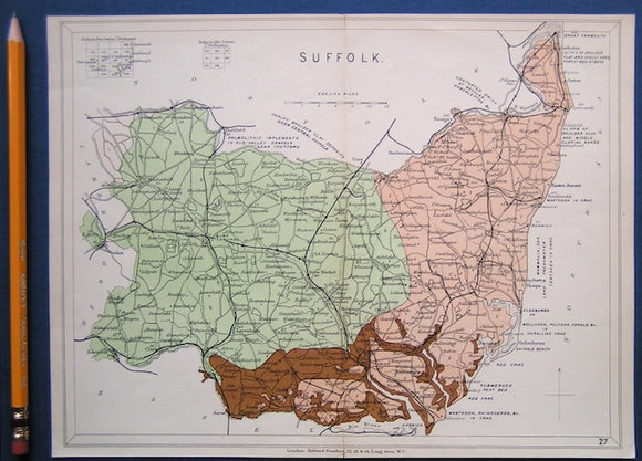
Suffolk (1913) county geological map from Stanford’s Geological Atlas of Great Britain and Ireland, 3rd edition. Stanford's and Reynolds' Atlases.
Suffolk (1913) county geological map from Stanford’s Geological Atlas of Great Britain and Ireland, 3rd edition. Approx. 1:480,000 scale. Colour printed map 16.5 x 25cm with centre fold, in good...
Bedfordshire, Buckinghamshire, Hertfordshire and Middlesex (1913) counties geological map from Stanford’s Geological Atlas. Stanford's and Reynolds' Atlases.
Bedfordshire, Buckinghamshire, Hertfordshire and Middlesex (1913) counties geological map from Stanford’s Geological Atlas of Great Britain and Ireland, 3rd edition. Approx. 1:480,000 scale. Colour printed map 16.5 x 25cm with...
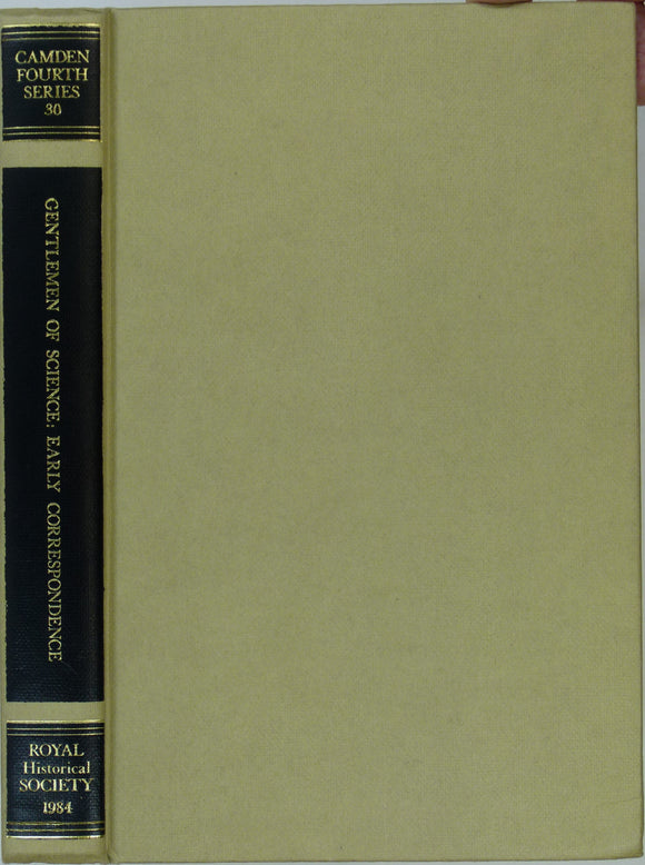
Morrell, Jack and Thackray, John (eds) (1984). Gentlemen of Science: Early Correspondence of the British Association for the Advancement of Science. Royal Historical Society.
Morrell, Jack and Thackray, John (eds) (1984). Gentlemen of Science: Early Correspondence of the British Association for the Advancement of Science. Camden Forth Series, vol. 30. London: Royal Historical Society,...
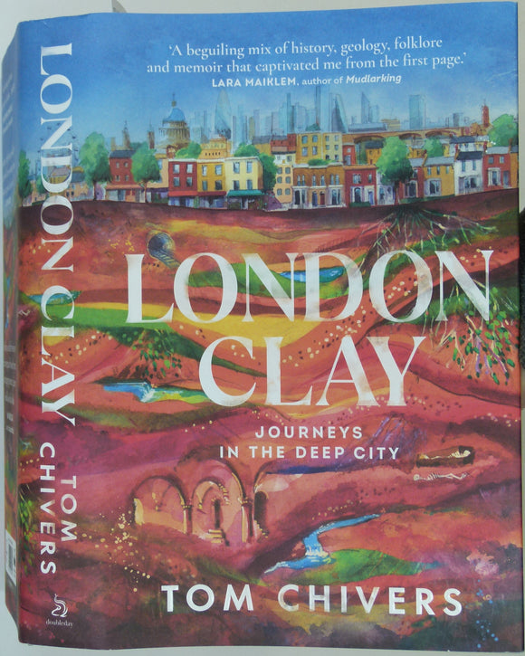
Chivers, Tom (2021). London Clay; Journeys in the Deep City. London: Doubleday, 449pp. Hardback. Doubleday.
Chivers, Tom (2021). London Clay; Journeys in the Deep City. London: Doubleday, 449pp. Hardback with dustjacket in new condition.
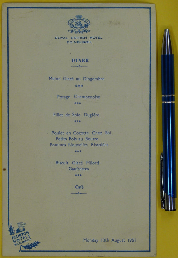
Autographed BA 1951 dinner menu. British Association Edinburgh meeting. Royal British Hotel menu 19 x 11.5cm for Monday 13th August, 1951. British Association.
Autographed BA 1951 dinner menu. British Association Edinburgh meeting. Royal British Hotel menu 19 x 11.5cm for Monday 13th August, 1951. Circulated to collect approximately 46 signatures as souvenir. Including:...
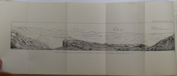
Avebury, Lord [Lubbock, John] ( 1906). The Scenery of Switzerland and the Causes to which it is due. London: MacMillan, 4th ed. Fair to good. MacMillan.
Avebury, Lord [Lubbock, John] ( 1906). The Scenery of Switzerland and the Causes to which it is due. London: MacMillan, 4th edition, 489 + xxix pp + 2pp adverts. First...
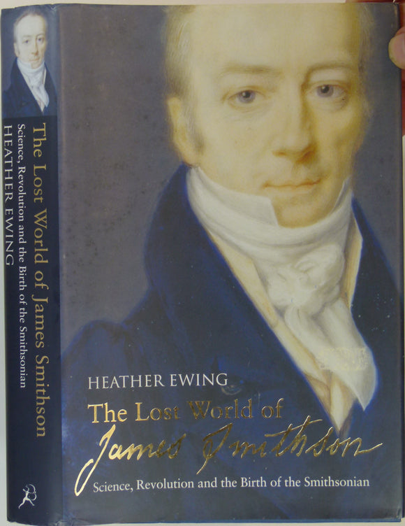
Ewing, Heather (2007). The Lost World of James Smithson; Science, Revolution and the Birth of the Smithsonian. London: Bloomsbury, 432 + x pp. Hardback. Bloomsbury.
Ewing, Heather (2007). The Lost World of James Smithson; Science, Revolution and the Birth of the Smithsonian. London: Bloomsbury, 432 + x pp. Hardback, blue cloth-covered boards with gilt lettering...
Richey, JE. (1932). ‘Tertiary Ring Structures in Britain’, extract from , Transactions of the Geological Society of Glasgow, v.19, pp.42--140. Geological Society of Glasgow.
Richey, JE. (1932). ‘Tertiary Ring Structures in Britain’, extract from , Transactions of the Geological Society of Glasgow, v.19, pp.42--140. Neat DIY paper cover, stapled . two foldout plates. Includes ring...

















![Avebury, Lord [Lubbock, John] ( 1906). The Scenery of Switzerland and the Causes to which it is due. London: MacMillan, 4th ed. Fair to good.](http://geolmaps.com/cdn/shop/products/SwissScenery2_1_{width}x.jpg?v=1668012399)
![Avebury, Lord [Lubbock, John] ( 1906). The Scenery of Switzerland and the Causes to which it is due. London: MacMillan, 4th ed. Fair to good.](http://geolmaps.com/cdn/shop/products/SwissScenery2_1_580x.jpg?v=1668012399)