Free UK postage
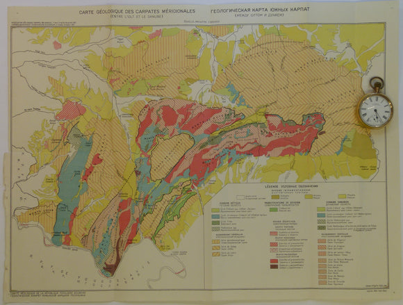
Romania. 1961. Carte Geologique des Carpates Meridionales (entre l’0lt at le Danube). 1:500,000
Romania. 1961. Carte Geologique des Carpates Meridionales (entre l’0lt at le Danube). 1:500,000 scale. Colour printed folded map, 38.5 x 51.5 cm. prepared for Association Geologique Carpato-Balkanique 5th congress. In...
Regular price £1000 £10.00
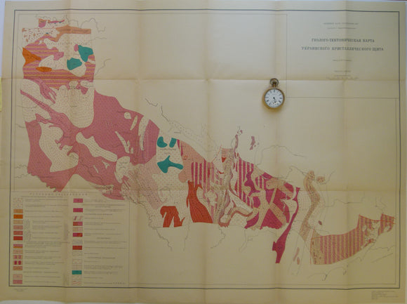
Semenchenko, H.I. 1963. Ukraine. Tectonic Map of Area between the Dneiper and Deneister Rivers. 1:1,000,000
Semenchenko, H.I. [семенченко, н.]. 1963. Ukraine. Tectonic Map of Area between the Dneiper and Deneister Rivers. 1:1,000,000 scale folded colour printed map 66 x 91cm. folding out from attached 15...
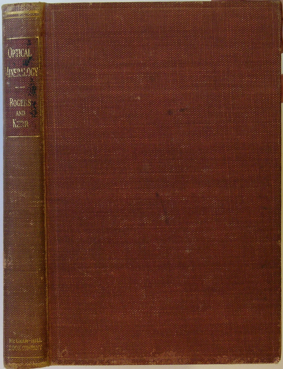
Rogers, AF and Kerr, PF, 1942. Optical Mineralogy. New York and London, McGraw-Hill
Rogers, AF and Kerr, PF, 1942. Optical Mineralogy. New York and London, McGraw-Hill, 2nd edn, 390pp. Hardback, 23.5 x 15.5cm, red-brown cloth-covered boards, considerable shelf-wear, slightly bumped and the rear...
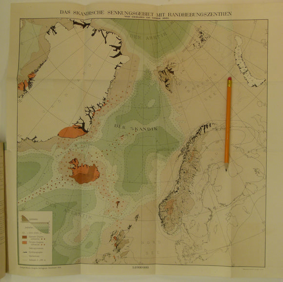
De Geer, G. 1911. Scandian Subsidence area with centres of uplift. Colour printed folded map
De Geer, G. 1911. Das Skandische Senkungsgebiet mit Randhebebungszentren. Colour printed folded map (41.5 x 33cm) at 1:800,000 (translates approx. as the Scandian Subsidence area with centres of uplift) with...
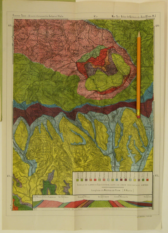
Sacco, Frederico, 1889. Untitled geological map of Castelnovo d’Asti (now Castelnuovo don Bosco) area (approx. 20km E of Turin)
Sacco, Frederico, 1889. Untitled geological map of Castelnovo d’Asti (now Castelnuovo don Bosco) area (approx. 20km E of Turin). Colour printed folded map (45.5 x 32cm) at 1:25,000 scale with...
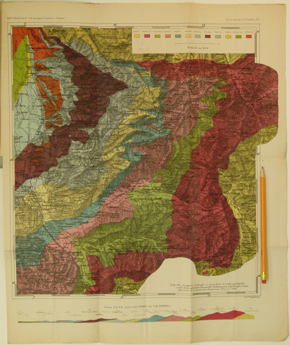
Sacco, Frederico, 1888. Untitled geological map of Villalvernia area (approx. 60km N of Genoa) in Liguria. Colour printed folded map
Sacco, Frederico, 1888. Untitled geological map of Villalvernia area (approx. 60km N of Genoa) in Liguria. Colour printed folded map (51 x 43cm) at 1:50,000 scale with ‘Il passagio tra...
Wales South 1944. Geological Map of the Prescelly Hills, North Pembrokeshire, colour. Geological So.
Wales South 1944. Geological Map of the Prescelly Hills, North Pembrokeshire, colour- printed folded map at 1:31,680 (2 ins = 1 mi), 31.5 x 39cm in ‘The Geology of the...
Wales South 1938. I – The River Scenery at the Head of the Vale of Neath. By Frederick J North. National Museum of Wales.
Wales South 1938. I – The River Scenery at the Head of the Vale of Neath. By Frederick J North. National Museum of Wales, Cardiff. 2nd edition. 60 pp. Paperback....
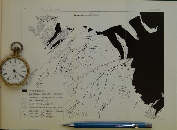
Wales North 1952. Untitled geological map of North Wales, B&W printed folded map
Wales North 1952. Untitled geological map of North Wales, B&W printed folded map at approx. 4 miles to 1 in. 20.5 x 26cm, in ‘The Structural Evolution of North Wales’...
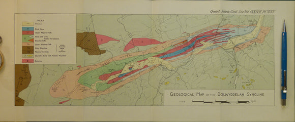
Wales North 1931. Geological Map of the Dolwyddelan Syncline, colour. Geological Society of London.
Wales North 1931. Geological Map of the Dolwyddelan Syncline, colour printed folded map at 1:21,120 (3 ins =1mile) 20 x 48cm, in ‘The Geology of the Dolwyddelan Syncline (North Wales)’...
Yorkshire 297 ne. Woolley Park. Surveyed 1933, issued 1939. Geological Survey of England & Wales.
Yorkshire 297 ne. Woolley Park. Surveyed 1933, issued 1939. Outline geology in blue on black basemap with red contours. Tape residue on top edge. In very good condition.
Yorkshire 295 sw and part Derbyshire 12. Sheffield. Surveyed 1950, issued 1957. Geological Survey of England & Wales.
Yorkshire 295 sw and part Derbyshire 12. Sheffield. Surveyed 1950, issued 1957. Outline geology in black on grey basemap with red contours. National grid information in red. Tape residue on...
Yorkshire 295 se. Aston. Surveyed 1951, issued 1955. Geological Survey of England & Wales.
Yorkshire 295 se. Aston. Surveyed 1951, issued 1955. Outline geology in black on grey basemap with red contours. National grid information in red. In very good condition.
Yorkshire 295 nw. Sheffield, east. Surveyed 1951, issued 1956. Geological Survey of England & Wales.
Yorkshire 295 nw. Sheffield, east. Surveyed 1951, issued 1956. Outline geology in black on grey basemap with red contours. National grid information in red. In very good condition.
Yorkshire 295 ne. Treeton. Surveyed 1951, issued 1957. Geological Survey of England & Wales.
Yorkshire 295 ne. Treeton. Surveyed 1951, issued 1957. Outline geology in black on grey basemap with red contours. National grid information in red. In very good condition.
Yorkshire 294 sw. Sheffield, west. Surveyed 1950, issued 1956. Geological Survey of England & Wales.
Yorkshire 294 sw. Sheffield, west. Surveyed 1950, issued 1956. Outline geology in black on grey basemap with red contours. National grid information in red. In very good condition.
Yorkshire 294 se. Sheffield. Surveyed 1949, issued 1956. Geological Survey of England & Wales.
Yorkshire 294 se. Sheffield. Surveyed 1949, issued 1956. Outline geology in black on grey basemap with red contours. National grid information in red. In very good condition.
Yorkshire 294 ne. Sheffield. Surveyed 1949, issued 1956. Geological Survey of England & Wales.
Yorkshire 294 ne. Sheffield. Surveyed 1949, issued 1956. Outline geology in black on grey basemap with red contours. National grid information in red. In very good condition.
Yorkshire 290 sw. Bramley. Surveyed 1951, issued 1955. Geological Survey of England & Wales.
Yorkshire 290 sw. Bramley. Surveyed 1951, issued 1955. Outline geology in black on grey basemap with red contours. National grid information in red. In very good condition.
Yorkshire 289 sw. Rotherham. Surveyed 1950, issued 1956. Geological Survey of England & Wales.
Yorkshire 289 sw. Rotherham. Surveyed 1950, issued 1956. Outline geology in black on grey basemap with red contours. National grid information in red. In very good condition.