Free UK postage
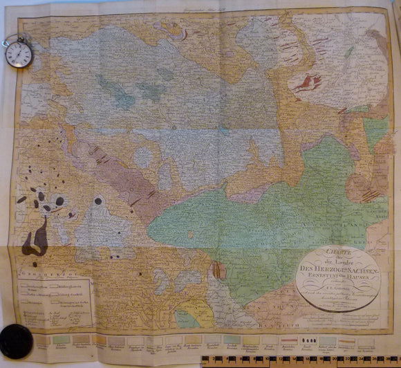
Charte uber die Laender des Herzoglich Sachsen-Ernestini sehen Hauses, 1823. 1823 Saxony-Ernestini.
Charte uber die Laender des Herzoglich Sachsen-Ernestini sehen Hauses, 1823 date on map. 54 x 61cm. Basemap by FL Gussefeld. Scale 1:250,000 approx. From Keferstein’s Geologie von Teutschland, v2. Folded,...
Regular price £15500 £155.00
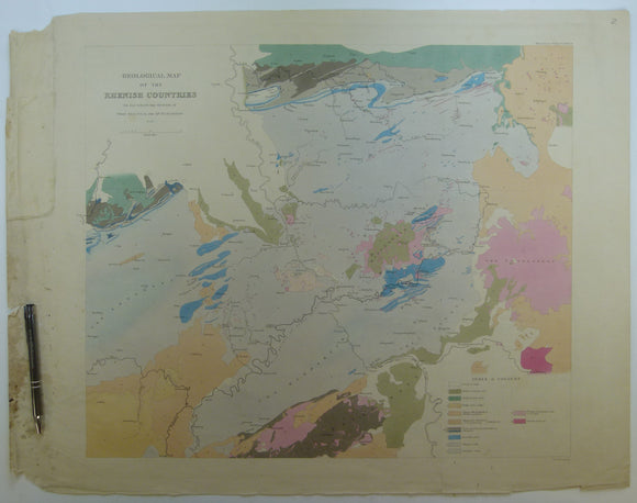
Sedgwick, A. and Murchison, R.I. (1842). ‘Geological Map of the Rhenish Countries’ from Transactions of the Geological Society,. Geological Society of London.
Sedgwick, A. and Murchison, R.I. (1842). ‘Geological Map of the Rhenish Countries’ from Transactions of the Geological Society, series 2, v.6, plate 24. Hand-coloured engraving by John Arrowsmith, 51 x...
Regular price £5000 £50.00
Deynhausen, v. and v. Dechen, (1825). ‘ [geognostische karte] Der Bleijberg Commern und seine Umbegung’. Hand-coloured engraving. Archiv fur Bergbau.
Deynhausen, v. and v. Dechen, (1825). ‘ [geognostische karte] Der Bleijberg Commern und seine Umbegung’ from Archiv Fur Bergbau and Huttenwesen, v.9. approx. scale 1:93,000. Hand-coloured engraving, 44.5 x 35.5,...
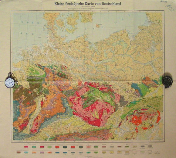
Kleine Geologische Karte von Deutschland, 1930. Geological Survey of Prussia.
Kleine Geologische Karte von Deutschland, 1930, scale 1:2,000,000. Folded colour print, 63x70cm. Wear on folds with minor tearing at start of folds and pinholes in corners. Signatures in upper right...
Regular price £1400 £14.00
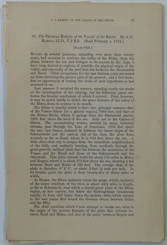
Ramsey, A.C, (1874). ‘the Physical History of the Valley of the Rhine’, extract from Transactions of the Geological Society. v.30, pp 81-95. Geological Society of London.
Ramsey, A.C, (1874). ‘the Physical History of the Valley of the Rhine’, extract from Transactions of the Geological Society. v.30, pp 81-95. Includes b/w lithograph map, ‘Map showing the present...
Regular price £800 £8.00
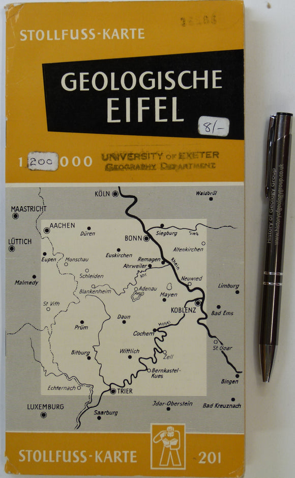
Eifel. Geologische Ubersichtskarte der Eifel und ihrer Umrandung (n.d.). Bonn: Wilhelm Stollfuss Verlag. Colour printed map 1:200,000,. Wilhlem Stollfuss Verlag.
Eifel. Geologische Ubersichtskarte der Eifel und ihrer Umrandung (n.d.). Bonn: Wilhelm Stollfuss Verlag. Colour printed map 1:200,000, 70 x 69 cm, folding to 23 x 10 cm in card folder....
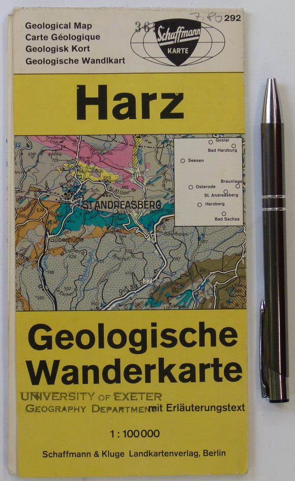
Harz Geologische Wanderkarte (n.d.). Berlin: Schaffmann und Kluge. Colour printed map and section, 59 x 49cm. Schaffman und Kluge.
Harz Geologische Wanderkarte (n.d.). Berlin: Schaffmann und Kluge. Colour printed map and section, 59 x 49cm folding to 20 x 10cm, scale 1:100,000. On reverse, brief regional geological account with...
[Geological Maps of] The Coal Fields of Westphalia and The Coal Fields of Bohemia, 1869, Plate 10, from Mines and Miners; or, Underground Life by L. Simonin
[Geological Maps of] The Coal Fields of Westphalia and The Coal Fields of Bohemia, 1869, Plate 10, from Mines and Miners; or, Underground Life by L. Simonin. London: Chapman and...
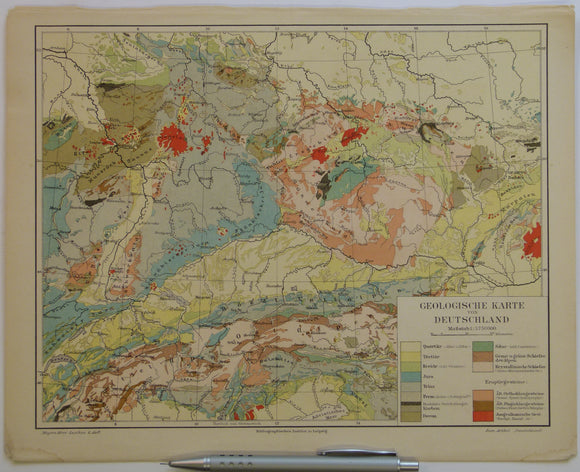
Anon 1902-08. ‘Geologische Karte von Deutschland’ colour printed map (24 x 30cm) at 1:3,750,000 scale from Myers-Konversations Lexicon
Anon 1902-08. ‘Geologische Karte von Deutschland’ colour printed map (24 x 30cm) at 1:3,750,000 scale from Myers-Konversations Lexicon, edition 6. Clean, bright colours, old centre-fold. Covers the solid geology and...
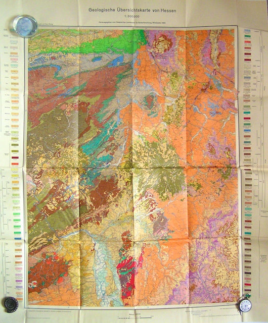
Geologische Ubersichtskarte von Hessen, 1960. Hesse Soil Survey.
Geologische Ubersichtskarte von Hessen, 1960, scale 1:300,000. Folded colour print, 102x85cm, together with explanatory booklet, 11pp, in German. Discreet library stamp in margin, in good condition.
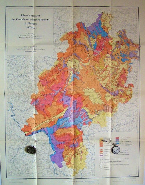
Ubersichtskarte der Grundwasserbeschaffenheitin Hessen (Overview map of Groundwater Quality of Hesse), 1966. Hesse Soil Survey.
Ubersichtskarte der Grundwasserbeschaffenheitin Hessen (Overview map of Groundwater Quality of Hesse), 1966, scale 1:300,000. Folded colour print, 95x72cm. Discreet library stamp in margin, in very good condition.


![Deynhausen, v. and v. Dechen, (1825). ‘ [geognostische karte] Der Bleijberg Commern und seine Umbegung’. Hand-coloured engraving](http://geolmaps.com/cdn/shop/products/German_13_Bleijberg_{width}x.jpg?v=1662814219)
![Deynhausen, v. and v. Dechen, (1825). ‘ [geognostische karte] Der Bleijberg Commern und seine Umbegung’. Hand-coloured engraving](http://geolmaps.com/cdn/shop/products/German_13_Bleijberg_580x.jpg?v=1662814219)


![[Geological Maps of] The Coal Fields of Westphalia and The Coal Fields of Bohemia, 1869, Plate 10, from Mines and Miners; or, Underground Life by L. Simonin](http://geolmaps.com/cdn/shop/products/P1080650_{width}x.JPG?v=1551270987)
![[Geological Maps of] The Coal Fields of Westphalia and The Coal Fields of Bohemia, 1869, Plate 10, from Mines and Miners; or, Underground Life by L. Simonin](http://geolmaps.com/cdn/shop/products/P1080650_580x.JPG?v=1551270987)