Free UK postage
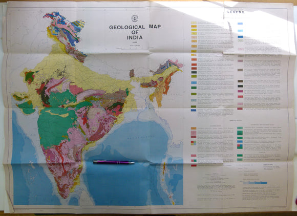
India. Anon (1993). Geological Map of India. Hyderabad: Geological Survey of India. Folded colour printed map, 1:5,000,000 scale,. Geological Survey of India.
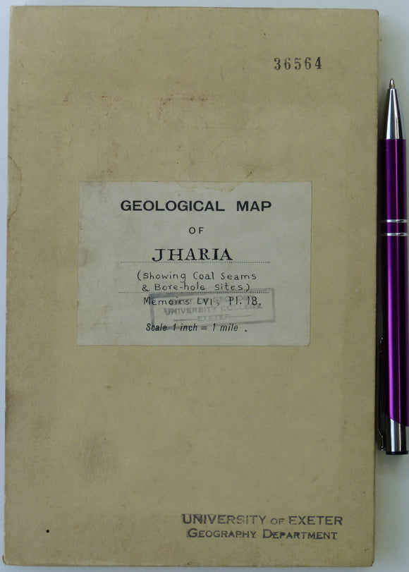
India. Anon. (1929). ‘Jharia Coal-Field Map Showing Coal Seams and Bore Hole Sites’ from Geological Survey of India Memoir, v.56,. Geological Survey of India.
India. Auden, J.B. (1949). Dykes in Western India, a Discussion of their Relationships with the Deccan Traps’, a reprint from Transactions. Geological Survey of India.
India. Ball, B. (1877). ‘On the Geology of the Mahanadi Basin and Its Vicinity [Odisha state]’, extract of The Records. Geological Survey of India.
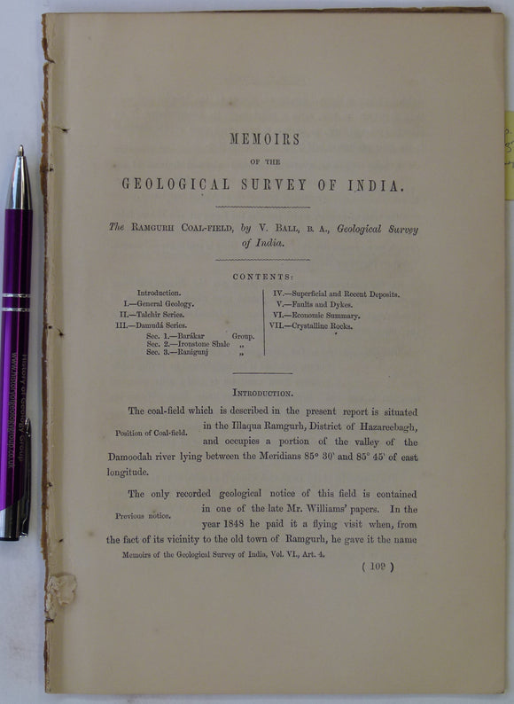
India. Ball, V. (1869). ‘The Ramgurh Coal-Field’, extract of The Memoirs of the Geological Survey of India,. Geological Survey of India.
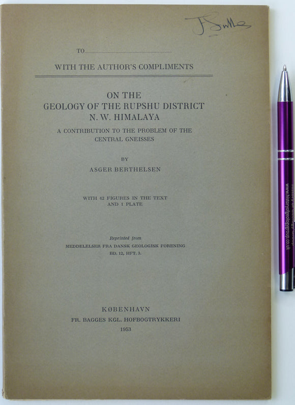
India. Berthelsen, Asger (1953). ‘On the Geology of the Rupshu District, North West Himalaya’ reprint from Meddelser fra Dansk Geologisk Forening, V.12. Geological Survey of India.
India. Blanford, W. T. (1869). ‘On the Geology of the Taptee and Lower Nerbudda Valleys and some adjoining districts [Madhya Pradesh state]’, extract. Geological Survey of India.
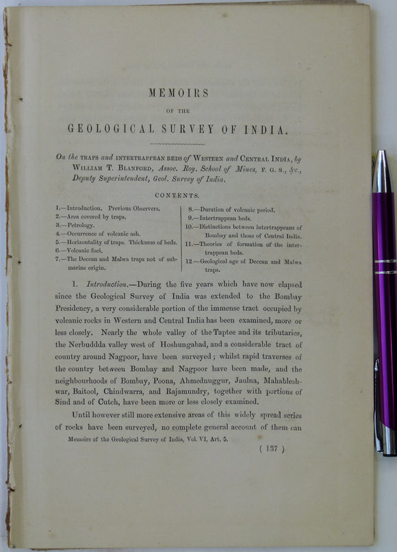
India. Blanford, W. T. (1869). ‘On the Traps and Intertrappean Beds of Western and Central India’, extract of The Memoirs of the Geological Survey of India,. Geological Survey of India.
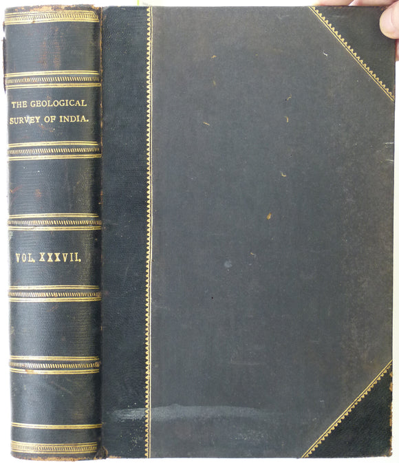
India. Fermor, L. Leigh (1909). ‘The Manganese Ore Deposits of India’ comprising all of volume 37 of Memoirs of the Geological Survey of India. Geological Survey of India.
India. Geological Map of Parts of Bundeland and Bogheland and of the Districts of Saugor [Sagar] and Jubulpore [Jabalpur], (1829), Upper Ganges River. Upper Ganges R.
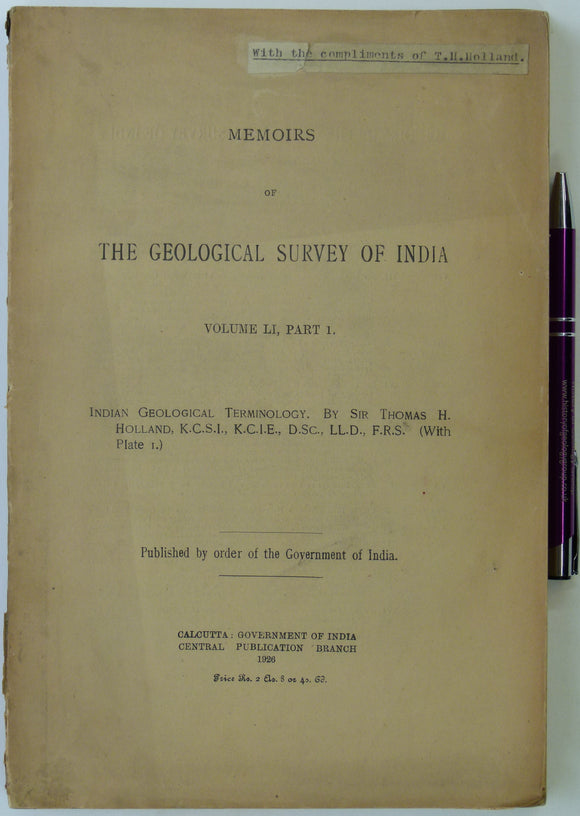
India. Holland, Thomas H. (1926). Indian Geological Terminology; Memoirs of the Geological Survey of India. Geological Survey of India.
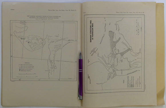
India. Hughes, T.W.H. (1877) ‘The Wardha Valley Coal-Field [Maharashtra State]’ and Geology of the Rajmehal Hills [West Bengal state]’ Memoirs of the Geological Survey of India, v.13,. Geological Survey of India.
India. Hughes, T.W.H. (1877). ‘Borings for Coal in India’, extract of The Records of the Geological Survey of India,. Geological Survey of India.
India. King, W. (1877). ‘Note on the Rocks of the Lower Godávari’, extract of The Records of the Geological Survey of India,. Geological Survey of India.
India. LaTouche, T.H.D. (1910). ‘Lakes of the Salt Range in the Punjab’, off print from The Records, Geological Survey of India,. Punjab.
India. Matley, C.A. (1939). ‘On Some Coprolites from the Maleri Beds of India’; off print from The Records,. Geological Survey of India.
India. McMahon, C.A. (1877). ‘The Blaini Group and the “Central Gneiss” of the Simla Himalayas’, extract of The Records. Geological Survey of India.
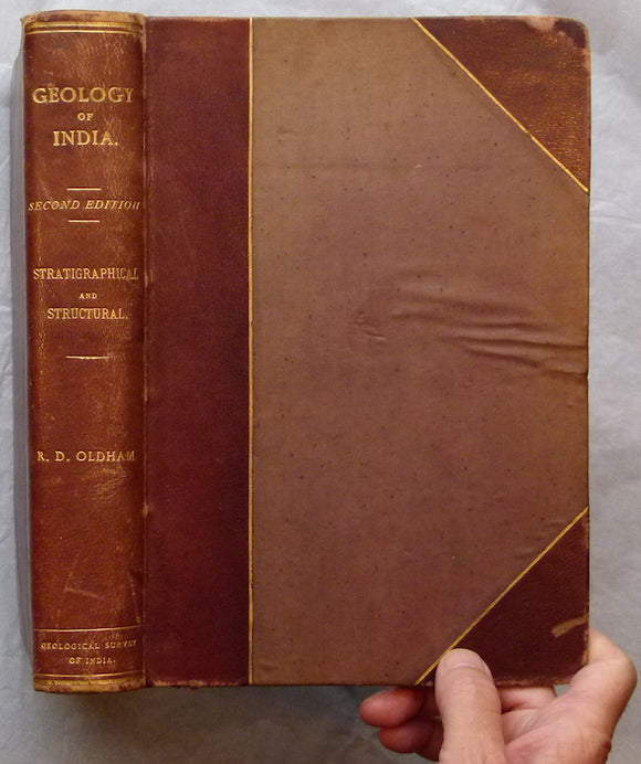
India. Oldham, R.D. (1893. A Manual of the Geology of India, chiefly compiled from the observations of the Geological Survey; Stratigraphical and Structural Geology, 2nd
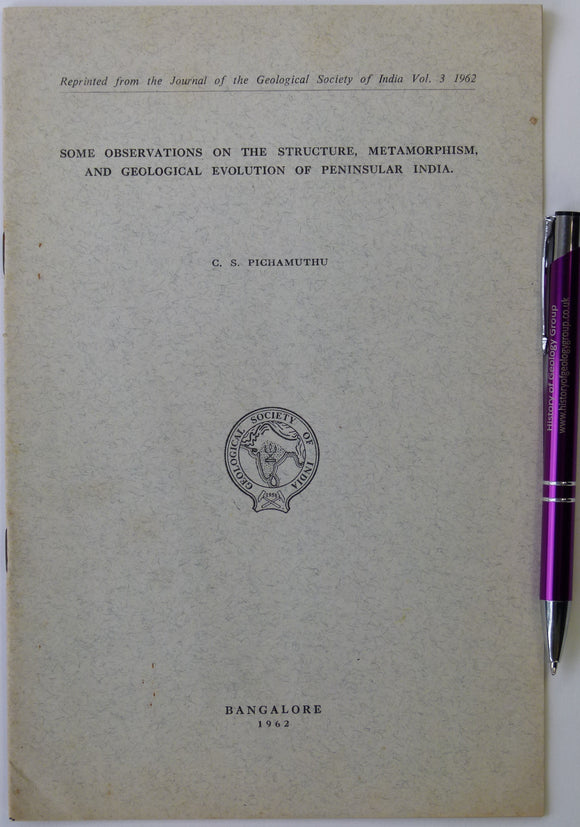
India. Pichamutha, C.S. (1962). ‘Some Observations on the Structure, Metamorphism, and Geology in the Evolution of Peninsular India’, Reprint. Geological Survey of India.
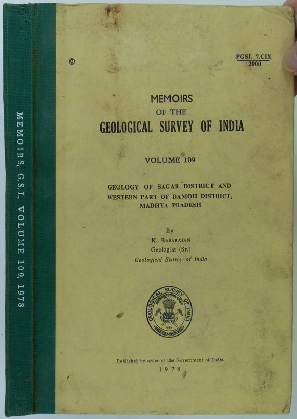
India. Rajarajan. (1978). ‘Geology of Sagar District and Western Part of Damoh District, Madhya Pradesh’, The Memoirs,. Geological Survey of India.
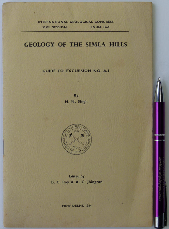
India. Singh, H.N. (1964). Geology of the Simla Hills; Guide to Excursion A-1 of International Geological Congress, XXII Session. New Delhi, 17pp. Geological Survey of India.
India. Sinha, Anshu K. (1989). Geology of the Higher Central Himalaya. Chichester: John Wiley and Sons. 1st edition, xiv + 219pp. Hardback. John Wiley.
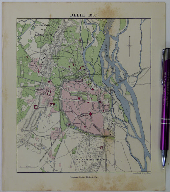
India. Smith, R.B. (1883). ‘Delhi 1857’, from Life of Lord Lawrence, NOT GEOLOGICAL. Smith Elder.
India. Stuart, M. (1919). ‘The Potash Salts of the Punjab Salt Range and Kohat and Suggestions regarding the Origin and History. Punjab.


![India. Ball, B. (1877). ‘On the Geology of the Mahanadi Basin and Its Vicinity [Odisha state]’, extract of The Records](http://geolmaps.com/cdn/shop/files/India5_21_Balla_{width}x.jpg?v=1711989637)
![India. Ball, B. (1877). ‘On the Geology of the Mahanadi Basin and Its Vicinity [Odisha state]’, extract of The Records](http://geolmaps.com/cdn/shop/files/India5_21_Balla_580x.jpg?v=1711989637)


![India. Blanford, W. T. (1869). ‘On the Geology of the Taptee and Lower Nerbudda Valleys and some adjoining districts [Madhya Pradesh state]’, extract](http://geolmaps.com/cdn/shop/files/India3_9_blanford2_{width}x.jpg?v=1711835977)
![India. Blanford, W. T. (1869). ‘On the Geology of the Taptee and Lower Nerbudda Valleys and some adjoining districts [Madhya Pradesh state]’, extract](http://geolmaps.com/cdn/shop/files/India3_9_blanford2_580x.jpg?v=1711835977)


![India. Geological Map of Parts of Bundeland and Bogheland and of the Districts of Saugor [Sagar] and Jubulpore [Jabalpur], (1829), Upper Ganges River](http://geolmaps.com/cdn/shop/products/india-upperganges_{width}x.jpg?v=1522955082)
![India. Geological Map of Parts of Bundeland and Bogheland and of the Districts of Saugor [Sagar] and Jubulpore [Jabalpur], (1829), Upper Ganges River](http://geolmaps.com/cdn/shop/products/india-upperganges_580x.jpg?v=1522955082)

![India. Hughes, T.W.H. (1877) ‘The Wardha Valley Coal-Field [Maharashtra State]’ and Geology of the Rajmehal Hills [West Bengal state]’ <em>Memoirs of the Geological Survey of India</em>, v.13,](http://geolmaps.com/cdn/shop/files/India_60_MemGSI13_{width}x.jpg?v=1709635309)
![India. Hughes, T.W.H. (1877) ‘The Wardha Valley Coal-Field [Maharashtra State]’ and Geology of the Rajmehal Hills [West Bengal state]’ <em>Memoirs of the Geological Survey of India</em>, v.13,](http://geolmaps.com/cdn/shop/files/India_60_MemGSI13_580x.jpg?v=1709635309)