Free UK postage
India. Sykes, Col. (1851). On a Fossil Fish from the Table-land of the Deccan, in the Peninsula of India. Extract from Quarterly. Geological Society of London.
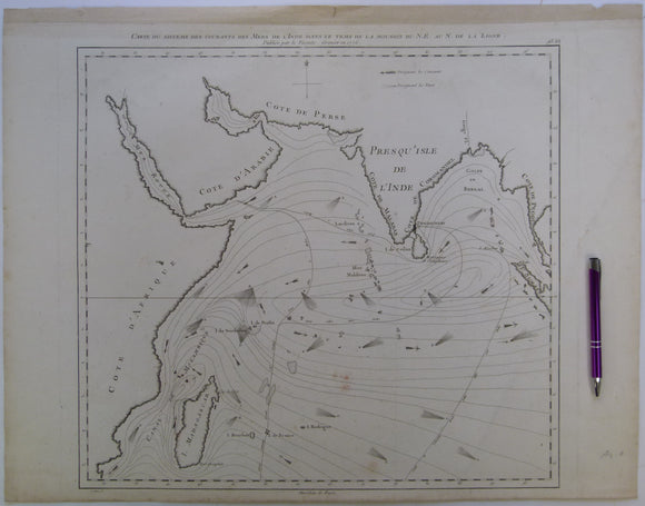
Indian Ocean. Grenier, Jacques-Raymond de (1776). Carte du Sisteme des Courantes des Mers de l’Inde dans le Tems de la Mousson du NE au N. de la Ligne. Paris: Lattré. Lattre.
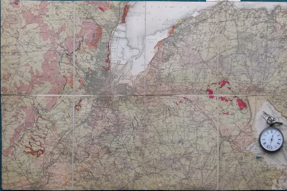
Indian Ocean; [Map of the] Distribution of Oceanic Deposits, John Murray, 1889. In ‘On Marine Deposits in the Indian, Southern and Antarctic Oceans’. Scottish Geographical Society.
Indonesia. (1972). Reconnaissance Hydrogeological Map , Bali. Geological Survey of Indonesia. 1:250,000 scale. Colour. Geological Survey of Indonesia.
Insole, Allan et al, (1998). The Isle of Wight; Guide No.60. Geologists’ Association, first edition. 132pp. PB,. Geologists' Association.
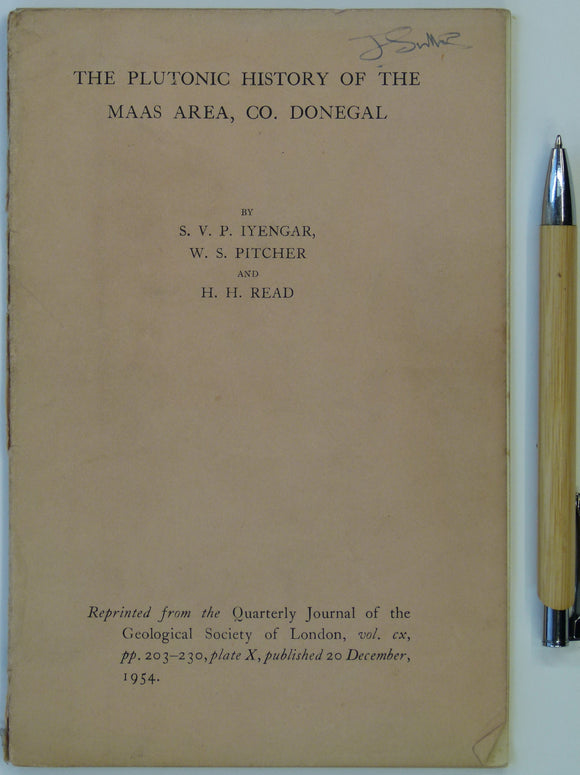
Inyangar, S.V.P., Pitcher, W.S., and Read, H.H. (1954). ‘The Geology of the Maas Area, Co. Donegal’, in ‘The Plutonic History of the Maas Area’, a reprint. Geological Society of London.
Iran. Masjid-I-Sulaiman Road Map (1954). A.I.O.C. [Anglo-Iranian Oil Company] 1:21,120 scale. Folded linen-backed paper (65 x 100cm), 3 colour linework. NOT GEOLOGICAL. Anglo-Iranian Oil Co.
Ireland sheet 7, Giant’s Causeway, 1” scale. 1887. 1st ed. Covers Portrush and Ballin. 55% sea. Base map 1865. Hand-coloured. Geological Survey of Ireland.
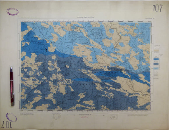
Ireland sheet 107, Ballinasloe, 1” scale. 1867. First edition. Base map not dated. Coloured 1903. Hand-coloured
Ireland sheet 11, Londonderry, 1” scale. 1890. First edition. Covers Rathmelton and Buncrana. Base map 1863. Hand-coloured. Geological Survey of Ireland.
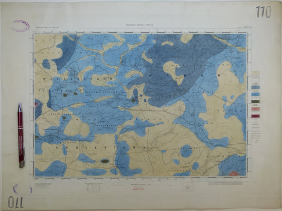
Ireland sheet 110, Edenderry, 1” scale. 1864. First edition. Base map not dated. Hand-coloured engraving,. geo.
Ireland sheet 13, Coleraine, 1” scale. 1883. First edition. Covers Garvagh, Ballymoney. Base map 1867. Hand-coloured. Geological Survey of Ireland.
Ireland sheet 19, Maghera, 1” scale. 1882. First edition. Covers Kilrea, Ahoghill, Portglenone. Base map 1868. Geological Survey of Ireland.
Ireland sheet 19, Maghera, 1” scale. 1882. First edition. Covers Kilrea, Ahoghill, Portglenone. Base map 1868. Hand-coloured. Geological Survey of Ireland.
Ireland sheet 20, Ballymena, 1” scale. 1883. First edition. Covers to northeast coast from Ballymena. coloured 1904. Geological Survey of Ireland.
Ireland sheet 21, Larne, 1” scale. 1869. First edition. Covers to Lough Larne, 85% sea. Base map undated. Hand-coloured. Geological Survey of Ireland.
Ireland sheet 21, Larne, 1” scale. 1883. Covers to Lough Larne, 85% sea. Base map undated. Hand-coloured. Geological Survey of Ireland.
Ireland sheet 26, Draperstown, 1” scale. 1882. First edition. Base map 1870. Hand-coloured engraving. Geological Survey of Ireland.
Ireland sheet 27, Cookstown, 1” scale. 1880. First edition. Base map 1867. Covers NW of Lough Neagh. Hand -coloured. Geological Survey of Ireland.
Ireland sheet 28, 29, 36, 37 drift, 1". Belfast Special Sheet, 1910. Colour print, 30.5 x 46.5cm,. Geological Survey of Ireland.
Ireland sheet 28, Antrim, 1” scale. 1874. First edition. Base map 1864. Covers NE of Lough Neagh. Hand -coloured. Geological Survey of Ireland.


![Indian Ocean; [Map of the] Distribution of Oceanic Deposits, John Murray, 1889. In ‘On Marine Deposits in the Indian, Southern and Antarctic Oceans’](http://geolmaps.com/cdn/shop/products/IndianO.deposits1889J_1_{width}x.jpg?v=1617639637)
![Indian Ocean; [Map of the] Distribution of Oceanic Deposits, John Murray, 1889. In ‘On Marine Deposits in the Indian, Southern and Antarctic Oceans’](http://geolmaps.com/cdn/shop/products/IndianO.deposits1889J_1_580x.jpg?v=1617639637)


![Iran. Masjid-I-Sulaiman Road Map (1954). A.I.O.C. [Anglo-Iranian Oil Company] 1:21,120 scale. Folded linen-backed paper (65 x 100cm), 3 colour linework. NOT GEOLOGICAL.](http://geolmaps.com/cdn/shop/files/Asia_13_Masjid_{width}x.jpg?v=1741886934)
![Iran. Masjid-I-Sulaiman Road Map (1954). A.I.O.C. [Anglo-Iranian Oil Company] 1:21,120 scale. Folded linen-backed paper (65 x 100cm), 3 colour linework. NOT GEOLOGICAL.](http://geolmaps.com/cdn/shop/files/Asia_13_Masjid_580x.jpg?v=1741886934)