Free UK postage
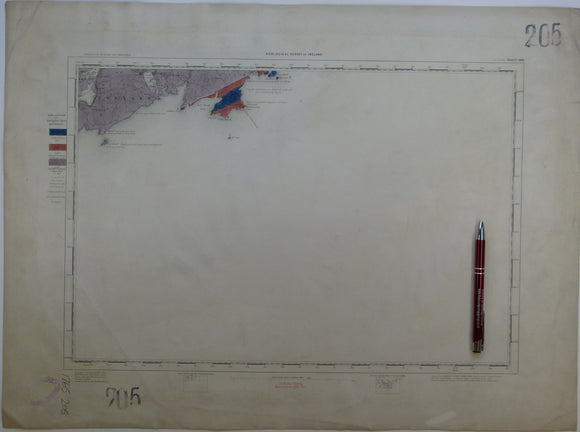
Ireland sheet 205, Toe Head, 1” scale. 1881. Base map not dated. Coloured 1907. 90% sea. Hand-coloured. Geological Survey of Ireland.
Ireland sheet memoir 126/125, (Roscrea/ Maryborough) 1862. Explanations - Sheet 126 (and the portion of 125 lying east of the Shannon). Near fine condition. Geological Survey of Ireland.
Ireland sheet memoir 135, (Ennis) 1860. Explanations - Sheet 135 - illustrating parts of Tipperary and King’s and Queens’s Counties. Near fine condition. Geological Survey of Ireland.
Ireland sheet memoir 154, (Tipperary) 1861. Explanations - Sheet 154 - illustrating parts of Tipperary and the King’s and Queens’s Counties. Near fine condition. Geological Survey of Ireland.
Ireland sheet memoir 155, (Cashel) 1860. Explanations - Sheet 155 - illustrating part of the County of Tipperary. Very good condition. Geological Survey of Ireland.
Ireland sheet memoir 156, (Callan) 1858. Descriptions - Sheet 46 NW - illustrating part of the Maps of the GSI. Very good condition. Geological Survey of Ireland.
Ireland sheet memoir 158/159, (Enniscorthy/ Blackwater) 1882. Explanatory Memoir - Sheets 158/159 – of the District of Enniscorthy. Very good condition. Geological Survey of Ireland.
Ireland sheet memoir 36, (Belfast) 1970. Geology of Belfast and the Lagan Valley (One-inch geological sheet 36). As new condition. Geological Survey of Ireland.
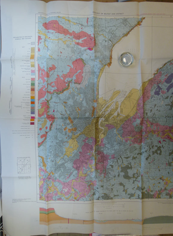
Ireland. Geology of Belfast and District: Special Engineering Geology Sheet, Solid and Drift. (1971). Geological Survey of Northern Ireland. Colour print,. Geological Survey of N. Ireland.
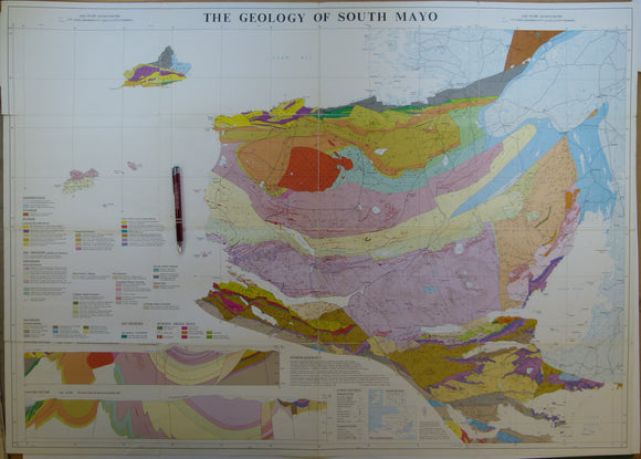
Ireland. The Geology of South Mayo. (1985). University of Glasgow. Colour print, folded, 72 x 101cm. Scale 1:63,360. University of Glasgow.
Isle of Wight (1886). ‘Tourist Map of the Isle of Wight, coloured Geologically’. London: T. Nelson. Flat colour printed map 1:100,000. Thomas Nelson.
Israel (1939). Geological Map of Palestine. Jaffa: Survey of Palestine, 1: 250,000 scale. Colour lithograph. Survey of Palestine.
Israel (1964). Geological Map of Israel: Jerusalem-Bet Shemesh. Ministry of Development, Geological Survey. 1: 50,000 scale. Colour. Geological Survey of Israel.
Jamaica (1958). Jamaica, Geology. Directorate of Overseas Surveys (Geology) 1099. Provisional edition. 1:250,000 scale, 73 x 100cm. Colour lithograph. In good condition. Directorate of Overseas Surveys.
Jamaica (1958). Jamaica, Geology. Directorate of Overseas Surveys (Geology) 1099. Provisional edition. 1:250,000 scale, 74 x 104cm. Colour lithograph. In good to very condition. Directorate of Overseas Surveys.
Jamaica (1958). Jamaica, Geology. Directorate of Overseas Surveys (Geology) 1099. Provisional edition. 1:250,000 scale, 74 x 104cm. Colour lithograph. In very good condition. Directorate of Overseas Surveys.
Jamieson, Thomas F., (1863). ‘Sketch-Map of a part of of Lochaber’. Fold-out colour printed map, 1:253,440. QJGS.
Japan (1956).Geological Map of Japan. Tokyo: Geological Survey of Japan. Colour lithograph on linen-backed paper. 1:2,000,000. Japanese Geological Survey.
Japan, Korea, Taiwan (1911).Geological Map of Japanese Empire. Tokyo: Imperial Geological Survey, Feb 1911. Colour lithograph in four quarter. Japanese Geological Survey.
Jardine, Lisa. (1999). Ingenious Pursuits; Building the Scientific Revolution. Doubleday, New York. Doubleday.
Jehu, T.J. (1922). The Archaean and Torridonian formations and the Later Intrusive Igneous Rocks of Iona. Edinburgh: Royal Society. Royal Society of Edinburgh.
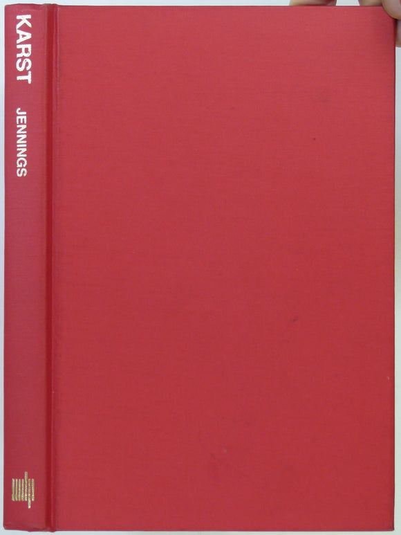
Jennings, JN. (1973). Karst. Cambridge, Mass.: MIT Press 2nd printing of 1st edition of 1971. MIT Press.
Jha, Alok. (2016). The Water Book; the Extraordinary story of our most ordinary substance. London: Headline, 376pp. 1st edition. Headline.