Free UK postage
Ayrshire, 50 (1868)1:10,560 scale OS basemap 1860. Covers Dailly and part of Dailly district. Colour washed engraving,. British Geological Survey.
Babbage, C. (1847). ‘Observations on the Temple of Serapis, at Pozzuoli, near Naples, . . . on . . .causes [of] Geological Cycles of Great Extent’ extract from the QJGSS. Geological Society of London.
Bailey, E.B. (1916).’The Islay Anticline (Inner Hebrides)’ extract from the Quarterly Journal of the Geological Society, v.72,. Geological Society of London.
Bailey, E.B. (1916).’The Structure of the South-West Highlands of Scotland’, extract from the Quarterly Journal of the Geological Society, v.72. Geological Society of London.
Bailey, E.B. (1921). ‘the Structure of the South-West Highlands of Scotland’ in QJGS. Geological Society of London.
Bailey, E.B. (1921).’The Islay Anticline (Inner Hebrides)’, extract from the Quarterly Journal of the Geological Society, v.77. Geological Society of London.
Bailey, E.B. (1938).’Eddies in Mountain Structures’, offprint of the Quarterly Journal of the Geological Society, v.94,. Geological Society of London.
Bailey, E.B. (1945).’Tertiary Igneous Tectonics of Rhum (Inner Hebrides)’, offprint of the QJGS, v.100. Geological Society of London.
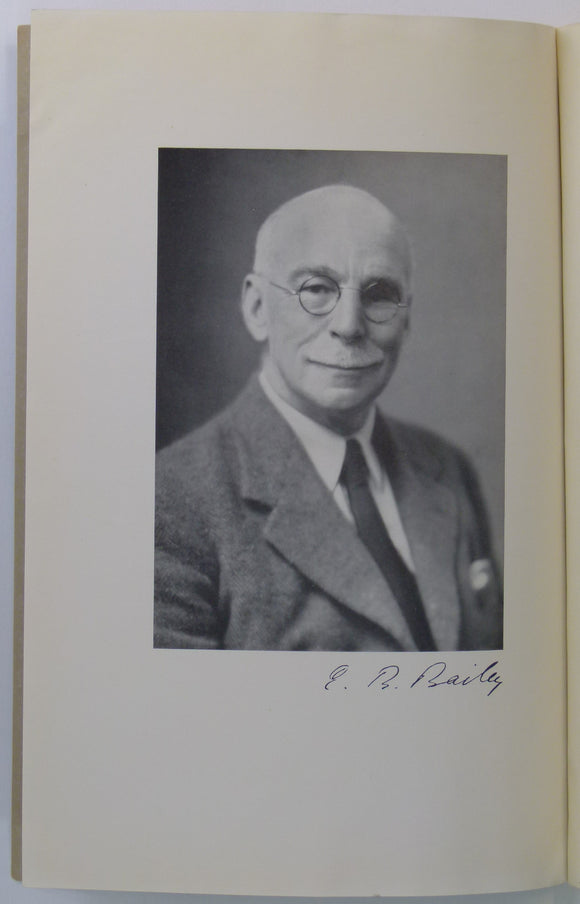
Bailey, Edward (1952). Geological Survey of Great Britain, London, Thos. Murby,. Thomas Murby.
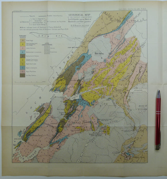
Bailey, Edward B, (1910), ‘Geological Map of the District Lying Between Loch Linnhe and the Moor of Rannoch and Etive Granites. QJGS.
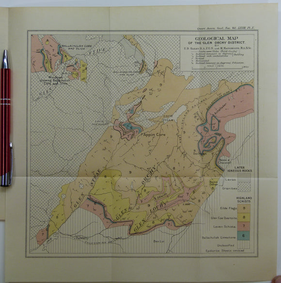
Bailey, Edward B, (1912), ‘Geological Map of the Glen Orchy District. Fold-out colour printed geological map. QJGS.
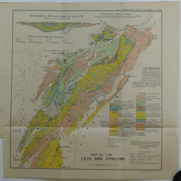
Bailey, Edward B, (1913), ‘Map of the Loch Awe Syncline’. Fold-out colour printed geological map and section. QJGS.
Bailey, Edward Battersby, 1881-1965, anon. (1965). Reprinted from Biographical Memoirs of Fellows of the Royal Society. Royal Society.
Bailey, Patrick (2004) Orkney. Newton Abbot, Pevensey Island Guides/ David & Charles. David & Charles.
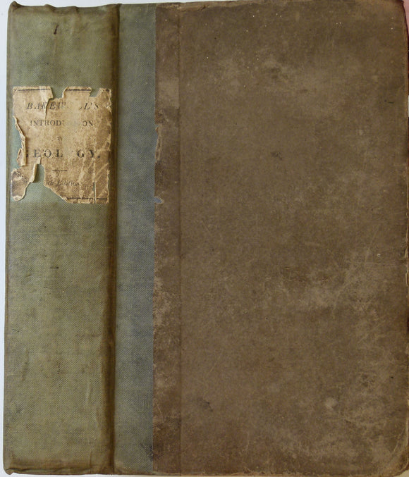
Bakewell, Robert. 1838. An Introduction to Geology: intended to convey a practical knowledge of the Science. Longman et al.
Ball, John (1898). The Western Alps; the Alpine Guide. London: Longmans, Green and Co. 3rd edition. xlix + 612pp. Hardback,. Longman et al.
Balme, M/R. et al. (2011). Martian Geology . London: Geological Society of London, special publication 356, 307pp. Hardback. Rijks Geologische Dienst.
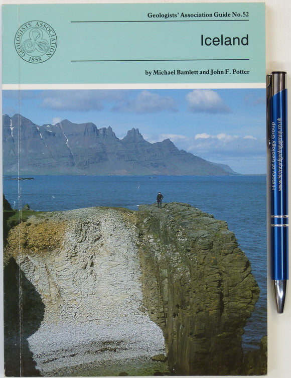
Bamlett, M and Potter, JF (1994). Iceland, Geologists’ Association Guide No.52. London:. Geologists' Association.
Banks, Sir Joseph. No date. Lithograph, 28 x 19 cm. portrait area 13.5 x 10.5 cm of engraving by C E Wagstaff c.1835
Barbados, Geology [Map] of the Scotland Area (1982) 1st edition. Directorate of Overseas Surveys, series 1228. Colour printed map at 1:20,000. Directorate of Overseas Surveys.
Barcelona – sheet 421, Mapa Geologico de Espana, 1978. IGME.
Barron, R.S. (1976). The Geology of Wiltshire; a Field Guide. Bradford-on-Avon: Moonraker Press, 1st edition. Moonraker Press.
Barrow, G. (1904), ‘ Moine Gneisses of the East-Central Highlands and their Position in the Highland Sequence’, extract from the Quarterly Journal of the Geological Society. Geological Society of London.
Barton, DB, 1967. A History of Tin Mining and Smelting in Cornwall. Truro:. published by author.


![Babbage, C. (1847). ‘Observations on the Temple of Serapis, at Pozzuoli, near Naples, . . . on . . .causes [of] Geological Cycles of Great Extent’ extract from the QJGSS](http://geolmaps.com/cdn/shop/files/SerapisBabbage_1_{width}x.jpg?v=1754601279)
![Babbage, C. (1847). ‘Observations on the Temple of Serapis, at Pozzuoli, near Naples, . . . on . . .causes [of] Geological Cycles of Great Extent’ extract from the QJGSS](http://geolmaps.com/cdn/shop/files/SerapisBabbage_1_580x.jpg?v=1754601279)


![Barbados, Geology [Map] of the Scotland Area (1982) 1st edition. Directorate of Overseas Surveys, series 1228. Colour printed map at 1:20,000](http://geolmaps.com/cdn/shop/files/Barbados_1_{width}x.jpg?v=1720347469)
![Barbados, Geology [Map] of the Scotland Area (1982) 1st edition. Directorate of Overseas Surveys, series 1228. Colour printed map at 1:20,000](http://geolmaps.com/cdn/shop/files/Barbados_1_580x.jpg?v=1720347469)