Free UK postage
Barton, R.M. (1964). An Introduction to the Geology of Cornwall. Truro: the Truro Bookshop, 1st edition 168 pp. Hardback,. self published.
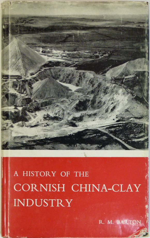
Barton, RM, 1966. A History of the Cornish China-Clay Industry. Truro:. published by author.
Bassett, M.G. (ed) (1982). Geological Excursions in Dyfed, South-West Wales. Cardiff: National Museum of Wales. National Museum of Wales.
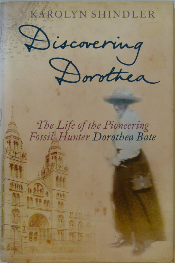
Bate, Dorothea. Discovering Dorothea;the Life of the Pioneering Fossil-Hunter Dorothea Bate, (2005), by Karolyn Shindler. Harper Collins.
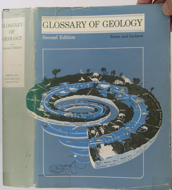
Bates, R.L. & Jackson, J.A. (eds). (1980). Glossary of Geology. Falls Church, VA: American Geological Institute, 2nd revised edn. 751. American Geological Institute.
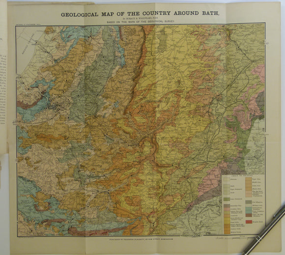
Bath. Geological Map of the Country Around Bath (c.1900.). Horace B Woodward. Folded, colour printed map 42 x 46cm, 1” = 2 miles,. Geologists' Association.
Bathurst, sheet SI 55-8, 1966, scale 1:250,000 Colour print 27"x40", folded, wear on folds, in Fair to…
Bauerman, Hilary. (1881). Text-Book of Systematic Mineralogy. London: Longman et al, 1st edition, vii + 367 pp. Hardback. Longman et al.
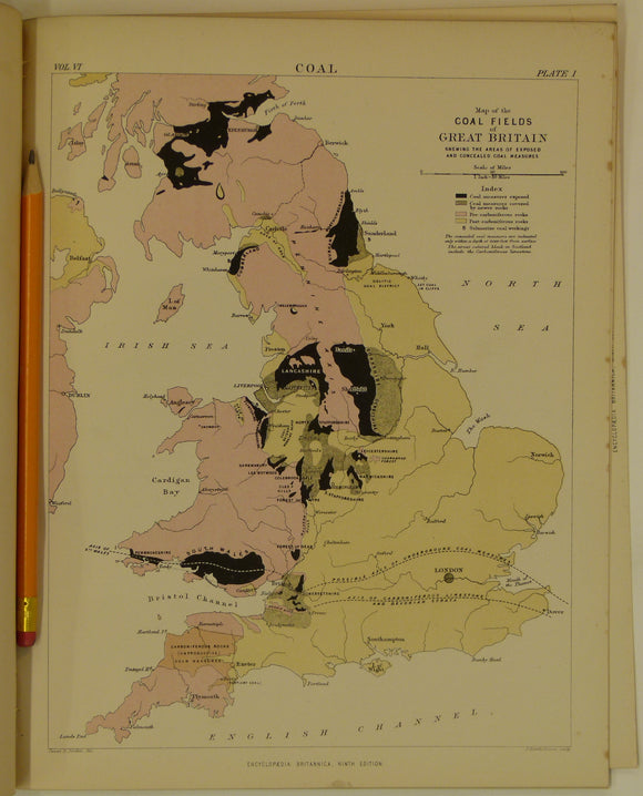
Bauermann, Hilary, 1875-89. ‘Coal’, extract from Encyclopedia Britannica, 9th edition. Pp.45-81 + 4 plates. Encyclopedia Britannica.
Baxter, Stephen (2004). Revolutions in the Earth: James Hutton and the True Age of the World,. Phoenix.
Bayfield, Captain, R.N. (1837). ‘Note on the Geology of the North Coast of the St. Lawrence [Canada]’. Geological Society of London.
Beale,S. and Dodd, M. (eds) (2008). Exploring Lakeland Rocks and Landscapes. Kirby-in-Furness: Cumberland Geological Society, 1st ed. Cumberland Geological Society.
Beck, B.A. and Wilson, W.L. (1987). Karst Hydrogeology: Engineering and Environmental Applications; Sinkholes and Environmental Impacts of Karst,. A A Balkema.
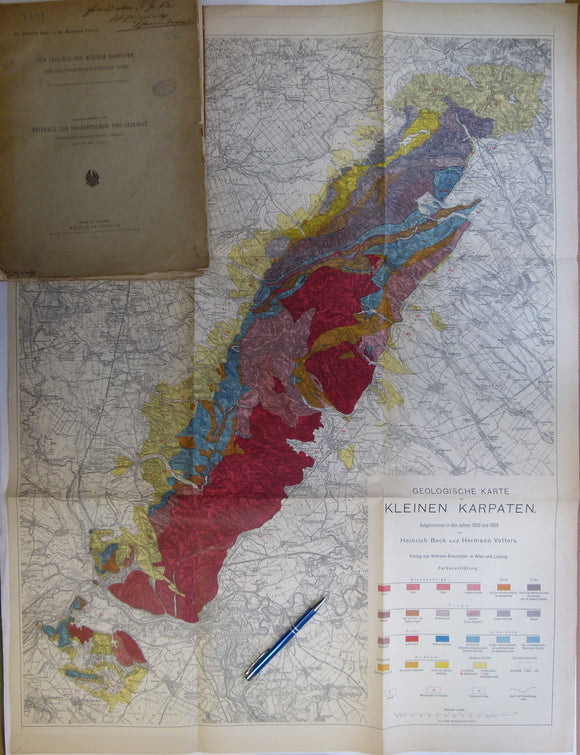
Beck, Heinrich, and Vetters, Hermann. (1904). ‘Geologische Karte der Kleinen Karpaten’, 1:75,000 scale, 91 x 69cm, colour printed and folding to 33 x 24cm. Wilhelm Braumuller.
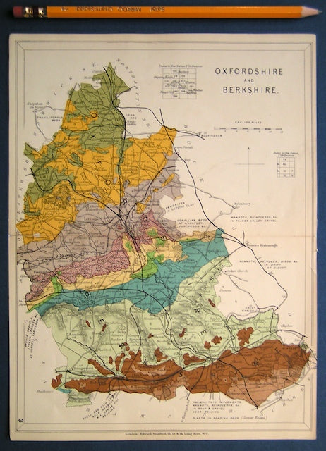
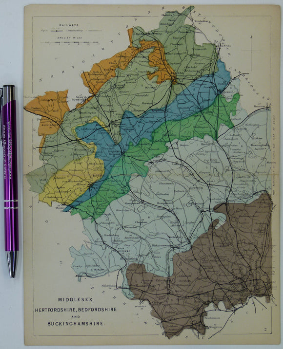
Bedfordshire, Buckinghamshire, Hertfordshire and Middlesex (1913) counties geological map from Stanford’s Geological Atlas. Stanford's and Reynolds' Atlases.
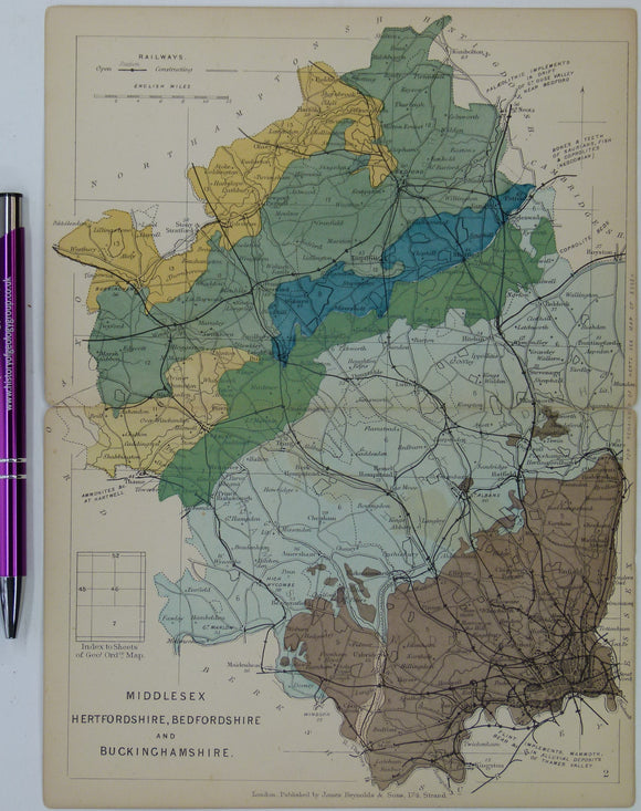
Bedfordshire, Buckinghamshire, Hertfordshire, and Middlesex (1864) counties geological map from Reynolds’s Geological Atlas of Great Britain, 1st edition. Reynolds.
Bedfordshire, Buckinghamshire, Hertfordshire, and Middlesex (1889) counties geological map from Reynolds’s Geological Atlas of Great Britain, 2nd. Reynolds.
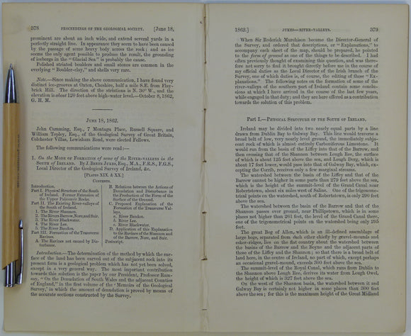
Beete Jukes, J. (1862). ‘Geological Map of parts of the Counties of Cork and Waterford’ in ‘On the Mode of Formation of the River Valleys in the South of Ireland’ extract. Geological Society of London.
Belfast District, Drift, (1901). First edition. Colour print, flat, 45 x 61cm. Scale 1:63,360. Base map 1903. Geological Survey of Ireland.
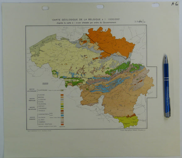
Belgium (1950). Carte Géologique de la Belgique; après la carte a 1:40,000 dressée par ordre du Govvernement. Flat colour printed map, 35.5 x 38.5cm. 1:500,000. Geological Survey of Belgium.
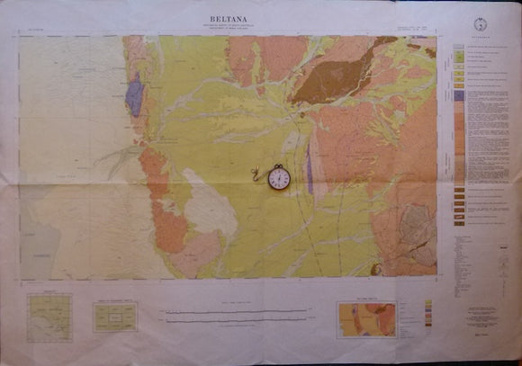
Beltana, SA. Sheet 696, zone 5, 1966, scale 1:63,360.
Berghaus, Hermann, 1892. Atlas de Geologie; Berghaus Physikalischer Atlas, Abteilung 1. Gotha: Justus Perthes, 7pp+ 15 double page maps. First edition. Justus Perthes.
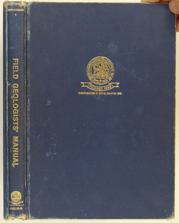
Berkman, D.A. and Ryall, W.R. (eds) (1982). Field Geologists’ Manual. Victoria: Australasian Institute of Mining and Metallurgy,301pp, 2nd edition. Hardback,. Australasian IMM.
Betterton, J., Craig, J. et al. (eds)(2019). Aspects of the Life and Works of Archibald Geikie. Geological Society of London Special Publication. Geological Society of London.


![Bayfield, Captain, R.N. (1837). ‘Note on the Geology of the North Coast of the St. Lawrence [Canada]’](http://geolmaps.com/cdn/shop/products/BayfieldTGSSt.Lawrence_1_{width}x.jpg?v=1614520659)
![Bayfield, Captain, R.N. (1837). ‘Note on the Geology of the North Coast of the St. Lawrence [Canada]’](http://geolmaps.com/cdn/shop/products/BayfieldTGSSt.Lawrence_1_580x.jpg?v=1614520659)