Free UK postage
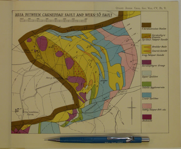
Wales Mid- 1949. 3 maps: Area between Llanelwedd and Carneddau Fault, and Area between Carneddau Fault and Wern-to Fault, and Area Between Wern-to Fault and Cwm-Amliw Fault , all colour. Geological Society of London.
Wales Mid- 1949. 3 maps: Area between Llanelwedd and Carneddau Fault, and Area between Carneddau Fault and Wern-to Fault, and Area Between Wern-to Fault and Cwm-Amliw Fault , all colour...
Regular price £1500 £15.00
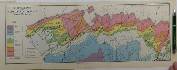
Trotter, Frederick Murray (1947). ‘Structure Map of the Ammanford District’, a fold out colour printed map. Geological Society of London.
Trotter, Frederick Murray (1947). ‘Structure Map of the Ammanford District’, a fold out colour printed map at 1:63,360 scale, 21 x 55cm, from ‘The Structure of the Coal Measures in...
Regular price £1200 £12.00
Wales Mid- 1946. [Map of] The Complex Intrusion of Welfield, Near Builth Wells, Radnorshire, colour. Geological Society of London.
Wales Mid- 1946. [Map of] The Complex Intrusion of Welfield, Near Builth Wells, Radnorshire, colour printed folded map at 1:3,600 (3 ins = 900 ft) 36 x 43cm, in ‘The...
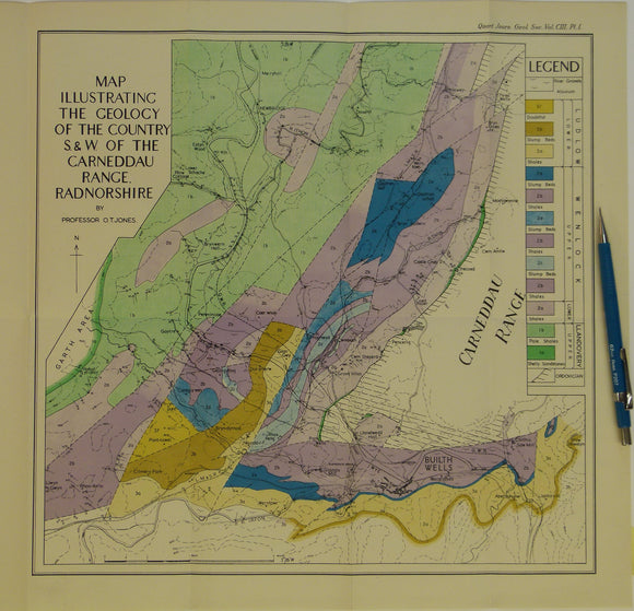
Wales Mid- 1947. Map Illustrating the Geology of the Country S.&W. of the Carneddau Range, Radnorshire, colour. Geological Society of London.
Wales Mid- 1947. Map Illustrating the Geology of the Country S.&W. of the Carneddau Range, Radnorshire, colour printed folded map at 1:31,680 (2 ins =1mile) 36 x 38cm, in ‘The...
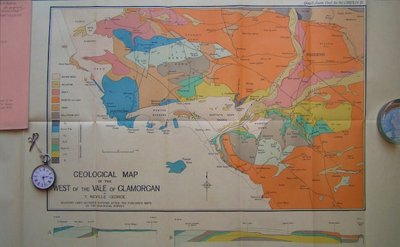
Geological Map of the West of the Vale of Glamorgan,1933. George, Neville QJGS.
Geological Map of the West of the Vale of Glamorgan,1933, with accompanying paper as off-print included, The Carboniferous Limestone series in the West of the Vale of Glamorgan, 52pp +...
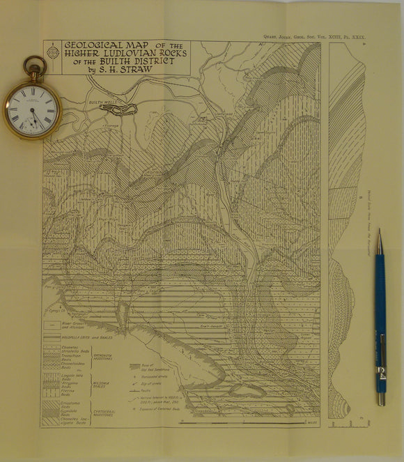
Wales Mid- 1947. Geological Map of the Higher Ludlovian rocks of the Builth District, b&w. Geological Society of London.
Wales Mid- 1947. Geological Map of the Higher Ludlovian rocks of the Builth District, b&w printed folded map at 1:15,840 (4 ins =1mile) 34 x 30cm, in ‘The Higher Ludlovian...
Regular price £800 £8.00


![Wales Mid- 1946. [Map of] The Complex Intrusion of Welfield, Near Builth Wells, Radnorshire, colour](http://geolmaps.com/cdn/shop/products/P1080550_{width}x.JPG?v=1547142668)
![Wales Mid- 1946. [Map of] The Complex Intrusion of Welfield, Near Builth Wells, Radnorshire, colour](http://geolmaps.com/cdn/shop/products/P1080550_580x.JPG?v=1547142668)