Free UK postage
Edinburghshire, 13 (1861)1:10,560 scale OS basemap 1854. Covers Bonnyrigg and Borthwick. Colour washed engraving. British Geological Survey.
Edinburghshire, 14 (1861)1:10,560 scale OS basemap 1854. 55% blank as adjacent county. Colour washed engraving,. British Geological Survey.
Edinburghshire, 17 (1864)1:10,560 scale OS basemap 1853. Covers part of Penicuik district. 60% blank as adjacent county. British Geological Survey.
Edwards, W.N. (1976). The Early History of Palaeontology. London: British Museum (Natural History). Reprint. British Museum.
Eiby, G.A. (1967). Earthquakes. London: Frederick Muller. 207pp. Second revised and expanded edition. HB,. Frederick Muller.
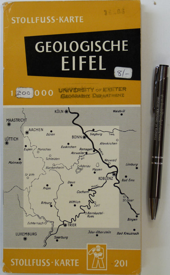
Eifel. Geologische Ubersichtskarte der Eifel und ihrer Umrandung (n.d.). Bonn: Wilhelm Stollfuss Verlag. Colour printed map 1:200,000,. Wilhlem Stollfuss Verlag.
Einstein: a Biography. Weidenfeld and Nicolson.
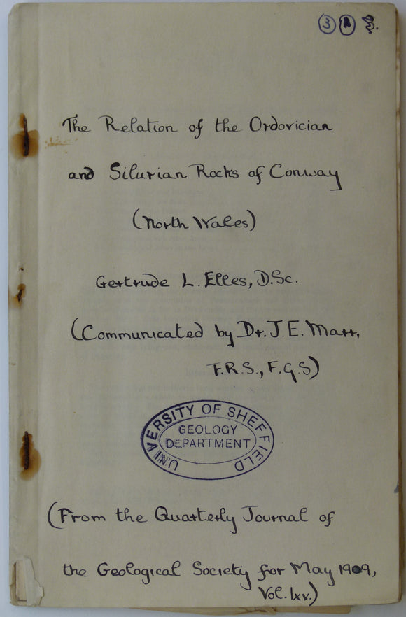
Elles, G.L. (1909). Geological Map of Conway’, fold out b/w printed map, 1:21,120 scale (3”=1 mile),. Geological Society of London.
Elles, Gertrude L., (1926). ‘[Map of the] Structure of the Ben Lawers Nappe as seen on Ben Lawers and Meall Corranaich’, fold-out colour printed. QJGS.
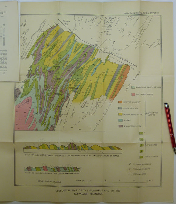
Elles, Gertrude L., (1934). ‘Geological Map of the Northern End of the Tayvallich Peninsula’ fold-out colour printed map 1:10,560. QJGS.
Emling, Shelley (2009). The Fossil Hunter; Dinosaurs, Evolution and the Woman whose Discoveries changed the World, (2009), by Shelley Emling. Palgrave Macmillan.
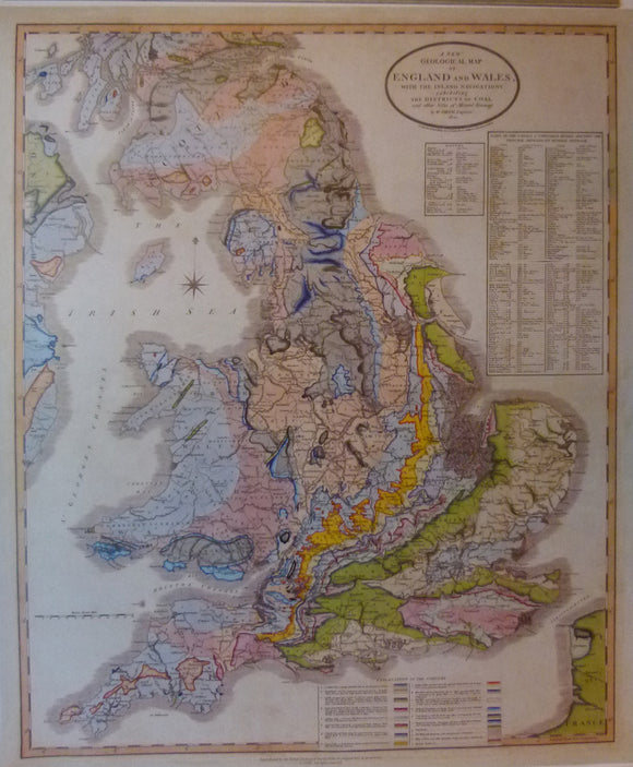
England & Wales, A New Geological Map of England and Wales, with the Inland Navigations exhibiting… Reproduction. Smith, William.
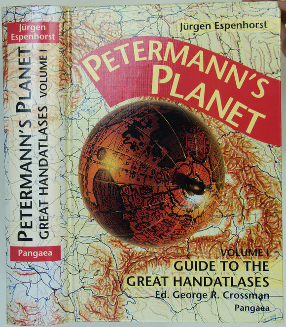
Espenhorst, Jürgen (2003). Petermann’s Planet; a Guide to German Handatlases and Their Siblings Throughout the World, 1800-1950. Vol.1, . Pangea Verlag.
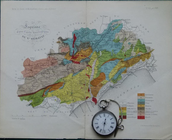
Esquisse d'une carte géologique de l'Hérault, 1876. 1876.
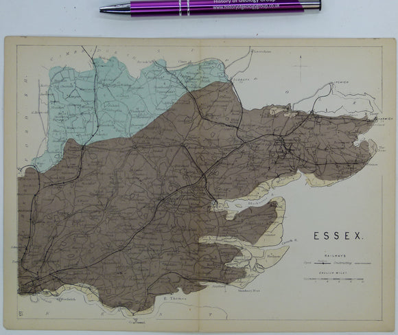
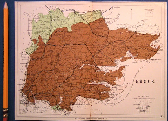
Essex (1864) county geological map from Reynolds’s Geological Atlas of Great Britain, 1st edition. Reynolds.
Essex (1889) county geological map from Reynolds’s Geological Atlas of Great Britain, 2nd edition. Reynolds.
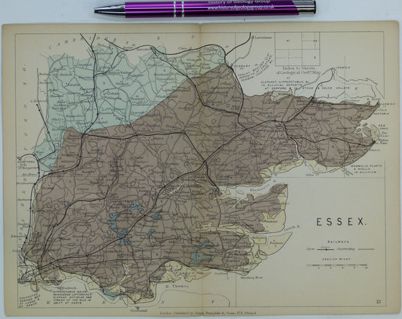
Essex (1913) county geological map from Stanford’s Geological Atlas of Great Britain and Ireland, 3rd edition. Stanford's and Reynolds' Atlases.
Etheridge, R. (c1864*). ‘A Geological Sketch of the Avon District’ pp 17-38 within The Handbook for Visitors to the Bristol and Clifton Hotwells, Bristol: Chilcot, 60pp. Hardback,. Chilcot.
Etna, Carta naturalistica e turistica [and geological] (1991). Firenze: S.E.L.C.A. for Club Alpino Italiano. Club Alpino Italiano.
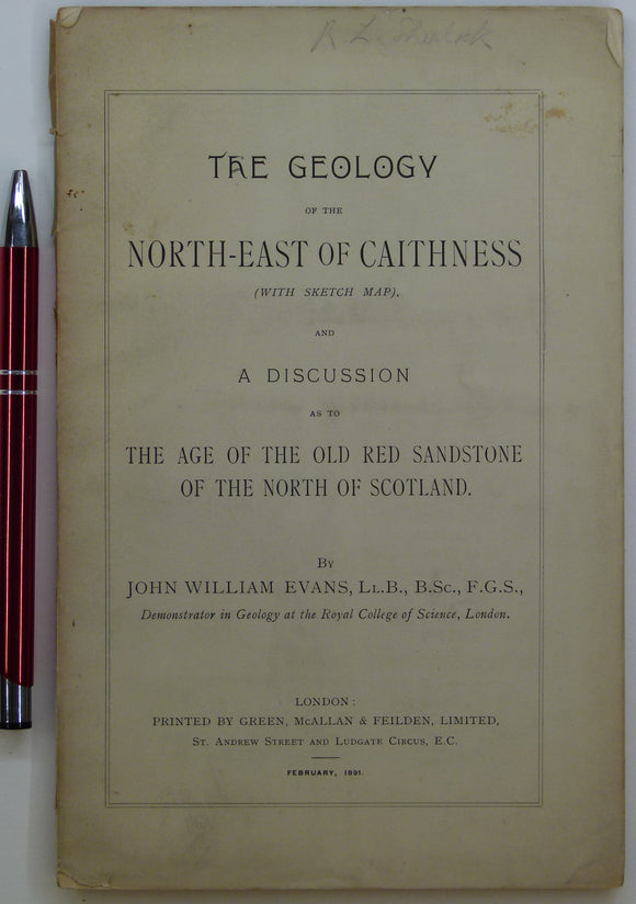
Evans, John W., (1891), geological map (untitled) of North-East Caithness. Fold-out b/w printed geological map. private publication.
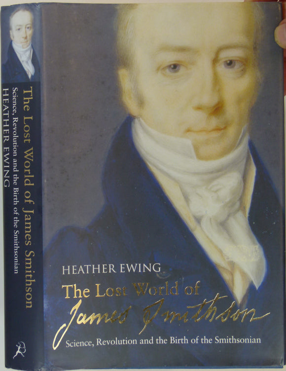
Ewing, Heather (2007). The Lost World of James Smithson; Science, Revolution and the Birth of the Smithsonian. London: Bloomsbury, 432 + x pp. Hardback. Bloomsbury.
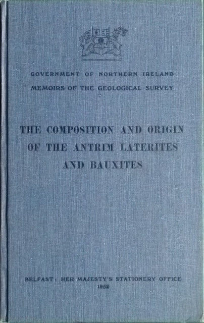
Eyles, V.A. (1952). The Composition and Origin of the Antrim Laterites and Bauxites. Geological Survey of N. Ireland.
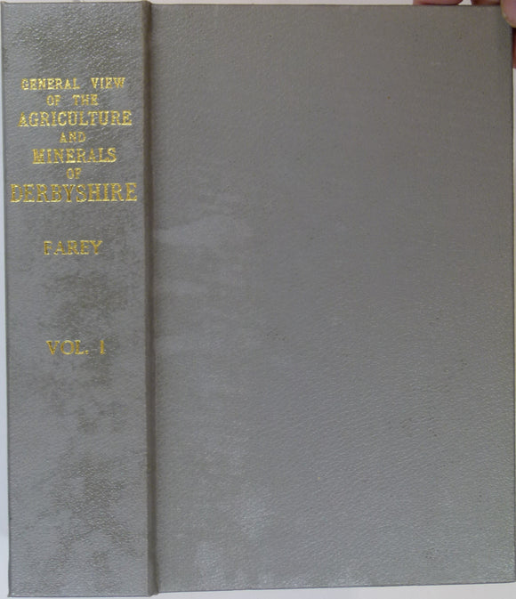
Farey, John (1811). General View of the Agriculture and Minerals of Derbyshire, vol 1. 1989 REPRODUCTION. Peak District Mines Hist. Soc..
Farey, John (c1814). ‘A [Geological] Map of Derbyshire and parts of the seven adjacent counties shewing the principal Strata. MacMillan.


![Elles, Gertrude L., (1926). ‘[Map of the] Structure of the Ben Lawers Nappe as seen on Ben Lawers and Meall Corranaich’, fold-out colour printed](http://geolmaps.com/cdn/shop/products/ScotExtr_52_{width}x.jpg?v=1652193357)
![Elles, Gertrude L., (1926). ‘[Map of the] Structure of the Ben Lawers Nappe as seen on Ben Lawers and Meall Corranaich’, fold-out colour printed](http://geolmaps.com/cdn/shop/products/ScotExtr_52_580x.jpg?v=1652193357)


![Etna, Carta naturalistica e turistica [and geological] (1991). Firenze: S.E.L.C.A. for Club Alpino Italiano.](http://geolmaps.com/cdn/shop/files/Etna_1_{width}x.jpg?v=1752943355)
![Etna, Carta naturalistica e turistica [and geological] (1991). Firenze: S.E.L.C.A. for Club Alpino Italiano.](http://geolmaps.com/cdn/shop/files/Etna_1_580x.jpg?v=1752943355)


![Farey, John (c1814). ‘A [Geological] Map of Derbyshire and parts of the seven adjacent counties shewing the principal Strata](http://geolmaps.com/cdn/shop/files/FareyDerbys_1_{width}x.jpg?v=1764505581)
![Farey, John (c1814). ‘A [Geological] Map of Derbyshire and parts of the seven adjacent counties shewing the principal Strata](http://geolmaps.com/cdn/shop/files/FareyDerbys_1_580x.jpg?v=1764505581)