Free UK postage
Middleton, R.E. (1893). ‘Water Contour Map to Accompany Report of the Hertfordshire Enquiry’. Royal Commission on Metropolitan Water Supply. Two colour lithograph. London County Council.
Middleton, R.E. (1893). ‘Water Contour Map to Accompany Report of the Hertfordshire Enquiry’. Royal Commission on Metropolitan Water Supply. Two colour lithographed map, 105 x 77.5 cm, at 1:63,360. Dissected,...
Regular price £2000 £20.00
Symons, G.J. (1892). ‘Hydrographical Map of the Thames Basin – Mean [Annual] Rainfall’. Royal Commission on Metropolitan Water Supply. Hand coloured lithographed map,. London County Council.
Symons, G.J. (1892). ‘Hydrographical Map of the Thames Basin – Mean [Annual] Rainfall’. London County Council for Royal Commission on Metropolitan Water Supply. Hand coloured lithographed map, 63 x 85.5...
Yorkshire 283 sw. Wentworth. Surveyed 1933, issued 1937. Geological Survey of England & Wales.
Yorkshire 283 sw. Wentworth. Surveyed 1933, issued 1937. Outline geology in black on grey basemap with red contours. Hand-coloured 1947. Slightly soiled. Tape residue on top edge. In good condition.
Yorkshire 283 se. Rawmarsh. Surveyed 1932, issued 1942. Geological Survey of England & Wales.
Yorkshire 283 se. Rawmarsh. Surveyed 1932, issued 1942. Outline geology in black on grey basemap with red contours. Hand-coloured 1947. Tape residue on top edge. In very good condition.
Yorkshire 283 ne. Wath upone Dearne. Surveyed 1932, issued 1935. Geological Survey of England & Wales.
Yorkshire 283 ne. Wath upone Dearne. Surveyed 1932, issued 1935. Outline geology in black on grey basemap with red contours. Hand-coloured 1939. Tape residue on top edge. In very good...
Yorkshire 282 se. Tankersley. Surveyed 1932, issued 1937. Geological Survey of England & Wales.
Yorkshire 282 se. Tankersley. Surveyed 1932, issued 1937. Outline geology in black on grey basemap with red contours. Hand coloured 1939. Tape residue on top edge. In good condition.
Yorkshire 281 se. Stocksbridge. Surveyed 1928, issued 1934. Geological Survey of England & Wales.
Yorkshire 281 se. Stocksbridge. Surveyed 1928, issued 1934. Outline geology in black on grey basemap with red contours. Hand-coloured 1947. Tape residue on top edge. In good to very good...
Yorkshire 281 ne. Penistone. Surveyed 1926, issued 1943. Geological Survey of England & Wales.
Yorkshire 281 ne. Penistone. Surveyed 1926, issued 1943. Outline geology in black on grey basemap with red contours. Hand-coloured 1947. Tape residue on top edge. In good condition.
Yorkshire 275 nw. Cudworth. Surveyed 1933, issued 1937. Geological Survey of England & Wales.
Yorkshire 275 nw. Cudworth. Surveyed 1933, issued 1937. Outline geology in black on grey basemap with red contours. Hand coloured 1948. Tape residue on top edge. In good condition.
Yorkshire 273 se. Thurlestone. Surveyed 1928, issued 1933. Geological Survey of England & Wales.
Yorkshire 273 se. Thurlestone. Surveyed 1928, issued 1933. Outline geology in blue on black basemap with red contours. Hand-coloured 1944. Tape residue on top edge. In good to very good...
Yorkshire 273 ne. Cumberworth. Surveyed 1928, issued 1942. Geological Survey of England & Wales.
Yorkshire 273 ne. Cumberworth. Surveyed 1928, issued 1942. Outline geology in black on grey basemap with red contours. Hand coloured 1948. Tape residue on top edge. In very good condition.
Yorkshire 263 ne. Hemsworth. Surveyed 1932, issued 1936. Geological Survey of England & Wales.
Yorkshire 263 ne. Hemsworth. Surveyed 1932, issued 1936. Outline geology in blue on black basemap with red contours. Hand coloured 1942. Tape residue on top edge. In good condition.
Yorkshire 262 sw. Darton. Surveyed 1933, issued 1936. Geological Survey of England & Wales.
Yorkshire 262 sw. Darton. Surveyed 1933, issued 1936. Outline geology in blue on black basemap with red contours. Hand-coloured. Pencil section line across east half. Slightly soiled. In good to...
Yorkshire 262 nw. West Bretton. Surveyed 1933, issued 1945. Geological Survey of England & Wales.
Yorkshire 262 nw. West Bretton. Surveyed 1933, issued 1945. Outline geology in black on grey basemap with red contours. Hand-coloured n.d. Tape residue on top edge. In good condition.
Yorkshire 262 ne. Woolley Park. Surveyed 1933, issued 1938. Geological Survey of England & Wales.
Yorkshire 262 ne. Woolley Park. Surveyed 1933, issued 1938. Outline geology in blue on black basemap and contours. Hand-coloured 1949. Tape residue on top edge. In good condition.
Yorkshire 261 sw. Shelley. Surveyed 1928, issued 1930. Geological Survey of England & Wales.
Yorkshire 261 sw. Shelley. Surveyed 1928, issued 1930. Outline geology in blue on black basemap and contours. Hand-coloured 1931. Tear neatly repaired. Tape residue on top edge. In good condition.
Yorkshire 261 nw. High Burton. Surveyed 1925, issued 1928. Geological Survey of England & Wales.
Yorkshire 261 nw. High Burton. Surveyed 1925, issued 1928. Outline geology in blue on black basemap and contours. Hand-coloured 1946. Slightly soiled. Tape residue on top edge. In good condition.
London Sheet 4nw 6", Willesden. Geological Survey of England & Wales.
London Sheet 4nw 6", Willesden. G-VG with neat tape repair to edge
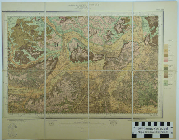
Sheet 268 New Series, Drift. 1” (1904). Reading, base map 1896, geologically surveyed 1898. 1:63,360 scale. Colour print. Dissected. British Geological Survey.
Sheet 268 New Series, Drift. 1” (1904). Reading, base map 1896, geologically surveyed 1898. 1:63,360 scale. Colour print. Dissected and mounted on linen, 43 x 55cm, and folded between blue marbled...
Regular price £1900 £19.00
Lancashire 95sw, 6". Little Hulton, 1929/1929, issued 1941. Complete hand coloured. Geological Survey of England & Wales.
Lancashire 95sw, 6". Little Hulton, 1929/1929, issued 1941. Complete hand coloured. In good condition.


![Symons, G.J. (1892). ‘Hydrographical Map of the Thames Basin – Mean [Annual] Rainfall’. Royal Commission on Metropolitan Water Supply. Hand coloured lithographed map,](http://geolmaps.com/cdn/shop/files/ThamesBasinprecipitation_2_{width}x.jpg?v=1790436588)
![Symons, G.J. (1892). ‘Hydrographical Map of the Thames Basin – Mean [Annual] Rainfall’. Royal Commission on Metropolitan Water Supply. Hand coloured lithographed map,](http://geolmaps.com/cdn/shop/files/ThamesBasinprecipitation_2_580x.jpg?v=1790436588)