Free UK postage
H&ASS. Fifeshire (1843). Anderson, John. Geological Map of Fifeshire, in ‘On the Geology of Fifeshire’, an extract from Transactions. Highland and Agric Soc. Scotland.
H&ASS. Fifeshire (1843). Anderson, John. Geological Map of Fifeshire, in ‘On the Geology of Fifeshire’, an extract from Transactions of Highland and Agricultural Society of Scotland, New Series, vol 13,...
Regular price £4400 £44.00
H&ASS. Banffshire (1843). Cunningham, R.J.H. Geognostical Map of Banffshire, in ‘Geognostical Account of Banffshire’, an extract from Transactions of Highland. Highland and Agric Soc. Scotland.
H&ASS. Banffshire (1843). Cunningham, R.J.H. Geognostical Map of Banffshire, in ‘Geognostical Account of Banffshire’, an extract from Transactions of Highland and Agricultural Society of Scotland, New Series, vol 14 (New...
Sheet 39, 1". Stirling (titled), 1882. 1st edition. Scale 1:63,360. Hand-coloured lithograph, 53 x 69cm, dissected, mounted on linen. British Geological Survey.
Sheet 39, 1". Stirling (titled), 1882. 1st edition. Scale 1:63,360. Hand-coloured lithograph, 53 x 69cm, dissected, mounted on linen and folded to 18 x 10.5cm between embossed red cloth-covered card...
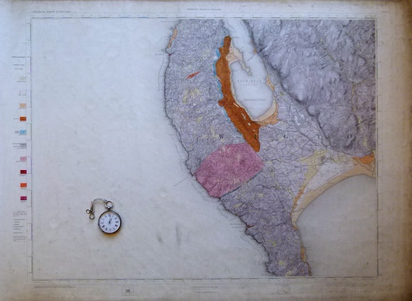
Sheet 3, 1". Stranraer, 1871, 1st edition. 21.25"x29" flat linen-packed paper. Geological Survey of Scotland.
Sheet 3, 1". Stranraer, 1871, 1st edition. 21.25"x29" flat linen-packed paper. 40% sea, topography expressed by hachuring. Soiling noticeable in blank areas, will clean up, otherwise in good condition.
Geikie, Archibald (1910). Geological Map of Scotland. Edinburgh: John Bartholomew. ‘New’ edition. Scale 1:633,600, WITHOUT explanatory notes. John Bartholomew.
Geikie, Archibald (1910). Geological Map of Scotland. Edinburgh: John Bartholomew. ‘New’ edition. Scale 1:633,600 (1 inch = 10 miles) colour printed lithograph 80 x 69.5cm, dissected and mounted on linen...
Regular price £4000 £40.00
Ayrshire, 46 (1868)1:10,560 scale OS basemap 1860. Covers Patna and Dalmellington. Colour washed engraving. British Geological Survey.
Ayrshire, 46 (1868)1:10,560 scale OS basemap 1860. Covers Patna in northwest and Dalmellington in the southeast. Colour washed engraving, (69 x 102 cm). Flat, pencilled library notation in bottom right...
Ayrshire, 36 (1868)1:10,560 scale OS basemap 1860. Covers Dalblair and part of Auchinleck district. Colour washed engraving,. British Geological Survey.
Ayrshire, 36 (1868)1:10,560 scale OS basemap 1860. Covers Dalblair and part of Auchinleck district. Colour washed engraving, (69 x 101.5 cm). Flat, pencilled library notation in bottom right corner, tear...
H&ASS. Peeblesshire (1843). Nicol, James. [Geological Map of] Peebleshire, in ‘On the Geology of Peeblesshire’, an extract. Highland and Agric Soc. Scotland.
H&ASS. Peeblesshire (1843). Nicol, James. [Geological Map of] Peebleshire, in ‘On the Geology of Peeblesshire’, an extract from Transactions of Highland and Agricultural Society of Scotland, New Series, vol 14...
Regular price £3900 £39.00
Geikie, James (1894). The Great Ice Age and its relation to the antiquity of Man. London: Edward Stanford. 3rd edition. xxviii + 850 pp. Hardback,. Edward Stanford.
Geikie, James (1894). The Great Ice Age and its relation to the antiquity of Man. London: Edward Stanford. 3rd edition. xxviii + 850 pp. Hardback, dark green cloth covered boards...
Sheet 66, 1". Banchory (titled), 1897. Scale 1:63,360. Hand-coloured lithograph, 52.5 x 67cm, dissected, mounted on linen and folded. British Geological Survey.
Sheet 66, 1". Banchory (titled), 1897. Scale 1:63,360. Hand-coloured lithograph, 52.5 x 67cm, dissected, mounted on linen and folded to 17.5 x11cm between worn marbled paper-covered card covers. Topography expressed...
Sheet 33, 1". Haddingtonshire, 1860. 1st edition. Scale 1:63,360. Hand-coloured lithograph, 53 x 69.5cm, dissected, mounted on linen and folded. British Geological Survey.
Sheet 33, 1". Haddingtonshire, 1860. 1st edition. Scale 1:63,360. Hand-coloured lithograph, 53 x 69.5cm, dissected, mounted on linen and folded to 17.5 x 10cm without covers. Topography expressed by hachuring....
Sheet 47, 1". Crieff, (titled), 1888, 1st edition. Geological Survey of Scotland.
Sheet 47, 1". Crieff, (titled), 1888, 1st edition. 20.75"x28" cut, mounted on linen and folded to 7"x4.7.5 without covers. Soiled and worn on folds with pinholes at fold intersections. Two...
Sheet 6, 1". Annan, 1879, 1st edition. 21.25"x29" flat linen-packed paper. Geological Survey of Scotland.
Sheet 6, 1". Annan, 1879, 1st edition. 21.25"x29" flat linen-packed paper. 65% blank as Solway Firth or England, topography expressed by hachuring. Very soiled noticeable in blank areas, will...
Sheet 103, 1". Golspie (titled), 1896. Scale 1:63,360. Hand-coloured lithograph, 53 x 70.5 cm, dissected, mounted on linen. British Geological Survey.
Sheet 103, 1". Golspie (titled), 1896. Scale 1:63,360. Hand-coloured lithograph, 53 x 70.5 cm, dissected, mounted on linen folded to 17.5 x 10cm between blue card covers. Topography expressed by...
Regular price £3500 £35.00
Cockburn, A.M. (1935). The Geology of St.Kilda. Edinburgh: Royal Society of Edinburgh. Off print from the Transactions. Royal Society of Edinburgh.
Cockburn, A.M. (1935). The Geology of St.Kilda. Edinburgh: Royal Society of Edinburgh. Off print from the Transactions of the RSE.v.58, pt.2, pp.511-547 + 4 photo plates and foldout map ‘Geological...
Geikie, A. (1865) The Scenery of Scotland, viewed in connexion with its Physical Geology. London: Macmillan, 1st edition, 360pp. Hardback. MacMillan.
Geikie, A. (1865) The Scenery of Scotland, viewed in connexion with its Physical Geology. London: Macmillan, 1st edition, 360pp. Hardback, green embossed cloth-covered boards with gilt lettering to spine. Hinges...
Renfrewshire, 13 (1870)1:10,560 scale OS basemap 1863. Covers Pollockshaws, Cathcart and Thornliebank. Colour washed engraving,. British Geological Survey.
Renfrewshire, 13 (1870)1:10,560 scale OS basemap 1863. Covers Pollockshaws, Cathcart and Thornliebank. Colour washed engraving, (68 x 101 cm). Flat, pencilled library notation in bottom right corner, otherwise clean and...
Lanarkshire, 37 (1871)1:10,560 scale OS basemap 1864. No place names. Colour washed engraving,. British Geological Survey.
Lanarkshire, 37 (1871)1:10,560 scale OS basemap 1864. No place names. Colour washed engraving, (69.5 x 102 cm). Flat, pencilled library notation in bottom right corner, soiled strip along bottom edge...
Dumbartonshire 28/29 (1870). 1:10,560 scale OS basemap 1864. Covers Forth & Clyde Canal, Garscube Iron Works. British Geological Survey.
Dumbartonshire 28/29 (1870). 1:10,560 scale OS basemap 1864. Covers Forth & Clyde Canal, Garscube Iron Works. Colour washed engraving, (67.5 x 100 cm). Flat, pencilled library notation in bottom right...
Edinburghshire, 17 (1864)1:10,560 scale OS basemap 1853. Covers part of Penicuik district. 60% blank as adjacent county. British Geological Survey.
Edinburghshire, 17 (1864)1:10,560 scale OS basemap 1853. Covers part of Penicuik district. 60% blank as adjacent county. Legend within blank area. Colour washed engraving, (69 x 99cm). Flat with old...




![H&ASS. Peeblesshire (1843). Nicol, James. [Geological Map of] Peebleshire, in ‘On the Geology of Peeblesshire’, an extract](http://geolmaps.com/cdn/shop/files/Peebleshire_2_{width}x.jpg?v=1791111351)
![H&ASS. Peeblesshire (1843). Nicol, James. [Geological Map of] Peebleshire, in ‘On the Geology of Peeblesshire’, an extract](http://geolmaps.com/cdn/shop/files/Peebleshire_2_580x.jpg?v=1791111351)


