Shop By
- British islands
- engineering geology
- England regional
- field guide
- Fossils
- geomorphology
- journal extract
- journal offprint
- Non-survey
- Oceans
- One inch survey
- Petrology
- Physical Geography
- popular geology
- Post 1900
- Pre 1900
- Precambrian
- quaternary
- reference
- Reproduction
- Scotland
- Scotland regional
- Scotland Survey Memoirs
- Six inch first edition
- Text book
- volcano


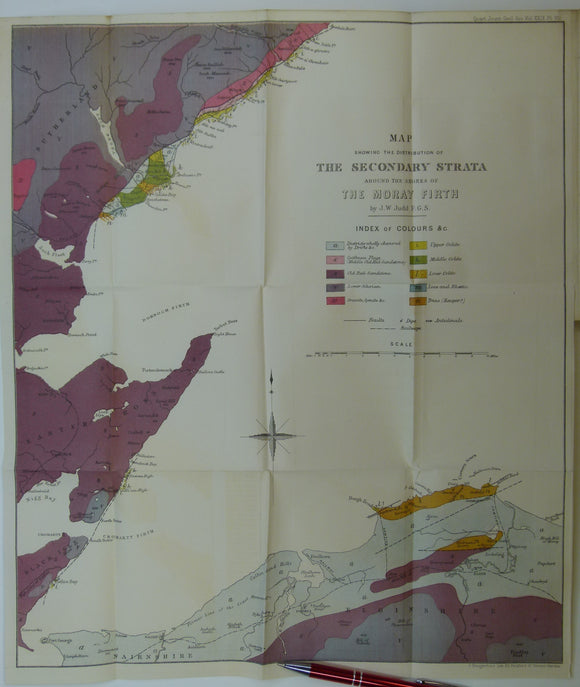


![Judd, J.W. (1873). [Geological] Map Showing ... the Secondary Strata Around the Moray Firth [Scotland], fold-out colour printed map,](http://geolmaps.com/cdn/shop/products/Judd2ndryScotland_1_{width}x.jpg?v=1619627314)
![Judd, J.W. (1873). [Geological] Map Showing ... the Secondary Strata Around the Moray Firth [Scotland], fold-out colour printed map,](http://geolmaps.com/cdn/shop/products/Judd2ndryScotland_1_580x.jpg?v=1619627314)
