Free UK postage
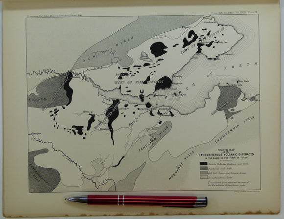
Giekie, Archibald, (1879), ‘On the Carboniferous Volcanic Rocks of the Basin of the Firth of Forth: their Structure in the Field. Royal Society of Edinburgh.
Giekie, Archibald, (1879), ‘On the Carboniferous Volcanic Rocks of the Basin of the Firth of Forth: their Structure in the Field and under the Microscope, off print from Transactions of...
Regular price £1600 £16.00
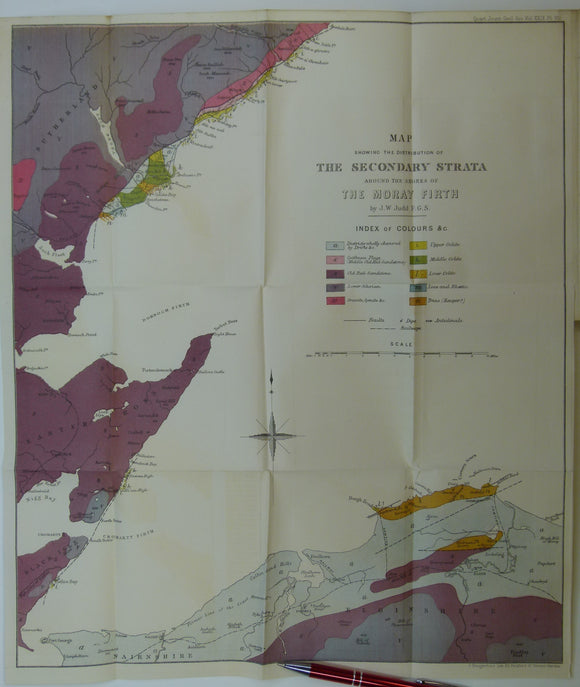
Judd, John W., (1873), ‘Map Showing the Secondary Strata around the Shores of the Moray Firth. Fold-out colour printed geological map. QJGS.
Judd, John W., (1873), ‘Map Showing the Secondary Strata around the Shores of the Moray Firth. Fold-out colour printed geological map, 1:126,720 (2 miles to 1 inch), 46 x 39.5cm...
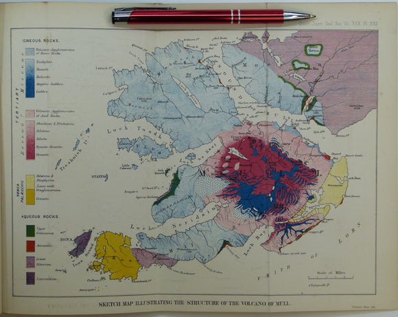
Judd, John W., (1874), ‘Sketch Map Illustrating the Structure of the Volcano of Mull. Fold-out colour printed geological map. QJGS.
Judd, John W., (1874), ‘Sketch Map Illustrating the Structure of the Volcano of Mull. Fold-out colour printed geological map, 1:126,720 (2 miles to 1 inch), 20.5x 29.5cm in ‘The Secondary...
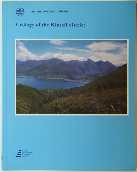
Sheet memoir 72W. (1993). May, F. and Peacock, JD. et al. Geology of the Kintail District. Geological Survey of Scotland.
Sheet memoir 72W. (1993). May, F. and Peacock, JD. et al. Geology of the Kintail District. British Geological Survey [Scotland], 1st edition. 74pp. A4 paperback, abundant colour illustration. In very...
Sheet memoir 40 & part 32. (1934). Allen, JK and Knox, J. Economic Geology of the Fife Coalfields; Area 2 Cowdenbeath and Central Fife. Geological Survey of Scotland.
Sheet memoir 40 & part 32. (1934). Allen, JK and Knox, J. Economic Geology of the Fife Coalfields; Area 2 Cowdenbeath and Central Fife including Fordell, Lochgelly, Cadham, and Kirkcaldy....
Sheet memoir 15 & part 9. (1936). Simpson, JB and Richey, JE. The Geology of the Sanquhar Coalfield and Adjacent Basin of Thornhill. Geological Survey of Scotland.
Sheet memoir 15 & part 9. (1936). Simpson, JB and Richey, JE. The Geology of the Sanquhar Coalfield and Adjacent Basin of Thornhill. Geological Survey of Scotland, 94pp. + 6...
Judd, J.W. (1873). [Geological] Map Showing ... the Secondary Strata Around the Moray Firth [Scotland], fold-out colour printed map,. Geological Society of London.
Judd, J.W. (1873). [Geological] Map Showing the Distribution of the Secondary Strata Around the Shores of the Moray Firth [Scotland], fold-out colour printed map, 1:63,360, (1”= 1 mile), 45.5 x...
Sheet 1, 1". Mull of Galloway, 1923, S, G. Flat with lines of old folds. Geological Survey of Scotland.
Sheet 1, 1". Mull of Galloway, 1923, S, G. Flat with lines of old folds. 90% sea.
Sutton, J. and Watson, J. (1950). ‘The Pre- Torridonian Metamorphic History of the Loch Torridon and Scourie Areas in the North-West Highlands,. Geological Society of London.
Sutton, J. and Watson, J. (1950). ‘The Pre- Torridonian Metamorphic History of the Loch Torridon and Scourie Areas in the North-West Highlands, and its Bearing on the Chronological Classification of...
Regular price £1500 £15.00
Sheet 31, 1". Airdrie, (titled), 1891. Scale 1:63,360. Hand-coloured lithograph, 52 x 69cm, dissected, mounted on linen and folded to 17.5 x 9.5cm without covers. British Geological Survey.
Sheet 31, 1". Airdrie, (titled), 1891. Scale 1:63,360. Hand-coloured lithograph, 52 x 69cm, dissected, mounted on linen and folded to 17.5 x 9.5cm without covers. Topography expressed by hachuring. Base...
Gribble, C.D. (ed) (1976). Ardnamurchan, a Guide to Geological Excursions. Edinburgh Geological Society,1st edition,122pp. + map. Edinburgh Geological Society.
Gribble, C.D. (ed) (1976). Ardnamurchan, a Guide to Geological Excursions. Edinburgh Geological Society,1st edition,122pp. + map in rear pocket. Paperback, pocket sized, negligible wear. Manuscript gift note on front free...
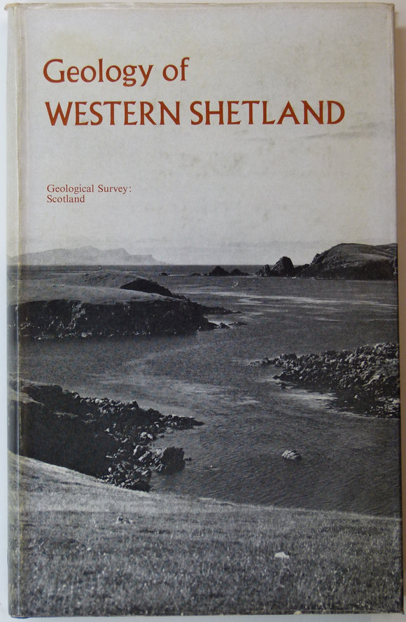
Sheet memoir 127 and parts of 125, 126, 128. (1976). Mykura, W. and Phemister, J. The Geology of Western Shetland. Geological Survey of Scotland,. Geological Survey of Scotland.
Sheet memoir 127 and parts of 125, 126, 128. (1976). Mykura, W. and Phemister, J. The Geology of Western Shetland. Geological Survey of Scotland, 304pp. + 30 plates, including 8...
Sheet memoir 80 and parts 90, 81 and 91. (1966). Anderson, F.W. and Dunham, K.C. The Geology Northern Skye. Memoirs. British Geological Survey.
Sheet memoir 80 and parts 90, 81 and 91. (1966). Anderson, F.W. and Dunham, K.C. The Geology Northern Skye. Memoirs of the Geological Survey, Scotland. Edinburgh: HMSO. 1st edition, 216...
Regular price £1400 £14.00
Garwood, E J. (1931). ‘The Tuedian Beds of North Cumberland and Roxburghshire, East of Liddel Water)’, extract of the QJGS. Geological Society of London.
Garwood, E J. (1931). ‘The Tuedian Beds of North Cumberland and Roxburghshire, East of Liddel Water)’, extract of the Quarterly Journal of the Geological Society, v.87, pp.97-159 + 10 plates,...
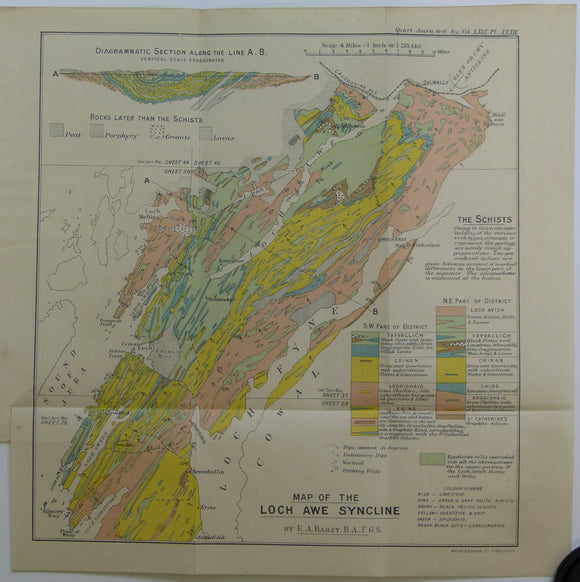
Bailey, Edward B, (1913), ‘Map of the Loch Awe Syncline’. Fold-out colour printed geological map and section. QJGS.
Bailey, Edward B, (1913), ‘Map of the Loch Awe Syncline’. Fold-out colour printed geological map and section, 1:253,440 (4 miles to an inch), 28 x 28cm in ‘The the Loch...
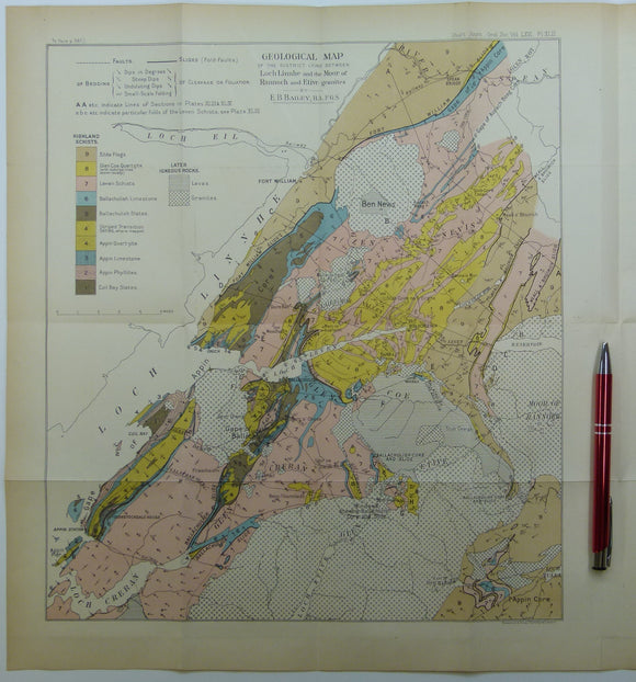
Bailey, Edward B, (1910), ‘Geological Map of the District Lying Between Loch Linnhe and the Moor of Rannoch and Etive Granites. QJGS.
Bailey, Edward B, (1910), ‘Geological Map of the District Lying Between Loch Linnhe and the Moor of Rannoch and Etive Granites’. Fold-out colour printed geological map and section, 1:126,720 (2...
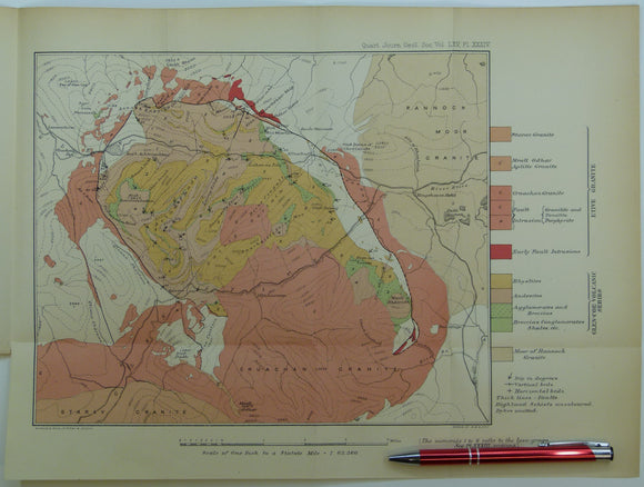
Clough, CT., Maufe, HB., and Bailey, Edward B, (1909), geological map (untitled) Glens Coe and Etive and mountains between. Fold-out colour printed. QJGS.
Clough, CT., Maufe, HB., and Bailey, Edward B, (1909), geological map (untitled) Glens Coe and Etive and mountains between. Fold-out colour printed geological map, 1:63,360, 28.5 x 38.5cm in ‘The...
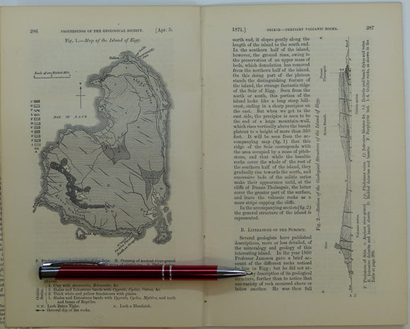
Giekie, Archibald, (1871), ‘Map of the Island of Eigg. b/w geological map, 1:63,360,. QJGS.
Giekie, Archibald, (1871), ‘Map of the Island of Eigg. b/w geological map, 1:63,360, 21.5x13.5cm in ‘On the Tertiary Volcanic Rocks of the British Islands’, extract from Quarterly Journal of the...
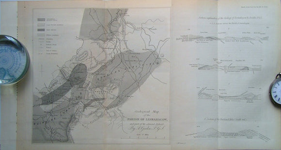
Geological Map of the Parish of Lesmahagow and part of the Adjacent District, 1860. Geikie, A, QJGS.
Geological Map of the Parish of Lesmahagow and part of the Adjacent District, 1860, with accompanying paper included, On the Old Red Sandstone of the South of Scotland, 12pp. Scale...
Macculloch, John (1840). REPRO. Geological Map of Scotland. Reproduction by British Geological Survey. 92.5 x 74 cm. British Geological Survey.
Macculloch, John (1840). REPRO. Geological Map of Scotland. Reproduction by British Geological Survey. 92.5 x 74 cm (a quarter of the original size). Faithful colour reproduction on white silk-finish medium...
Regular price £1200 £12.00






![Judd, J.W. (1873). [Geological] Map Showing ... the Secondary Strata Around the Moray Firth [Scotland], fold-out colour printed map,](http://geolmaps.com/cdn/shop/products/Judd2ndryScotland_1_{width}x.jpg?v=1619627314)
![Judd, J.W. (1873). [Geological] Map Showing ... the Secondary Strata Around the Moray Firth [Scotland], fold-out colour printed map,](http://geolmaps.com/cdn/shop/products/Judd2ndryScotland_1_580x.jpg?v=1619627314)