Free UK postage
Corsi, Pietro, et al (ed). (2004). ‘The Italian Geological Survey, 1861-1970; a Preliminary History’, pp 8-22 with 7 repro maps. SystemCart.
Czizek Johann Bapt. (1847). Geognostiche Karte Ungebunen Wien’s [Vienna, Austria]. Reproduction. 1 inch to a mile approx. self published.
Durham, A Geological Map of Durham, 1824. Reproduction. Smith, William.
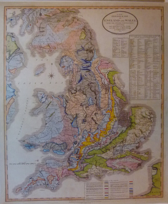
England & Wales, A New Geological Map of England and Wales, with the Inland Navigations exhibiting… Reproduction. Smith, William.
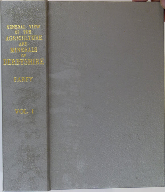
Farey, John (1811). General View of the Agriculture and Minerals of Derbyshire, vol 1. 1989 REPRODUCTION. Peak District Mines Hist. Soc..
Gloucestershire, A Geological Map of Gloucestershire, 1819. Reproduction. Smith, William.
Kent. William Smith's Geological Map of Kent, 1819. REPRODUCTION. Smith, William.
Kriz, Jiri. (1999). Joachim Barrande. Prague: Cesky Geologicky Ustav.12pp. PHOTOCOPY with colour portrait of JB as front cover. Offprint. Czech Geological Survey.
Macculloch, John (1840). REPRO. Geological Map of Scotland. Reproduction by British Geological Survey. 92.5 x 74 cm. British Geological Survey.
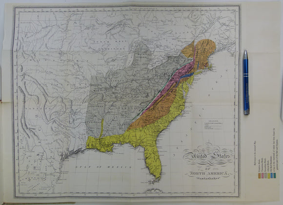
Maclure, William (1817). Observations on the Geology of the United States of America; A 1962 REPRODUCTION. Werner Fritsch.
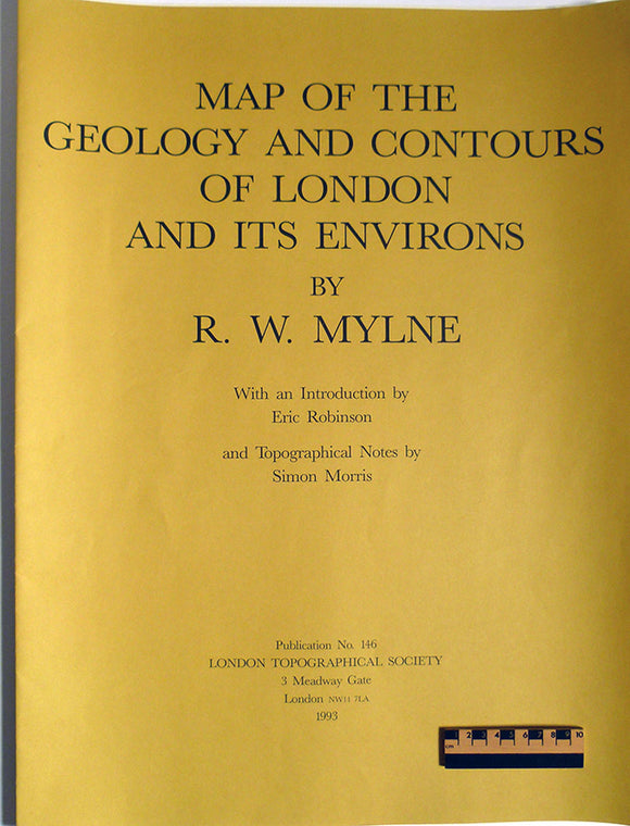
Map of the Geology and Contours of London and its Environs. R. W. Mylne's 1856 map reproduced in 1993. London Topographic Society.
Martin, William (1809). Outlines of an Attempt to Establish a Knowledge of Extraneous Fossils on Scientific Principles. Macclesfield: J.Wilson. REPRODUCTION. Geological Society of London.
Murchison, R.I. and Nicol, J. (1856) REPRO Geological Map of Europe. Edinburgh: Blackwood, plate 4. Reproduction 60 x 76cm. Blackwood.
Mylne, Robert W. (1871). REPRO. Geological Map of London and Its Environs. Reproduction by British Geological Survey. 48 x 69 cm (original size). British Geological Survey.
Old Series Ordnance Survey [reproduced] Maps, Volume 3 (1981). South-central England (Hampshire and the Isle of Wight and. Harry Margary.
Old Series Ordnance Survey [reproduced] Maps, Volume 6 (1989). Wales (except for small parts of Flintshire, Radnorshire, and . Harry Margary.
Old Series Ordnance Survey [reproduced]Maps, Volume 8 (1992). Northern England and the Isle of Man (Cumberland, Durham, Isle of Man,. Harry Margary.
Oxfordshire, A Geological Map of Oxfordshire, 1819. Reproduction. Smith, William.
Oxfordshire, A Geological Map of Oxfordshire, 1820. Reproduction. Smith, William.
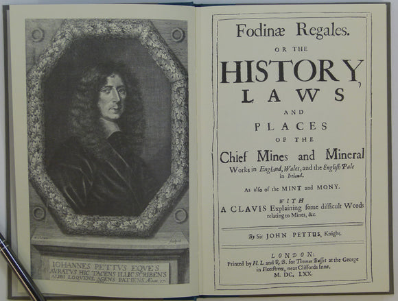
Pettus, John (1670) Repro. Fodinae Regalis. Or the History , Laws and Places of the Chief Mines and Mineral Works in England, Wales, and the English Pale in Ireland. Institute of Mining and Metallurgy.
Plattes, Gabriel (1639). A Discovery of Subterraneall Treasure, viz. Of all manner of Mines and Mineralls, from Gold to the Coale. London: J. Okes, REPRODUCTION (1980). Institute of Mining and Metallurgy.
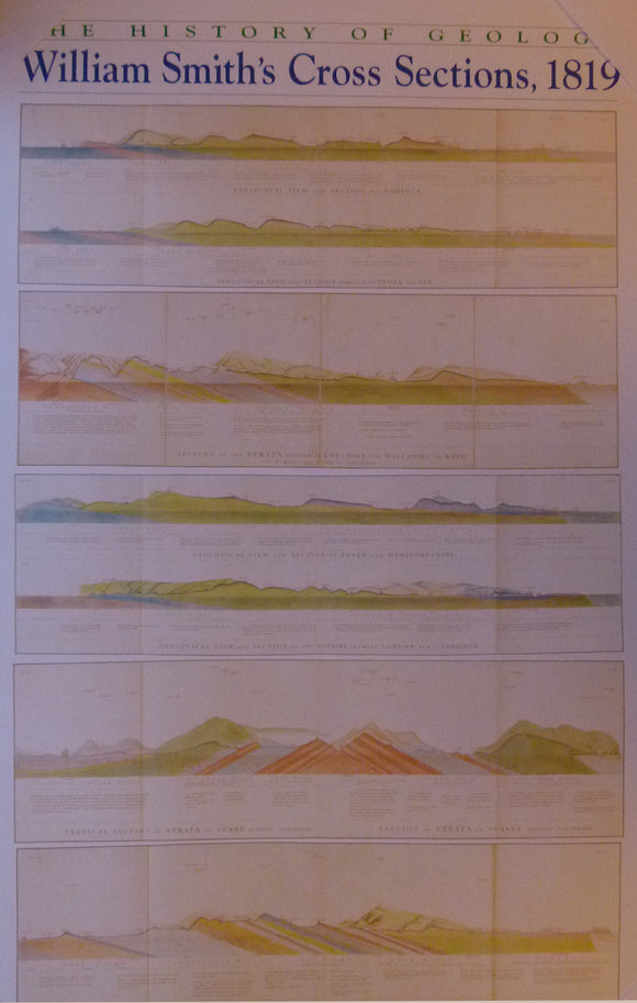
sections, The History of Geology, William Smith’s Cross Sections, 1819. Reproduction. Smith, William.
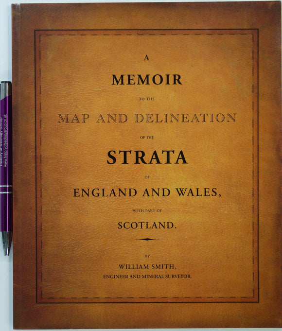
Smith William. (2015). A Memoir to the Map and Delineation of the Strata of England and Wales with part of Scotland. FACSIMILE. British Geological Survey. British Geological Survey.
Smith, William (1819) REPRO Geological Map of Gloucestershire. 1974 reproduction by the Natural History Museum. Full size 64 x 54.5cm. British Museum.


![Czizek Johann Bapt. (1847). Geognostiche Karte Ungebunen Wien’s [Vienna, Austria]. Reproduction. 1 inch to a mile approx.](http://geolmaps.com/cdn/shop/files/ViennabyCzjzek1847_1_{width}x.jpg?v=1764506417)
![Czizek Johann Bapt. (1847). Geognostiche Karte Ungebunen Wien’s [Vienna, Austria]. Reproduction. 1 inch to a mile approx.](http://geolmaps.com/cdn/shop/files/ViennabyCzjzek1847_1_580x.jpg?v=1764506417)


![Old Series Ordnance Survey [reproduced] Maps, Volume 3 (1981). South-central England (Hampshire and the Isle of Wight and](http://geolmaps.com/cdn/shop/files/OldSeriesAtlasv3_1_{width}x.jpg?v=1710259664)
![Old Series Ordnance Survey [reproduced] Maps, Volume 3 (1981). South-central England (Hampshire and the Isle of Wight and](http://geolmaps.com/cdn/shop/files/OldSeriesAtlasv3_1_580x.jpg?v=1710259664)
![Old Series Ordnance Survey [reproduced] Maps, Volume 6 (1989). Wales (except for small parts of Flintshire, Radnorshire, and </em>](http://geolmaps.com/cdn/shop/files/OldSeriesAtlasv6_1_{width}x.jpg?v=1710259966)
![Old Series Ordnance Survey [reproduced] Maps, Volume 6 (1989). Wales (except for small parts of Flintshire, Radnorshire, and </em>](http://geolmaps.com/cdn/shop/files/OldSeriesAtlasv6_1_580x.jpg?v=1710259966)
![Old Series Ordnance Survey [reproduced]Maps, </em>Volume 8 (1992). Northern England and the Isle of Man (Cumberland, Durham, Isle of Man,](http://geolmaps.com/cdn/shop/files/OldSeriesAtlasv8_1_{width}x.jpg?v=1710260724)
![Old Series Ordnance Survey [reproduced]Maps, </em>Volume 8 (1992). Northern England and the Isle of Man (Cumberland, Durham, Isle of Man,](http://geolmaps.com/cdn/shop/files/OldSeriesAtlasv8_1_580x.jpg?v=1710260724)