Free UK postage
Allan, Douglas A. (1926). ‘the Volcanic History of Southern Fife’ offprint. Durham Phil Soc.
Allen, D.A. (1940). ‘The Geology of the Highland Border from Glen Almond to Glen Artney’, offprint of the Transactions of the Edinburgh Geological Society. Edinburgh Geological Society.
Anon. (1979). Mesozoic and Tertiary Volcanism in the North Atlantic and Neighbouring regions: Bull. Geological Survey of GB, No. 70. British Geological Survey.
Bailey, E.B. (1916).’The Islay Anticline (Inner Hebrides)’ extract from the Quarterly Journal of the Geological Society, v.72,. Geological Society of London.
Bailey, E.B. (1916).’The Structure of the South-West Highlands of Scotland’, extract from the Quarterly Journal of the Geological Society, v.72. Geological Society of London.
Bailey, E.B. (1921). ‘the Structure of the South-West Highlands of Scotland’ in QJGS. Geological Society of London.
Bailey, E.B. (1921).’The Islay Anticline (Inner Hebrides)’, extract from the Quarterly Journal of the Geological Society, v.77. Geological Society of London.
Bailey, E.B. (1945).’Tertiary Igneous Tectonics of Rhum (Inner Hebrides)’, offprint of the QJGS, v.100. Geological Society of London.
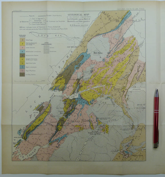
Bailey, Edward B, (1910), ‘Geological Map of the District Lying Between Loch Linnhe and the Moor of Rannoch and Etive Granites. QJGS.
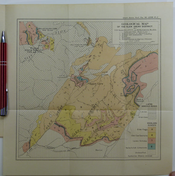
Bailey, Edward B, (1912), ‘Geological Map of the Glen Orchy District. Fold-out colour printed geological map. QJGS.
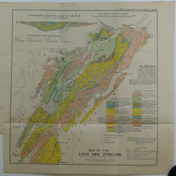
Bailey, Edward B, (1913), ‘Map of the Loch Awe Syncline’. Fold-out colour printed geological map and section. QJGS.
Bailey, Patrick (2004) Orkney. Newton Abbot, Pevensey Island Guides/ David & Charles. David & Charles.
Barrow, G. (1904), ‘ Moine Gneisses of the East-Central Highlands and their Position in the Highland Sequence’, extract from the Quarterly Journal of the Geological Society. Geological Society of London.
Black, G.P. (1966). Arthur’s Seat; a History of Edinburgh’s Volcano. Edinburgh: Oliver and Boyd, 1st edition. Oliver and Boyd.
Bryce, James (1872). The Geology of Arran and the other Clyde Islands. Glasgow: William Collins, 354pp. 4th edition. William Collins.
Clarkson, Euan and Upton, Brian (2009). Death of an Ocean; a Geological Borders Ballad. Edinburgh: Dunedin Academic Press, 1st ed. Dunedin.
Clough, CT., Maufe, HB., and Bailey, Edward B, (1909), geological map (untitled) Glens Coe and Etive and mountains between. Fold-out colour printed. QJGS.
Cockburn, A.M. (1935). The Geology of St.Kilda. Edinburgh: Royal Society of Edinburgh. Off print from the Transactions. Royal Society of Edinburgh.
Darling, f. Fraser (1947). Natural History in the Highlands and Islands. Collins: London. New Naturalist Series.
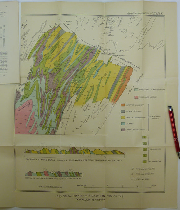
Elles, Gertrude L., (1934). ‘Geological Map of the Northern End of the Tayvallich Peninsula’ fold-out colour printed map 1:10,560. QJGS.
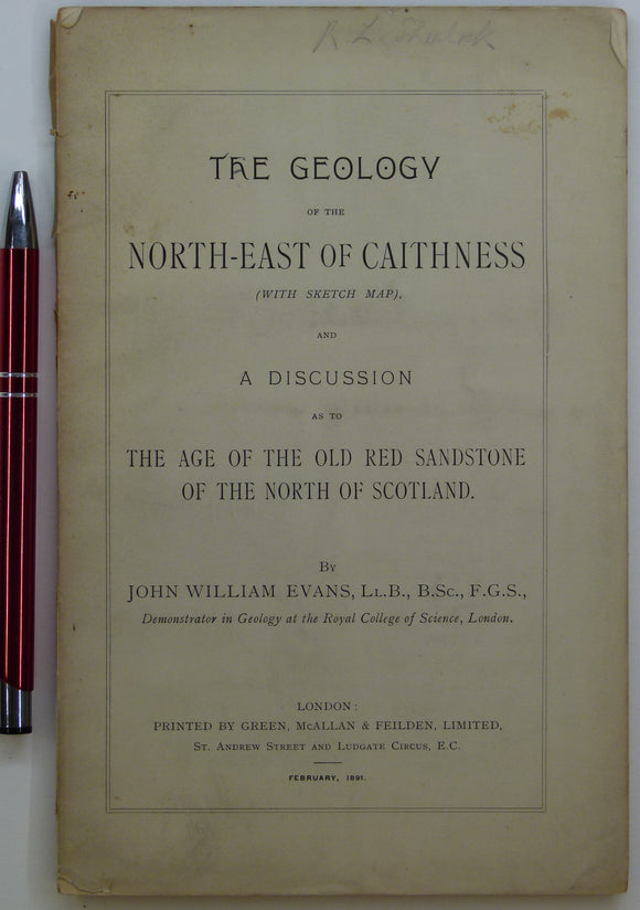
Evans, John W., (1891), geological map (untitled) of North-East Caithness. Fold-out b/w printed geological map. private publication.
Faujas St.-Fond, B. (1907). A Journey through England and Scotland to the Hebrides in 1794, 1907. Hugh Hopkins.
Garwood, E J. (1931). ‘The Tuedian Beds of North Cumberland and Roxburghshire, East of Liddel Water)’, extract of the QJGS. Geological Society of London.
Garwood, E J. (1931). ‘The Tuedian Beds of North Cumberland and Roxburghshire, East of Liddel Water)’, offprint of the QJGS, v.87. Geological Society of London.