Free UK postage
Belfast District, Drift, (1901). First edition. Colour print, flat, 45 x 61cm. Scale 1:63,360. Base map 1903. Geological Survey of Ireland.
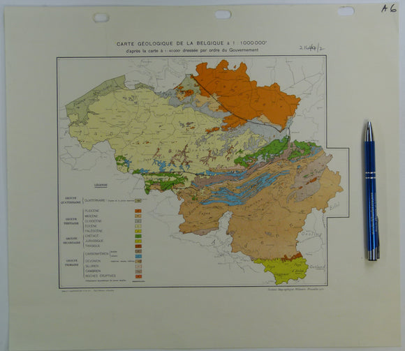
Belgium (1950). Carte Géologique de la Belgique; après la carte a 1:40,000 dressée par ordre du Govvernement. Flat colour printed map, 35.5 x 38.5cm. 1:500,000. Geological Survey of Belgium.
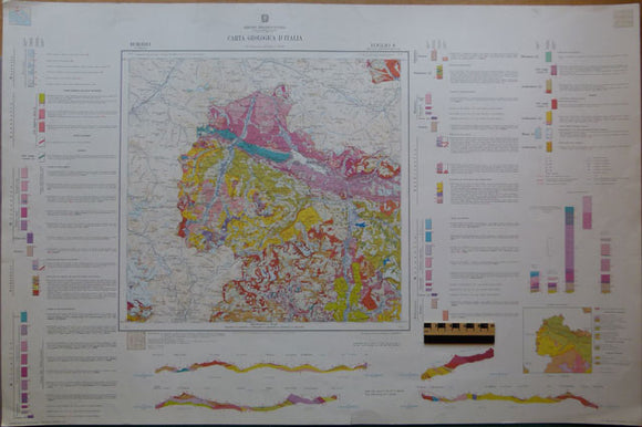
Boromeo, 1970, sheet 8 of Geologica d’Italia by Servizio Geologica d’Italia. Boromeo.
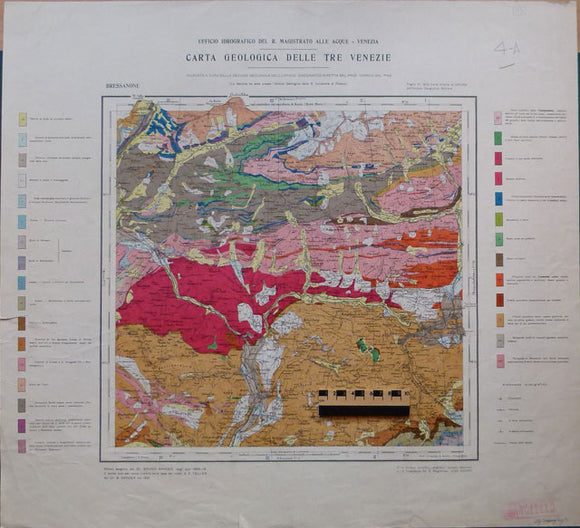
Bressanone, 1924, from Carta Geologica delle Tre Venezie, sheet 6, by Ufficio Idrografico del R. Magistrato alla Acque – Venezia. Bressanone.
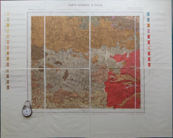
Bronte, sheet 261, Carta Geologicad’Italia (Isola di Sicilia). 261 Bronte a.
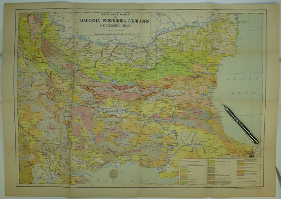
Bulgaria (c.1950). Geological Map of Bulgaria. 1:1,000,000 scale. Colour printed folded map, 50 x 70cm. Bulgarian Geological Survey.
Carte Geologique de la France, 1979. Bureau de Researches Geologiques et Minieres.
Carte Geologique de la France, 1980. Bureau de Researches Geologiques et Minieres.
Carte Tectonique de France, 1980. Bureau de Researches Geologiques et Minieres.
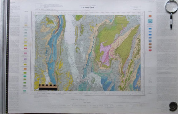
Chambéry. Bureau de Researches Geologiques et Minieres.
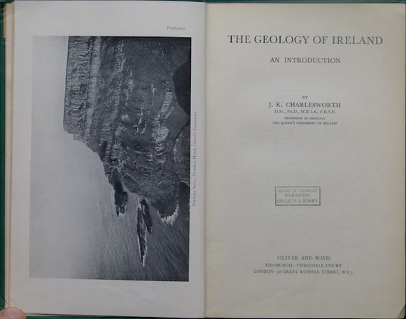
Charlesworth, J.K. (1953). The Geology of Ireland: an Introduction, 1953. Oliver and Boyd.
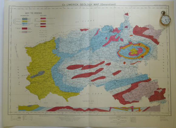
Co. Limerick Geology Map. 1969. Ordnance Survey of Ireland. Geological Survey of Ireland.
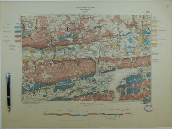
Cork District, Drift, (1903). First edition. Colour print, flat, 45 x 60.5cm. Scale 1:63,360. Base map 1899. Geological Survey of Ireland.
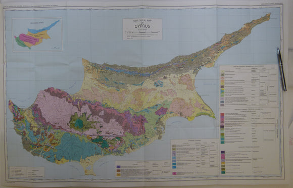
Cyprus (1995) Geological Map of Cyprus. Geological Survey Dept, revised edition. Colour printed map 1:250,000 scale (58 x 96cm) folded. geological survey of Cyprus.
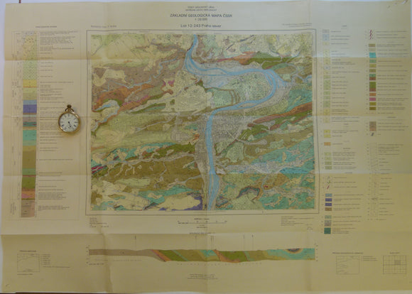
Czechoslovakia. 1983. List 12-243 Praha-sever. Prague. Colour printed geological map, 50 x 88cm at 1:25,000
Czechoslovakia. No date. M-33-13 Karlovy Vary-Plauen. Colour printed geological map, 38 x 49.5cm at 1:200,000 scale.
Czechoslovakia. No date. M-33-14 Teplice-Annaberg-Buchholz. Colour printed geological map, 38 x 37cm at 1:200,000
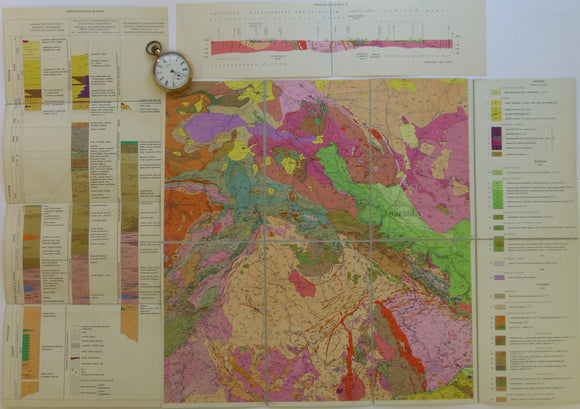
Czechoslovakia. No date. M-33-8 Chabarovice-Dresden. Colour printed geological map, 38 x 49.5cm at 1:200,000
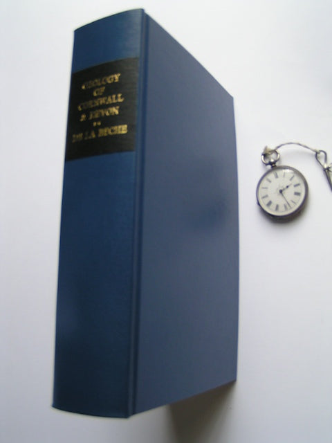
De la Beche, Henry T. (1839). Report on the Geology of Cornwall, Devon and West Somerset. Longman et al.
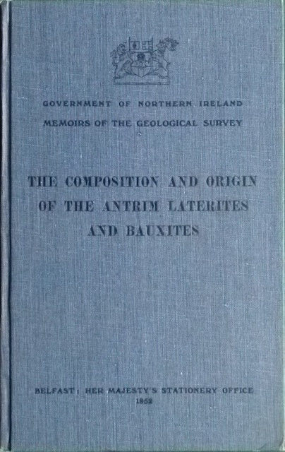
Eyles, V.A. (1952). The Composition and Origin of the Antrim Laterites and Bauxites. Geological Survey of N. Ireland.
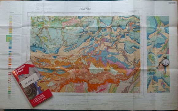
Fayence, sheet 998, Carte Geologique Detaill é de la France, 1966. Bureau de Researches Geologiques et Minieres.
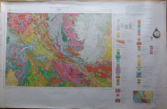
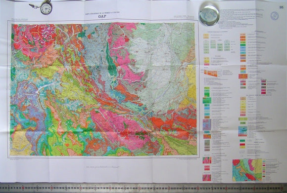
Gap, sheet 35 of Carte Geologique de France, 1980. Bureau de Researches Geologiques et Minieres.
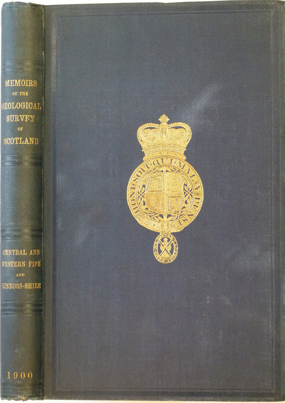
Geikie, Archibald. 1900. Geology of Central and Western Fife and Kinross. Geol. Survey of Scotland Memoir. Geological Survey of Scotland.
Glacial Drift Map of Co. Limerick Geology Map. 1966. Geological Survey of Ireland. Geological Survey of Ireland.