Free UK postage
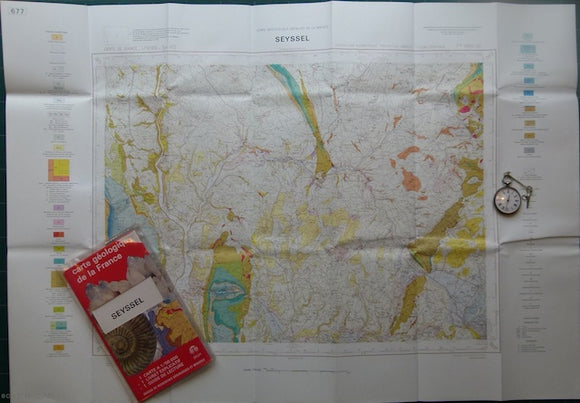
Sheet 677, Seyssel, Carte Géologique Détaillée de la France, 1972. Bureau de Researches Geologiques et Minieres.
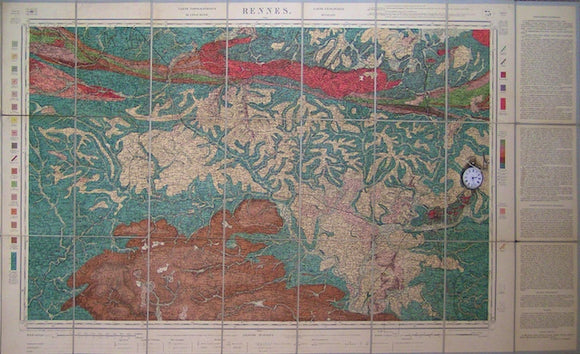
Sheet 75, Rennes, Carte Geologique Détaillée-Rennes,1893. Scale 1:160,000. Bureau de Researches Geologiques et Minieres.
Sheet 8-II, 1:50,000. Nieweschans, 1946. Rijks Geologische Dienst.
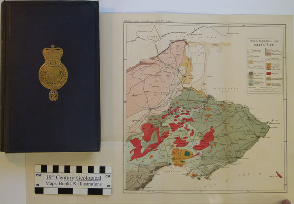
Sheet memoir 41. Geikie, Archibald. 1902. Geology of Eastern Fife. Geol. Survey of Scotland Memoir. Geological Survey of Scotland.
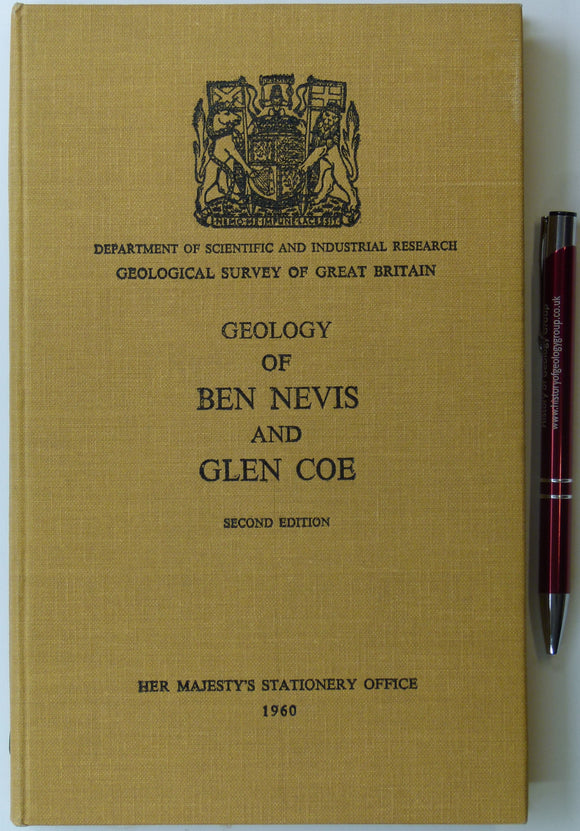
Sheet memoir 53. Bailey, E.B., Maufe, M.A. et al. (1960). The Geology of Ben Nevis and Glen Coe and Surrounding Country. second…. Geological Survey of Scotland.
Sheet WarOffice(UK)GSGS4324, 1:50,000. Biesboch, 18. Rijks Geologische Dienst.
Sheet WarOffice(UK)GSGS4324, 1:50,000. Kempen, 22. Rijks Geologische Dienst.
Sheet 45ne drift, Old Series 1". 1873. Buckinghamshire, Oxfordshire: Buckingham, Souldern. Base map 1833, railways inserted 1890. Geological Survey of England & Wales.
Sheet 45ne, Old Series 1". 1873. Buckinghamshire, Oxfordshire: Buckingham, Souldern. Base map 1833, railways inserted 1890. Geological Survey of England & Wales.
Sheet 46ne Drift, Old Series 1". 1884. 1st drift edition Buckinghamshire, Hertfordshire: Ampthill, Hitchin, Baldock. Base map 1834. Geological Survey of England & Wales.
Sheet 52sw, Old Series 1". 1871. Bedfordshire, Northamptonshire: Northampton. Topography 1835. Geological Survey of England & Wales.
Sheet 53sw, Old Series 1". 1880. Warwickshire Northamptonshire: Southam, Fenny Compton. Hand coloured engraving. Geological Survey of England & Wales.
Sheet 54nw, Old Series 1". 1898. Worcestershire: Droitwich, Bromsgrove. Hand coloured engraving. Geological Survey of England & Wales.
Sheet 35, Old Series 1". 1890. Gloucestershire / Monmouth / Wiltshire: Bristol, Chepstow, Badminton. Topography1830. British Geological Survey.
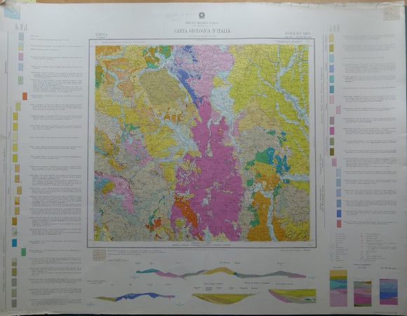
Siena, sheet 120, Carta Geologicad’Italia, 1968. 120 Siena.
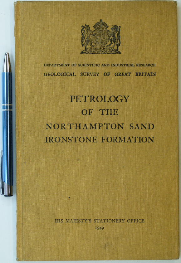
Taylor, J.H., (1949). Petrology of the Northampton Sand Ironstone Formation. Memoir of the Geological Survey. Geological Survey of England & Wales.
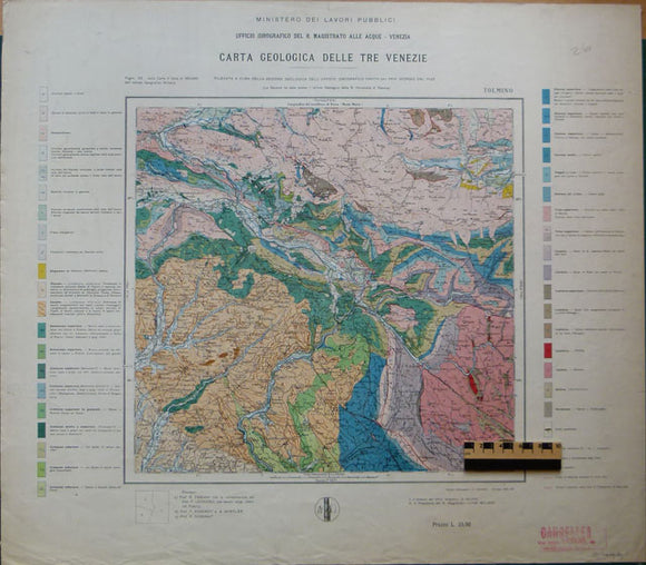
Tolmino, 1937, from Carta Geologica delle Tre Venezie, sheet 26, by Ufficio Idrografico del R. Magistrato alla Acque – Venezia. Tolmino.
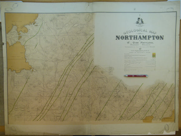
Western Australia, Geological Map of Northampton, 1898. By Gov’t geologist, A.Gibb Maitland. 1:15,840. Geological Survey of Western Australia.
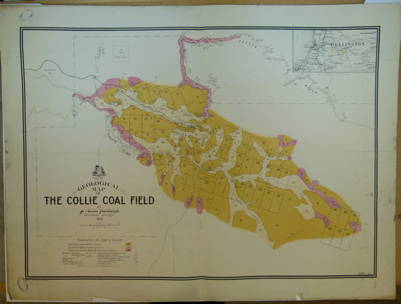
Western Australia, Geological Map of the Collie Coal Field, 1898. By Gov’t geologist, A.Gibb Maitland. 1:31,680. Geological Survey of Western Australia.
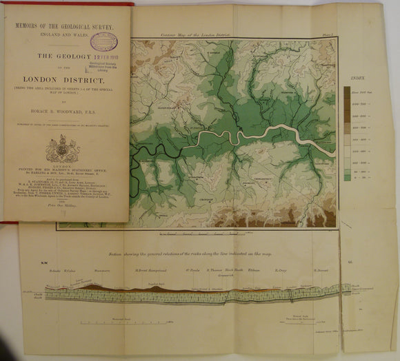
Woodward, H.B. (1909). The Geology of the London District (being the area included in the Sheets 1 – 4 of the Special Map of London) 1st edition.
Wright, J.F. (1968). The Geology of the Church Stretton area: Explanation of 1:25,000 Geological Sheet SO59. London: HMSO. British Geological Survey.