Free UK postage
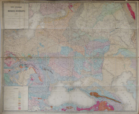
Carte Geologique de la Russie d’Europe, 1859. Approx 1:3,675,000 scale. (77 x 93.5cm) hand-coloured engraved map. Jules Guillemin.
Oswald, Felix (1914). A Geological Map of the Caucasus, 1:1,000,000 scale. Colour lithograph, includes parts of Ukraine, Georgia, Armenia and Azerbaijan. self published.
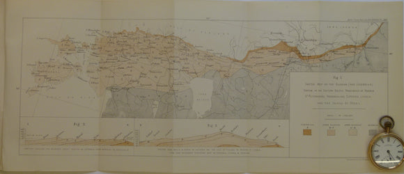
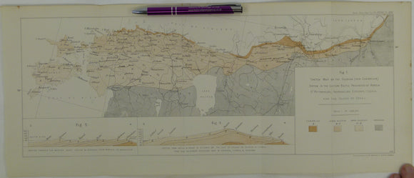
Schmidt, F. (1882). 'Sketch Map of the Silurian (and Cambrian) System in the Eastern Baltic Provinces of Russia. Geological Society of London.
Schmidt, F. (1882). 'Sketch Map of the Silurian (and Cambrian) System in the Eastern Baltic Provinces of Russia –. Geological Society of London.