Free UK postage
Ireland sheet 97, Mount Bellew, 1” scale. 1867. First edition. Base map not dated. Coloured 1909. Hand-coloured. Geological Survey of Ireland.
Ireland sheet 98, Ballymahon, 1” scale. 1865. First edition. Lough Ree. Base map not dated. Coloured 1909. Hand-coloured. Geological Survey of Ireland.
Ireland sheet 99, Mullinagar, 1” scale. 1864. First edition. Covers Ballynacarrigy, Loughs Ennell and Owel. Hand-coloured. Geological Survey of Ireland.
Ireland sheet 101, Trim, 1” scale. 1901. Covers Dunboyne. Base map not dated. Coloured 1902. Hand-coloured. Geological Survey of Ireland.
Ireland sheet 106, Athenry, 1” scale. 1867, first edition. Oranmore Bay, Monivea. Base map not dated. Hand-coloured. Geological Survey of Ireland.
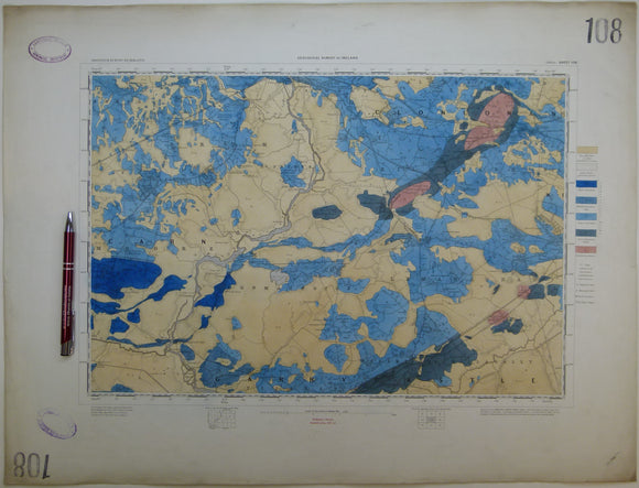
Ireland sheet 108, Athlone, 1” scale. 1865. First edition. Covers Shannonbridge, Moate, Ferrane. Hand-coloured. Geological Survey of Ireland.
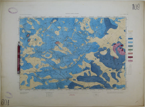
Ireland sheet 109, Tullamore, 1” scale. 1864. First edition. Base map not dated. Covers Clara, Phillipstown. Hand-coloured. Geological Survey of Ireland.
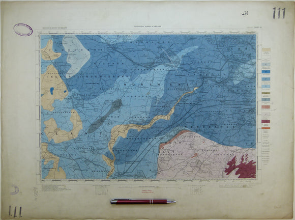
Ireland sheet 111, Maynooth, 1” scale. 1901. Covers Robertstown, Kilcock, Clondalkin. Hand-coloured. Geological Survey of Ireland.
Ireland sheet 112 drift, Dublin, 1” scale. 1901. Base map 1900. Covers Howth, Killiney, Palmerstown. Colour printed. Geological Survey of Ireland.
Ireland sheet 112 drift, Dublin, 1” scale. 1901. Base map 1900. Covers Howth, Killiney, Palmerstown. Colour printed,. Geological Survey of Ireland.
Ireland sheet 115, Loughrea, 1” scale. 1901. Base map not dated. Covers Kinvarra. Hand-coloured. Geological Survey of Ireland.
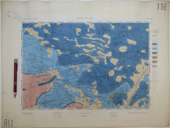
Ireland sheet 116, Portumna, 1” scale. 1863, first edition. Covers Killimore, Eyrecourt. Hand-coloure. Geological Survey of Ireland.
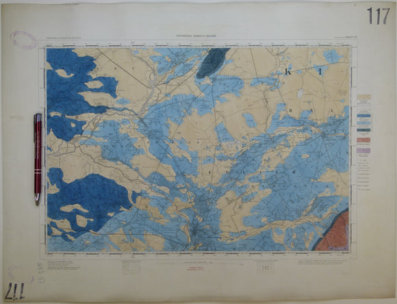
Ireland sheet 117, Parsonstown, 1” scale. 1901. Covers Frankford, Banagher, Cloghan. Hand-coloured. Geological Survey of Ireland.
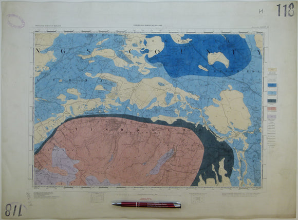
Ireland sheet 118, Mountmellick, 1” scale. 1901. Base map not dated. Coloured 1904. Hand-coloured. Geological Survey of Ireland.
Ireland sheet 124, Gort, 1” scale. 1901. Covers Lough Cooter. Base map not dated. Coloured 1902. Hand-coloured. Geological Survey of Ireland.
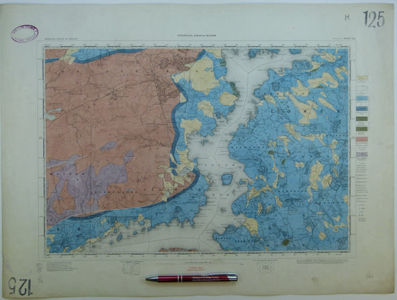
Ireland sheet 125, Woodford, 1” scale. 1901. Covers Lough Derg. Coloured 1904. Hand-coloured. Geological Survey of Ireland.
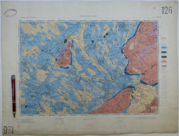
Ireland sheet 126, Roscrea, 1” scale. 1901. Base map not dated. Coloured 1910. Hand-coloured. Geological Survey of Ireland.
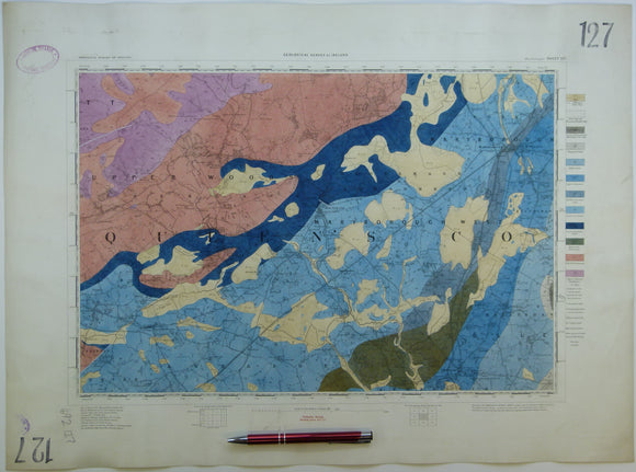
Ireland sheet 127, Maryborough, 1” scale. 1901. Covers Abbeyleix, Mountraith. Hand-coloured. Geological Survey of Ireland.
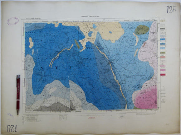
Ireland sheet 128, Athy, 1” scale. 1901. Covers Stradbally. Base map not dated. Coloured 1908. Hand-coloured. Geological Survey of Ireland.
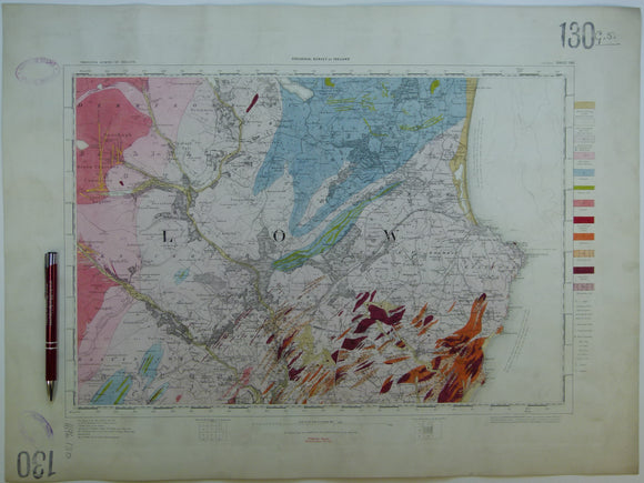
Ireland sheet 130, Wicklow, 1” scale. 1901. Covers Vale of Glendalough, Rathdrum. Hand-coloured. Geological Survey of Ireland.
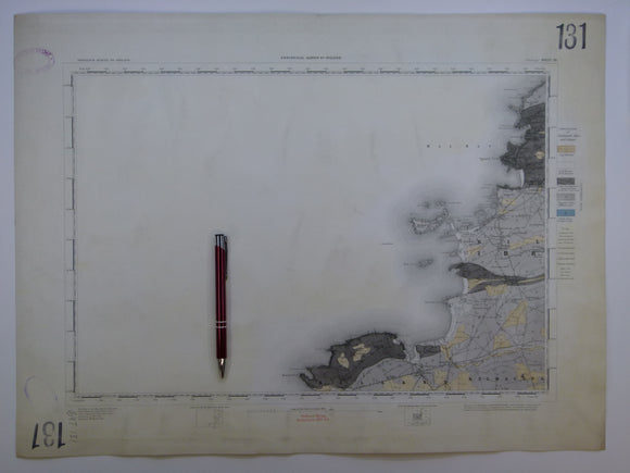
Ireland sheet 131, Mullagh, 1” scale. 1882. Covers Atlantic coast: Donegal Point, Mal Bay – 80% sea. Hand-coloured. Geological Survey of Ireland.
Ireland sheet 132, Ennis, 1” scale. 1882. Covers Milltown Malbay. Coloured 1905. Hand-coloured. Geological Survey of Ireland.
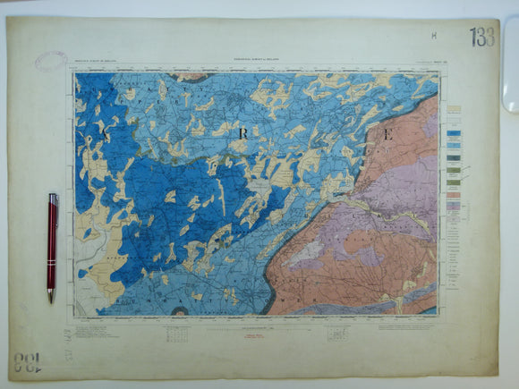
Ireland sheet 133, Sixmilebridge, 1” scale. 1882. Covers Newmarket in Fergus, Tulla. Hand-coloured. Geological Survey of Ireland.
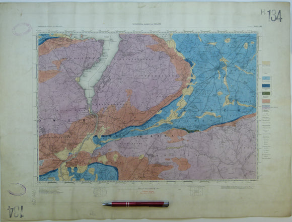
Ireland sheet 134, Nenagh, 1” scale. 1901. Covers Killaloe, Silvermines. Base map not dated. Hand-coloured. Geological Survey of Ireland.