Free UK postage
Sheet 109sw drift, Old Series 1". 1895. First drift edition. Northumberland: Rothbury, Amble. Hand coloured. Geological Survey of England & Wales.
Sheet 110ne drift, Old Series 1". 1884. First drift edition. Northumberland: Berwick on Tweed. Hand coloured. Geological Survey of England & Wales.
Sheet 110sw drift, Old Series 1". 1885. First drift edition. Northumberland: Cornhill. Hand coloured engraving. Geological Survey of England & Wales.
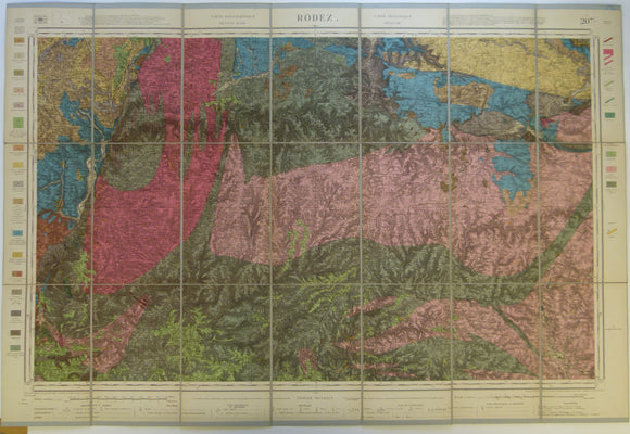
Sheet 207, Rodez, Carte Géologique Détaillée de la France, 1893. Scale 1:80,000. Bureau de Researches Geologiques et Minieres.
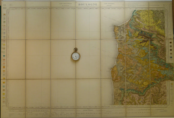
Sheet 3, Boulogne, Carte Géologique Détaillée de, 1885, 2nd edition, 1:80,000 scale. Bureau de Researches Geologiques et Minieres.
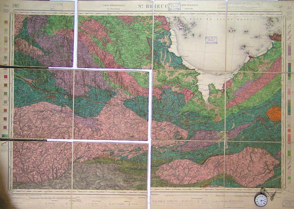
Sheet 59, St. Brieuc, Carte Géologique Détaillée, 1897. Scale 1:160,000. Bureau de Researches Geologiques et Minieres.
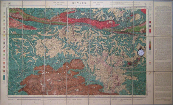
Sheet 75, Rennes, Carte Geologique Détaillée-Rennes,1893. Scale 1:160,000. Bureau de Researches Geologiques et Minieres.
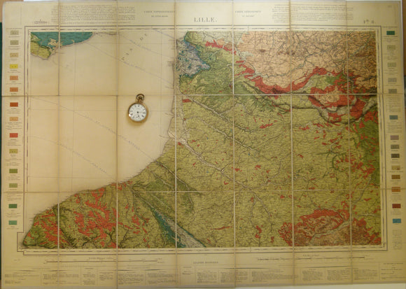
Sheet 8, Lille, Carte Géologique de, 1897, 1:320,000 scale. Base map 1852. French Geological Survey.
Sheet Memoir 112-113 (parts), 82se Old Series (1879). The Geology of parts of Nottinghamshire and Derbyshire, by Aveline, W.T. British Geological Survey.
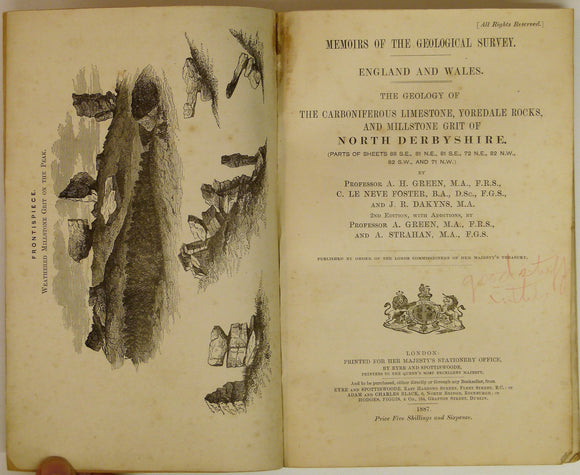
Sheet Memoir 125. Geology of the Carboniferous Limestone, Yoredale Rocks and Millstone Grit of North Derbyshire, by Green…. Geological Survey of England & Wales.
Sheet Memoir 249. Newport (Geology of the South Wales Coalfield, part I), by Strahan, A. 1899. First edition.
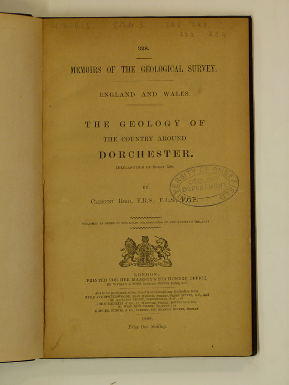
Sheet Memoir 328, 329, 332, 334. 4 old series reports bound in one volume, all 1st editions by Reid, C. Dorchester, 1899, 52pp. Geological Survey of England & Wales.
Sheet 45ne drift, Old Series 1". 1873. Buckinghamshire, Oxfordshire: Buckingham, Souldern. Base map 1833, railways inserted 1890. Geological Survey of England & Wales.
Sheet 45ne, Old Series 1". 1873. Buckinghamshire, Oxfordshire: Buckingham, Souldern. Base map 1833, railways inserted 1890. Geological Survey of England & Wales.
Sheet 46ne Drift, Old Series 1". 1884. 1st drift edition Buckinghamshire, Hertfordshire: Ampthill, Hitchin, Baldock. Base map 1834. Geological Survey of England & Wales.
Sheet 52sw, Old Series 1". 1871. Bedfordshire, Northamptonshire: Northampton. Topography 1835. Geological Survey of England & Wales.
Sheet 53sw, Old Series 1". 1880. Warwickshire Northamptonshire: Southam, Fenny Compton. Hand coloured engraving. Geological Survey of England & Wales.
Sheet 54nw, Old Series 1". 1898. Worcestershire: Droitwich, Bromsgrove. Hand coloured engraving. Geological Survey of England & Wales.
Sheet 35, Old Series 1". 1890. Gloucestershire / Monmouth / Wiltshire: Bristol, Chepstow, Badminton. Topography1830. British Geological Survey.
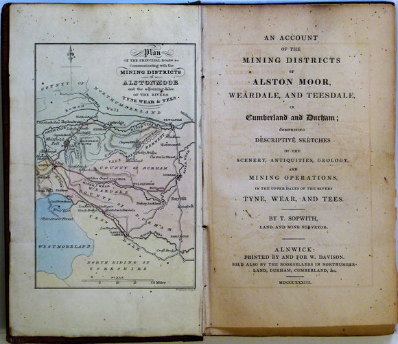
Sopwith, Thomas. 1833. An Account of the Mining Districts of Alston Moor, Weardale and Teesdale. William Davison.