Free UK postage
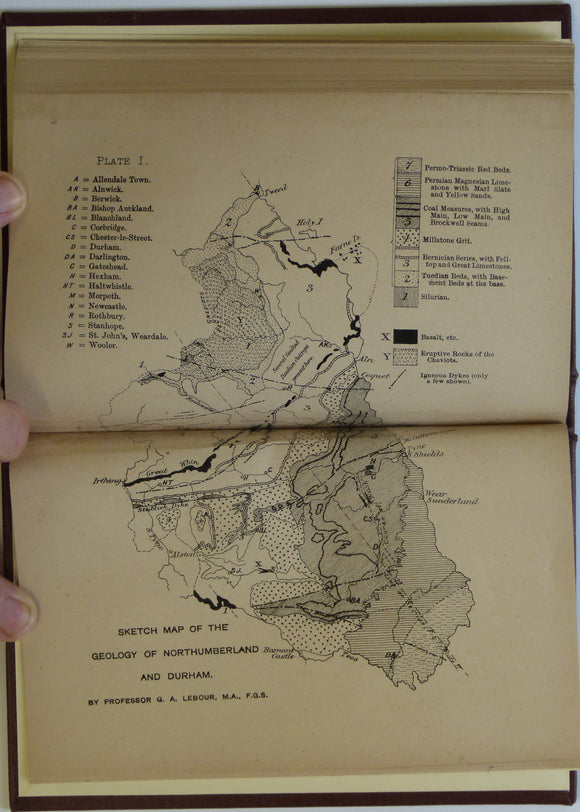
Lebour, GA. 1886. Outlines of the Geology of Northumberland and Durham. Lambert and Co..
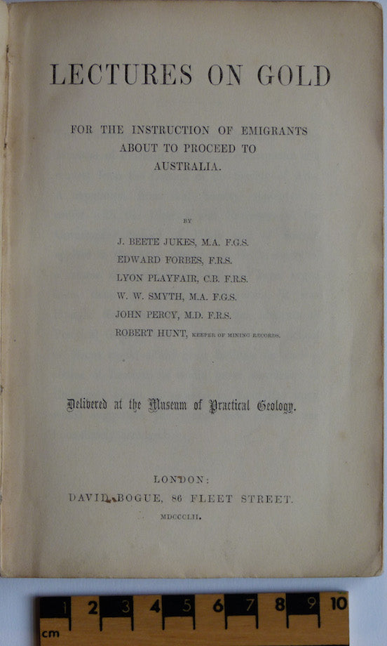
Lectures on Gold; for the instruction of Emigrants about to Proceed to Australia, 1852. Beete Jukes et al.
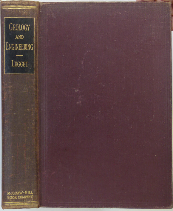
Leggett, R,F, (1939). Geology and Engineering. London: McGraw Hill. 650pp. 1st ed, 6th impression. . Hardcover,. McGraw-Hill.
Leicestershire 23ne, 6". Coalville, 1903/1905, black outline, blue geology. Geological Survey of England & Wales.
Leicestershire 23nw, 6". Packington, 1904/1905, black outline, blue geology. Geological Survey of England & Wales.
Leicestershire 23se, 6". Ibstock, 1903/1905, black outline, blue geology. Geological Survey of England & Wales.
Leicestershire 23sw, 6". Heather, 1903/1905, black outline, blue geology. Geological Survey of England & Wales.
Leicestershire 28nw, 6". Newton Regis, 1903/1923, black outline, blue geology. Geological Survey of England & Wales.
Leicestershire 29ne, 6". Nailstone, 1904/1905, black outline, blue geology, In fair condition. Geological Survey of England & Wales.
Leicestershire 31ne, 6". Belgrave, 1904/1905, black outline, blue geology. Geological Survey of England & Wales.
Leicestershire 31nw, 6". Anstey, 1904/1905, black outline, blue geology. Geological Survey of England & Wales.
Leicestershire 31se, 6". Leicester, east, 1904/1905, black outline, blue geology. Geological Survey of England & Wales.
Leicestershire 31sw, 6". Leicester, west, 1904/1905, black outline, blue geology. Geological Survey of England & Wales.
Leicestershire 34nw, 6". Dordon, 1904/1923, black outline, blue geology. Geological Survey of England & Wales.
Leicestershire 37ne, 6". Leicester, southeast, 1904/1905, black outline, blue geology. Geological Survey of England & Wales.
Leicestershire 37nw, 6". Leicester, southwest, 1904/1905, black outline, blue geology. Geological Survey of England & Wales.
Leicestershire 42sw, 6". Nuneaton, 1949/1949, black outline, red geology. Geological Survey of England & Wales.
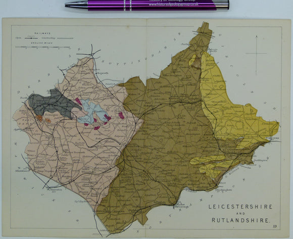
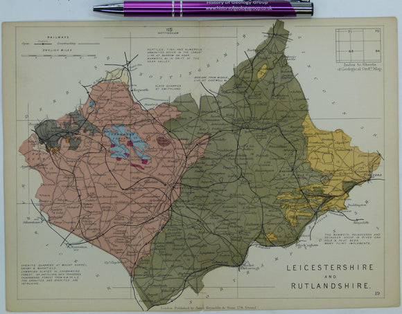
Leicestershire and Rutlandshire (1864) counties geological map from Reynolds’s Geological Atlas of Great Britain, 1st. Reynolds.
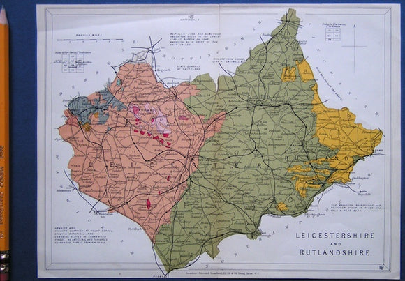
Leicestershire and Rutlandshire (1889) counties geological map from Reynolds’s Geological Atlas of Great Britain, 2nd. Reynolds.
Leicestershire and Rutlandshire (1913) counties geological map from Stanford’s Geological Atlas of Great Britain and Ireland, 3rd edition. Stanford's and Reynolds' Atlases.
Lenard, Philip (1954). Great Men of Science; a History of Scientific Progress. London: Bell, Translated from German. Bell and Sons.
Leveridge, B.E. et al (eds), (2011). The Marine Devonian of Great Britain, Special edition of PGA. Elsevier. V.122, Issue 4. 250pp. Geologists' Association.
Lewis, C.L. and Knell, S.J. (2009). The Making of the Geological Society of London. Special Publication 317. London: Geological Society, 471pp. Hard cover. New. Geological Society of London.
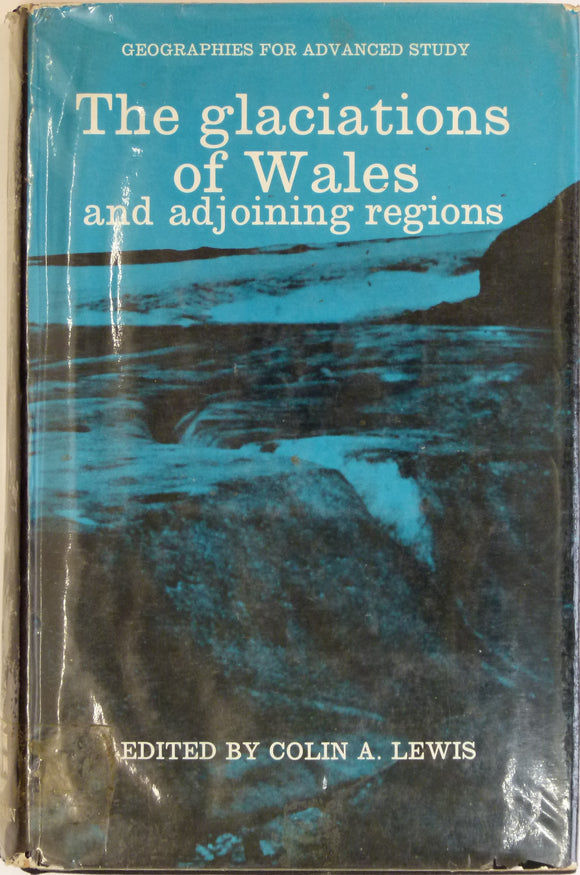
Lewis, Colin A. (ed), 1970. The Glaciations of South Wales and Adjoining Regions. Longman et al.