Free UK postage
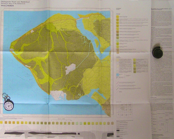
Walcheren, 1971. RGD.
Wales Mid- 1906. [Geological] Map of the Ordovician Rocks of Western Caermarthenshire, colour. Geological Society of London.
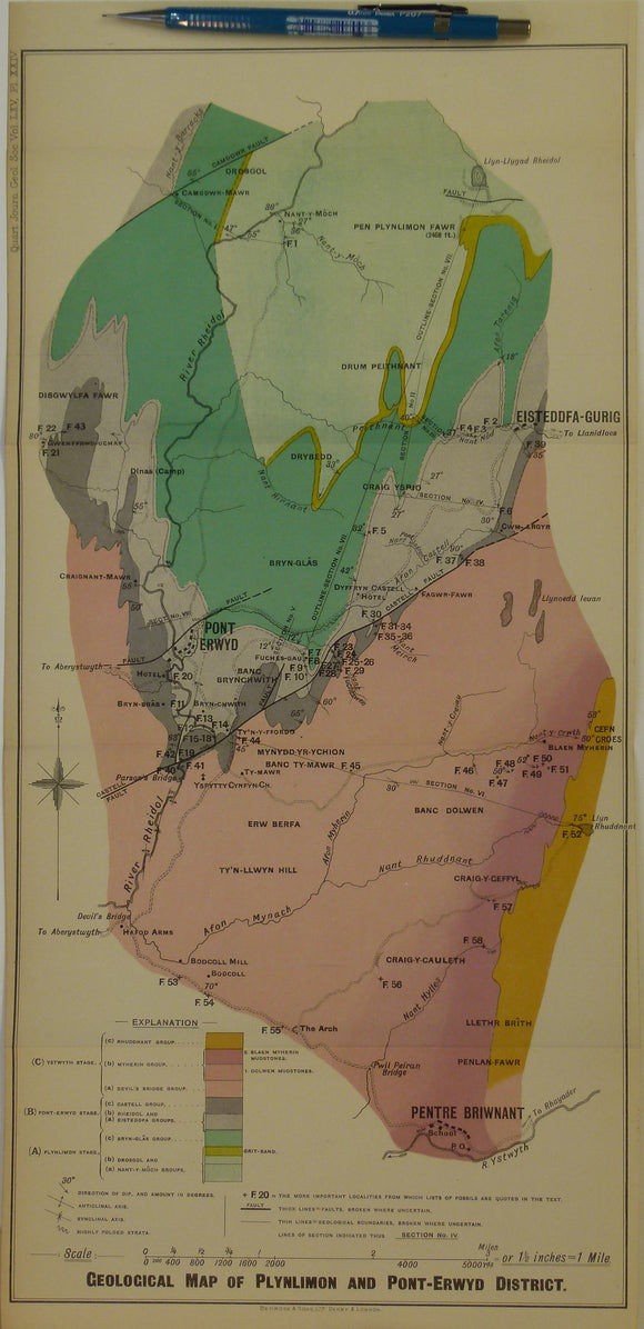
Wales Mid- 1909. Geological Map of Plynlimon and Pont-Erwyd District, colour. Geological Society of London.
Wales Mid- 1916. Map Illustrating the Geology of the District around Machynlleth and the Llyfnant Valley, colour. Geological Society of London.
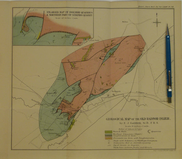
Wales Mid- 1917. Geological Map of the Old Radnor Inlier, colour printed. Geological Society of London.
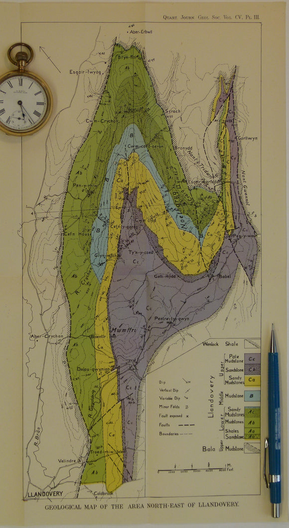
Wales Mid- 1925. Geological map of the Area South-East of Llandovery, colour. Geological Society of London.
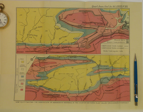
Wales Mid- 1933. Map Illustrating the Disposition of Arenaceous Material in the Country between Elan Valley (Rhayader) & Pumpsaint, colour. Geological Society of London.
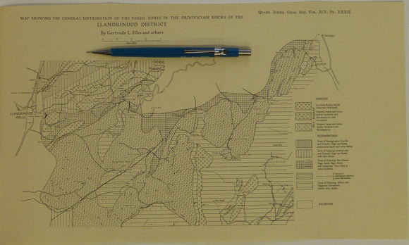
Wales Mid- 1939. Map Showing the General Distribution of the Fossil Zones n the Ordovician Rocks of the Llandrindod District, b&w. Geological Society of London.
Wales Mid- 1946. [Map of] The Complex Intrusion of Welfield, Near Builth Wells, Radnorshire, colour. Geological Society of London.
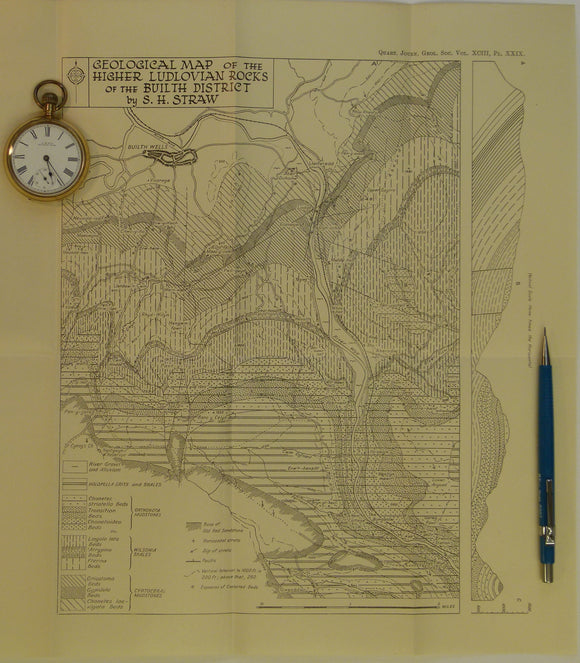
Wales Mid- 1947. Geological Map of the Higher Ludlovian rocks of the Builth District, b&w. Geological Society of London.
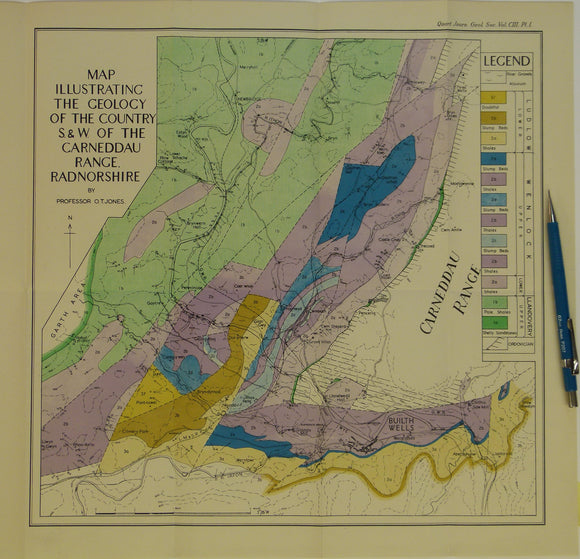
Wales Mid- 1947. Map Illustrating the Geology of the Country S.&W. of the Carneddau Range, Radnorshire, colour. Geological Society of London.
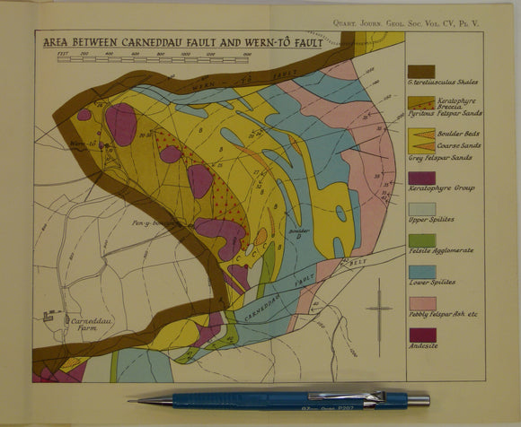
Wales Mid- 1949. 3 maps: Area between Llanelwedd and Carneddau Fault, and Area between Carneddau Fault and Wern-to Fault, and Area Between Wern-to Fault and Cwm-Amliw Fault , all colour. Geological Society of London.
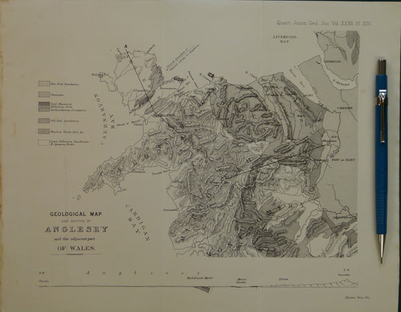
Wales North 1876. Geological Map of and Section of Anglesey and adjacent part Wales. Geological Society of London.
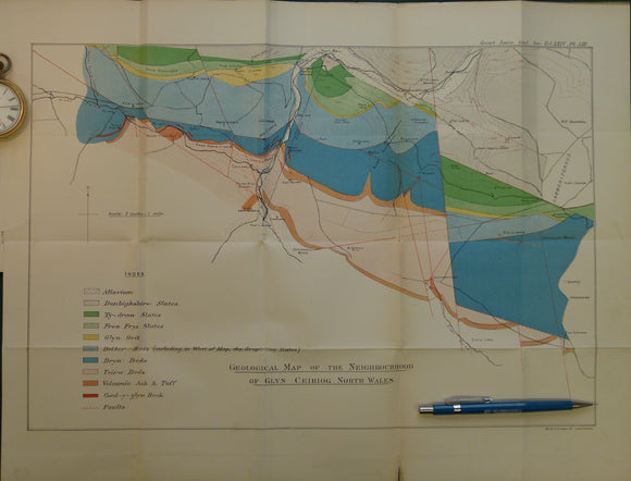
Wales North 1908. Geological Map of the Neighbourhood of Glyn Ceiriog, North Wales. Geological Society of London.
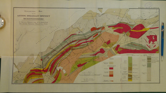
Wales North 1920. Geological Map of Arthog-Dolgelley District Merionethshire. Geological Society of London.
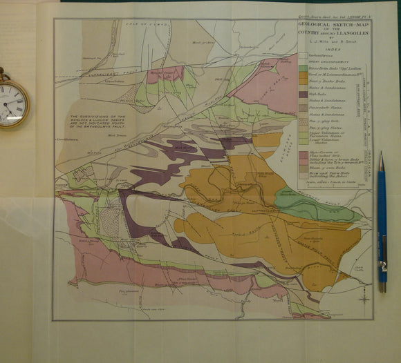
Wales North 1922. Geological Sketch-Map of the Country around Llangollen. Geological Society of London.
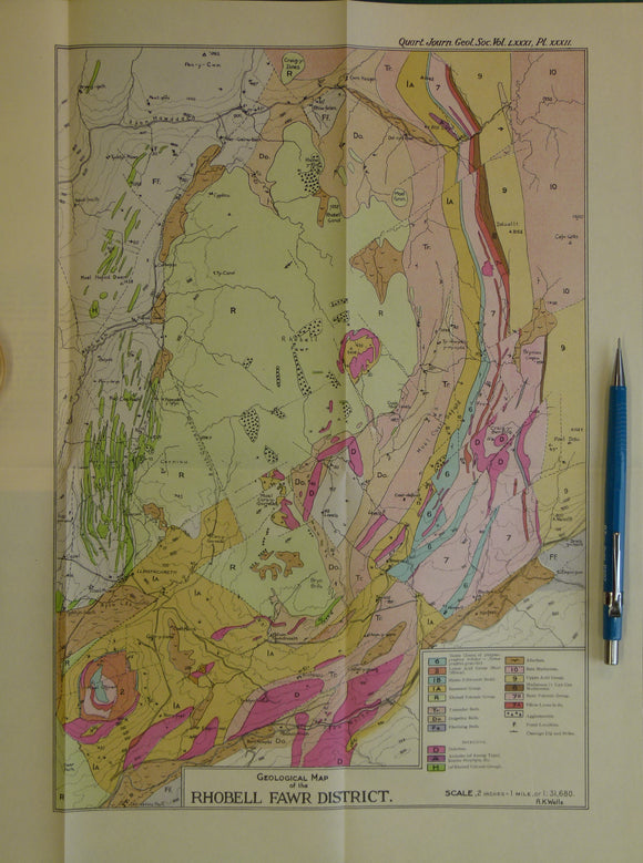
Wales North 1925. Geological Map of the Rhobell Fawr District, colour. Geological Society of London.
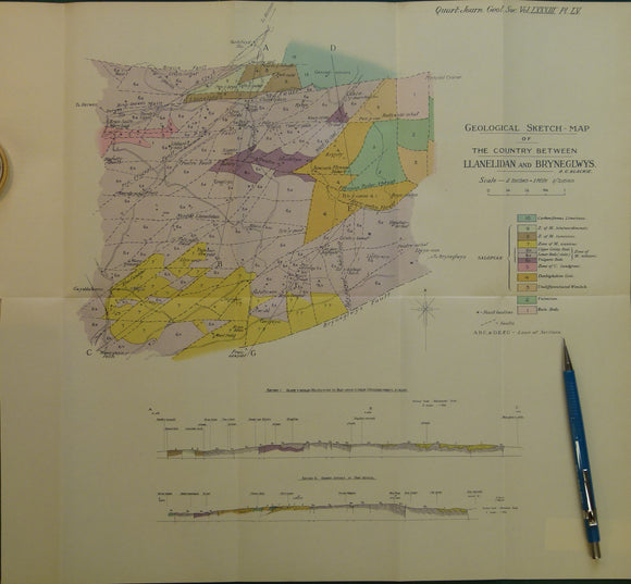
Wales North 1928. Geological Sketch-Map of the Country Between Llanelidan and Bryneglwys, colour. Geological Society of London.
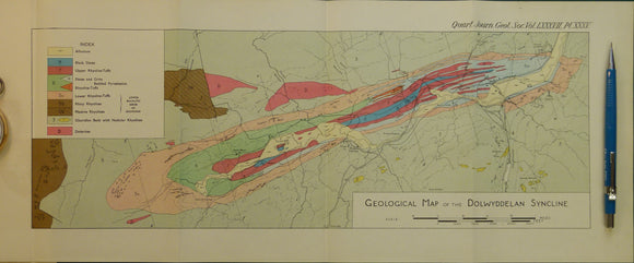
Wales North 1931. Geological Map of the Dolwyddelan Syncline, colour. Geological Society of London.
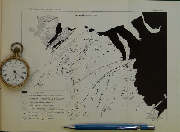
Wales North 1952. Untitled geological map of North Wales, B&W printed folded map
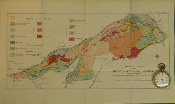
Wales South 1912. Geological Map of the Brawdy and Haycastle District, Pembrokeshire, colour. Geological Society of London.
Wales South 1938. I – The River Scenery at the Head of the Vale of Neath. By Frederick J North. National Museum of Wales.
Wales South 1944. Geological Map of the Prescelly Hills, North Pembrokeshire, colour. Geological So.

![Wales Mid- 1906. [Geological] Map of the Ordovician Rocks of Western Caermarthenshire, colour](http://geolmaps.com/cdn/shop/products/P1080558_{width}x.JPG?v=1547141707)
![Wales Mid- 1906. [Geological] Map of the Ordovician Rocks of Western Caermarthenshire, colour](http://geolmaps.com/cdn/shop/products/P1080558_580x.JPG?v=1547141707)


![Wales Mid- 1946. [Map of] The Complex Intrusion of Welfield, Near Builth Wells, Radnorshire, colour](http://geolmaps.com/cdn/shop/products/P1080550_{width}x.JPG?v=1547142668)
![Wales Mid- 1946. [Map of] The Complex Intrusion of Welfield, Near Builth Wells, Radnorshire, colour](http://geolmaps.com/cdn/shop/products/P1080550_580x.JPG?v=1547142668)