Free UK postage
Plymen, G.H. (1951). The Geological Structure of Guernsey [Channel Islands], offprint from La Societe Guernesiaise. La Societe Guernesiaise.
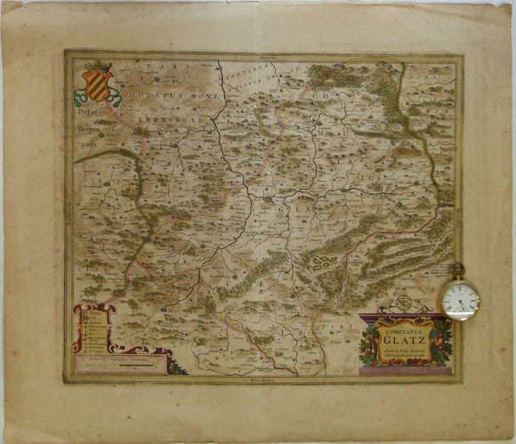
Poland. 1639. Comitatus Glatz. Authore Iona Sculteto. Henricus Hondius execudit, Amsterdam. Hand coloured engraving at 1:100,000 approx
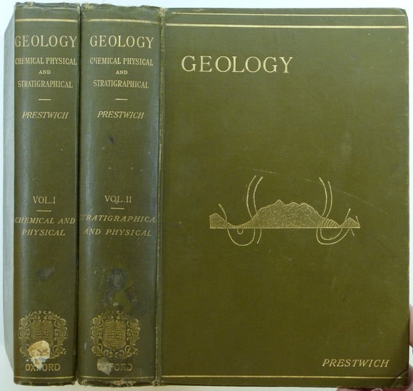
Prestwich, Joseph, (1886/88). Geology: Chemical, Physical and Stratigraphical. Oxford: Clarendon Press, first edition. 2 volumes. Clarendon Press.
Prosser, Robert (1977). Geology Explained in the Lake District. Newton Abbot: David and Charles. First edition. David & Charles.
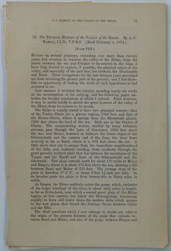
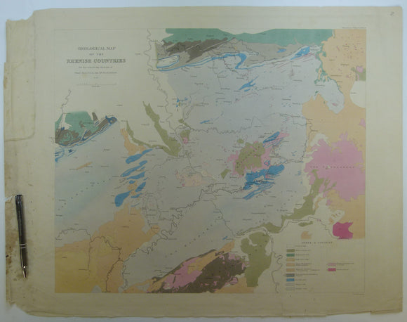
Ramsey, A.C, (1874). ‘the Physical History of the Valley of the Rhine’, extract from Transactions of the Geological Society. v.30, pp 81-95. Geological Society of London.
Rawdon, P.F. & Wright, J.K. (1992). The Yorkshire Coast: Guide No.34. Geologists’ Association, second edition. Geologists' Association.
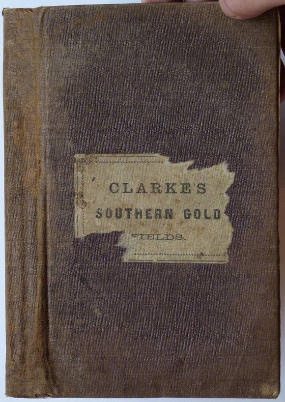
Researches in the Southern Gold Fields of New South Wales, 1860
Richardson, L., (1904). A Handbook of the Geology of Cheltenham and Neighbourhood. Cheltenham: Norman, Sawyer & Co. 303pp. Norman, Sawyer & co.
Richardson, L., (1904). A Handbook of the Geology of Cheltenham and Neighbourhood. Cheltenham: Norman, Sawyer & Co. 303pp. HB,. Norman, Sawyer & co.
Richey, JE. (1932). ‘Tertiary Ring Structures in Britain’, extract from , Transactions of the Geological Society of Glasgow, v.19, pp.42--140. Geological Society of Glasgow.
Romania. 1961. Carte Geologique de la Vallee du Danube entre Drencova et T. Severin. 1:100,000 scale
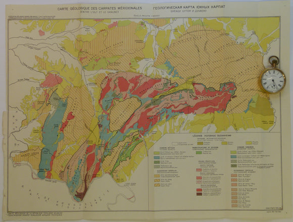
Romania. 1961. Carte Geologique des Carpates Meridionales (entre l’0lt at le Danube). 1:500,000
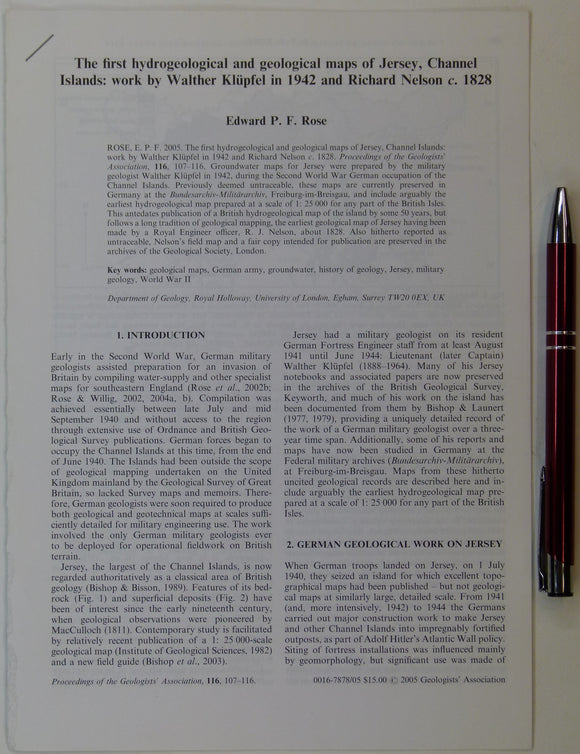
Rose, Edward P.F. (2005). ‘ The first hydrogeological and geological maps of Jersey, Channel Islands:. Geologists' Association.
Rowe, Arthur, (1901). ‘The Zones of the White Chalk’, in the Proceedings of the Geologists’ Association, v.17, pt.1, pp. 1-77. Geologists' Association.
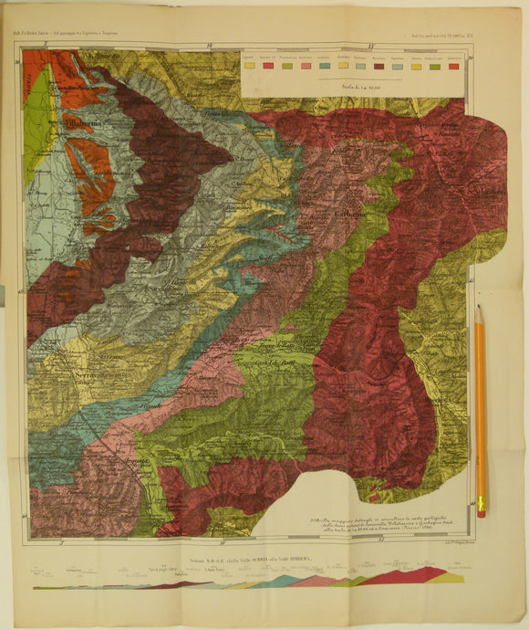
Sacco, Frederico, 1888. Untitled geological map of Villalvernia area (approx. 60km N of Genoa) in Liguria. Colour printed folded map
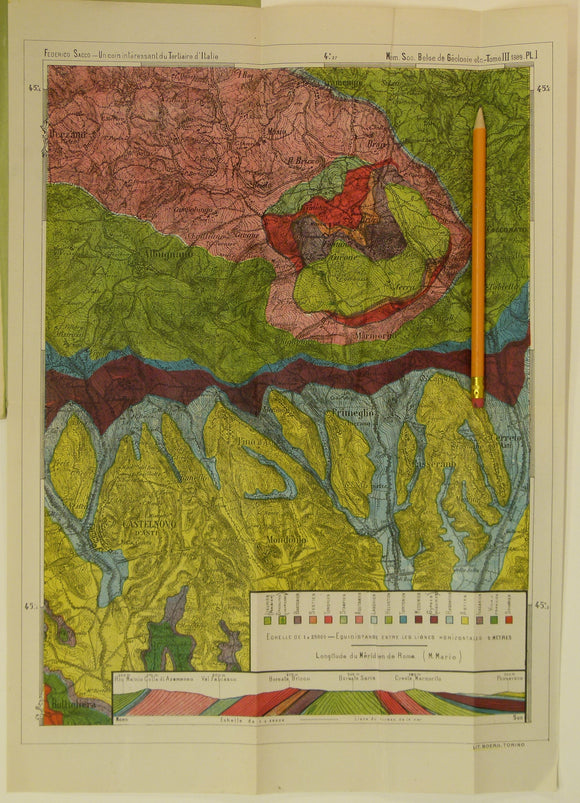
Sacco, Frederico, 1889. Untitled geological map of Castelnovo d’Asti (now Castelnuovo don Bosco) area (approx. 20km E of Turin)
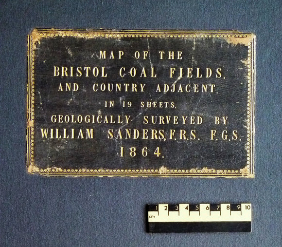
Sanders, William (1864). Map of the Bristol Coal Field and Country Adjacent in 19 Sheets, Geologically Surveyed. Hardback atlas, Rare. self published.
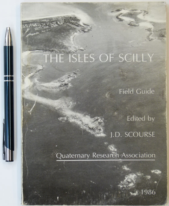
Scourse, J.D., (1986). The Isles of Scilly: Field Guide. Quaternary Research Association. 151pp. Quaternary Research Association.
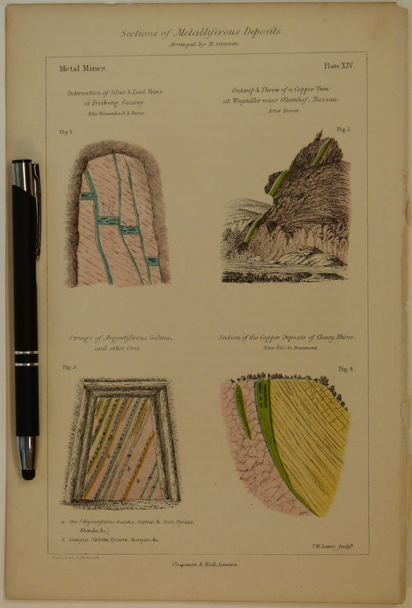
Sections of Metalliferous Deposits; Metal Mines, 1869, Plate 14, from Mines and Miners; or, Underground Life by L. Simonin
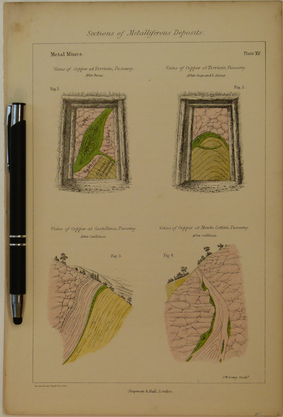
Sections of Metalliferous Deposits; Metal Mines, 1869, Plate 15, from Mines and Miners; or, Underground Life by L. Simonin
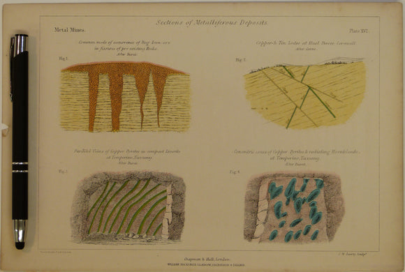
Sections of Metalliferous Deposits; Metal Mines, 1869, Plate 16, from Mines and Miners; or, Underground Life by L. Simonin
Sedgwick, A. and Murchison, R.I. (1842). ‘Geological Map of the Rhenish Countries’ from Transactions of the Geological Society,. Geological Society of London.
Shackleton, E.H. (1973). Lakeland Geology; Where to go: What to see. Clapham: Dalesman Books. Second edition. Dalesman Books.
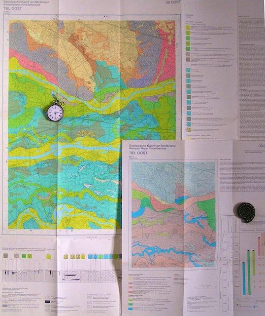
Sheet 39 East, 1982. RGD.
![Plymen, G.H. (1951). The Geological Structure of Guernsey [Channel Islands], offprint from La Societe Guernesiaise](http://geolmaps.com/cdn/shop/products/Guernsey1951_1_{width}x.jpg?v=1611263051)
![Plymen, G.H. (1951). The Geological Structure of Guernsey [Channel Islands], offprint from La Societe Guernesiaise](http://geolmaps.com/cdn/shop/products/Guernsey1951_1_580x.jpg?v=1611263051)