Free UK postage
Broadhurst, Fred, (2003). Rocky Rambles in the Peak District: Geology Beneath Your Feet. Wilmslow: Sigma Leisure. 42pp. Sigma Leisure.
Brumhead, Derek (1979). Geology Explained in the Yorkshire Dales and on the Yorkshire Coast. David & Charles.
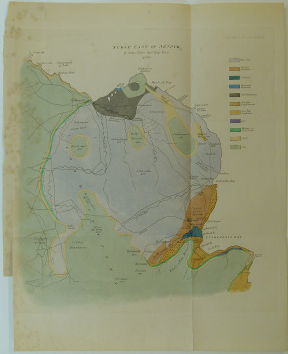
Bryce, James. (1837). ‘On the Geological Structure of the North-eastern Part of the County of Antrim’. Geological Society of London.
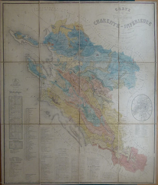
Carte du Departement de la Charente Inférieure,1870. 1870.
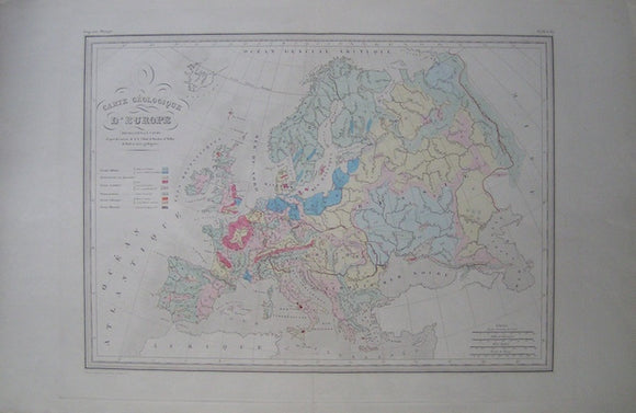
Carte Geologique d'Europe in Atlas de Geographie Universelle. Malte-Brun, V.
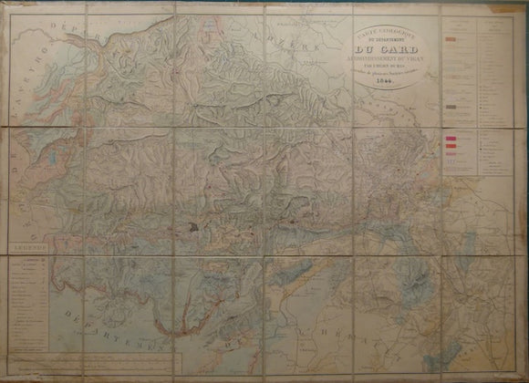
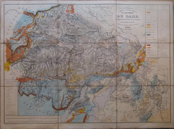
Carte Geologique de Dept. Du Gard, arrondissement du Vigan. 1844-79.
Carte Geologique de Dept. Du Gard, arrondissement du Vigan, 1844. 1844.
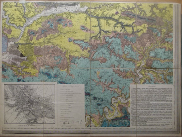
Carte géologique de l'Oise, 1858. 1858.
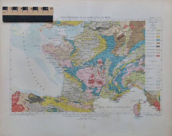
Carte Geologique de la France et ses Mers, 1878. 1878.
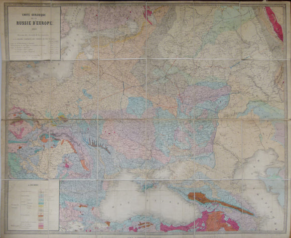
Carte Geologique de la Russie d’Europe, 1859. Approx 1:3,675,000 scale. (77 x 93.5cm) hand-coloured engraved map. Jules Guillemin.
Carte Geologique des Environs de l'Aix et de Chambery, 1863. 1863.
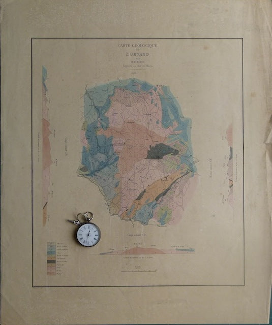
Carte Géologique du Morvand. Ca. 1840.
Carte géologique et minéralogique de Departement de l'Herault Arrondissement de Béziers, 1876. 1876.
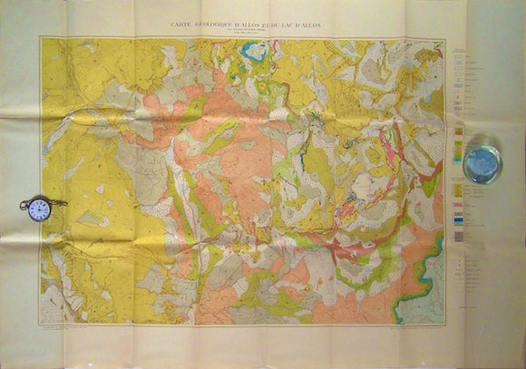
Carte Geologiqued'Allos et du Lac d'Allos, 1927. Gubler-Wahl, Y, 1927.
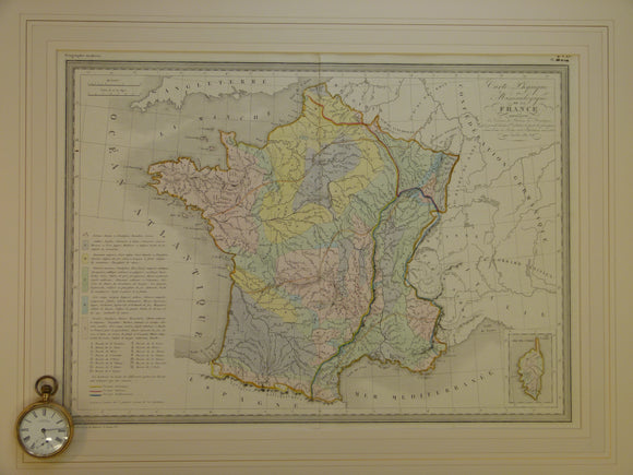
Carte Physique et Mineralogique de la France, c.1840, from Atlas Geographie Moderne, engraved by Thierry. Hand coloured
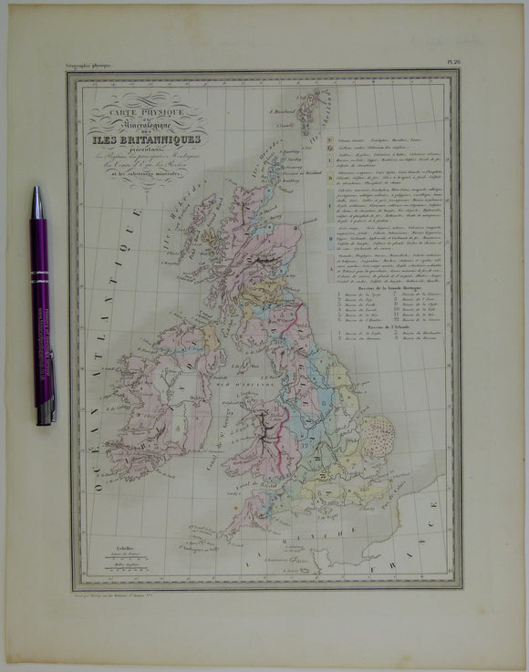
Carte Physique et Mineralogique des Îles Britanniques, 1843. Thierry.
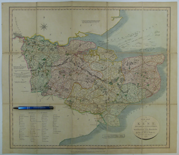
Cary, John. (1828). A New Map of Kent. London: John Cary. With William Smith's geology engraved but coloured over.Hand coloured engraved map 51.5 x 59.5cm. John Cary.
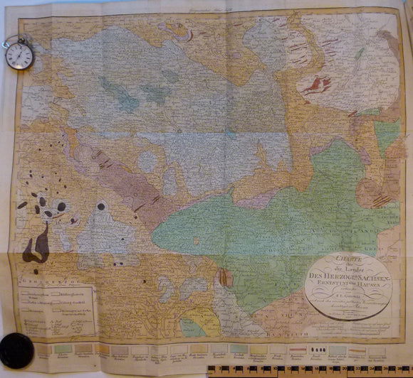
Charte uber die Laender des Herzoglich Sachsen-Ernestini sehen Hauses, 1823. 1823 Saxony-Ernestini.
Cope, F. Wolverson (1976). Geology Explained in the Peak District. Newton Abbot: David & Charles. Third edition. David & Charles.
Cope, F. Wolverson (1999). The Peak District. GA Guide No.26. London: Geologists’ Association. 78pp. Geologists' Association.
Cope, JCW, Ingham, JK and Rawson, PF (eds) (1992). Atlas of Palaeogeography and Lithofacies [of British Isles], Geological Society Memoir no.13. Geological Society of London.
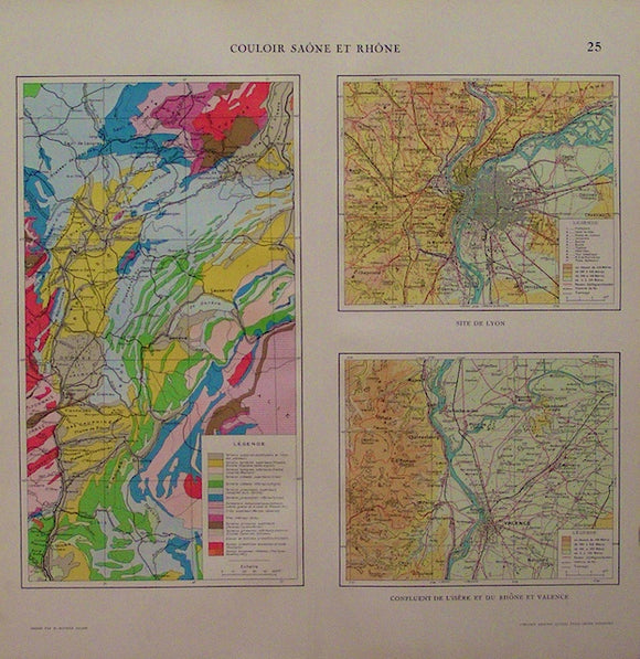
Couloir Saone et Rhone, 1923. Librarie Aristide Quillet, 1923.
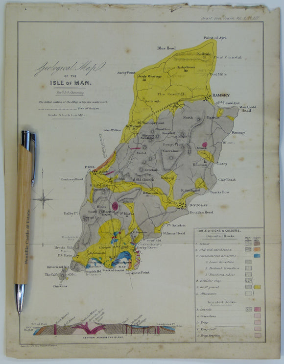
Cummings J.G. (1845). ‘Geological Map of the Isle of Man’ in ‘On the Geology of the Isle of Man’ extract from the Proc Geol Soc. London. V2, pp.317-348. Hand-coloured lithograph,. Geological Society of London.
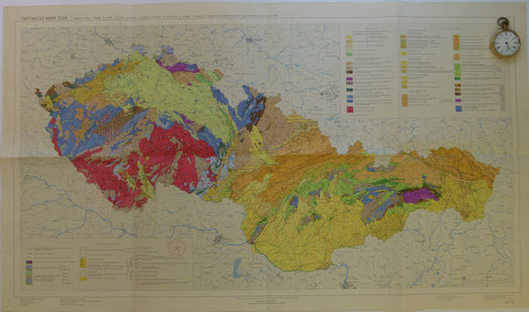
Czechoslovakia. 1968. Tectonic Map of Czechoslovakia. Beily, A. Folded colour printed map at 1:1,000,000


![Cope, JCW, Ingham, JK and Rawson, PF (eds) (1992). Atlas of Palaeogeography and Lithofacies [of British Isles], Geological Society Memoir no.13.](http://geolmaps.com/cdn/shop/products/P1130410_{width}x.jpg?v=1668514365)
![Cope, JCW, Ingham, JK and Rawson, PF (eds) (1992). Atlas of Palaeogeography and Lithofacies [of British Isles], Geological Society Memoir no.13.](http://geolmaps.com/cdn/shop/products/P1130410_580x.jpg?v=1668514365)