Free UK postage
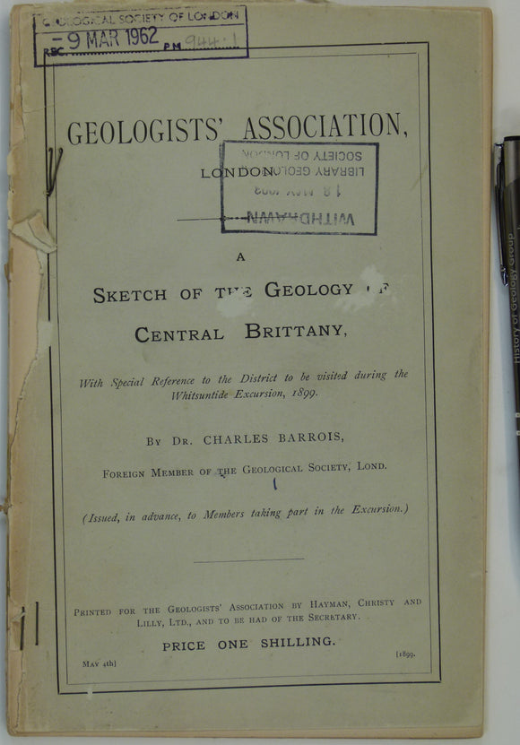
France (1899). Barrois, Charles. A Sketch of the Geology of Central Brittany . London: GA. Preprinted guide for GA Whitsuntide Excursion, 1899. Geologists' Association.
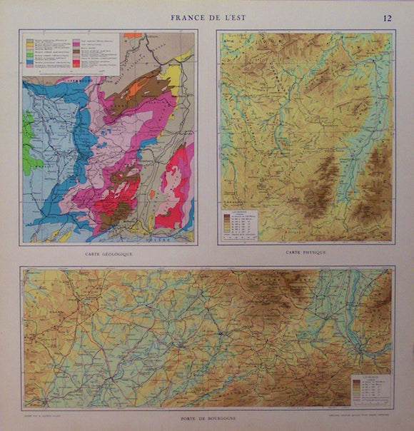
France de l'Est, 1923. Librarie Aristide Quillet, 1923.
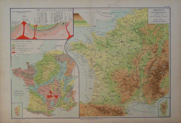
France Geologique,1889. Librarie Classique Eugene Belin, 1889.
Funnell, B.M. (ed) (1984). East Anglian Geology. Special Issue of Bulletin of the Geological Society of Norfolk. Geological Society of Norfolk.
Gardiner, C.I. (1914). ‘Geological Map of the Lough Nafooey Area’ [Ireland] in ‘The Ordovician and Silurian Rocks of the Lough Nafooey Area (County Galway)’, extract. Geological Society of London.
Gardiner, C.I., and Reynolds, S.H. (1912). ‘Geological Map of the Kilbride Peninsula (Mayo)’ [Ireland] in ‘The Ordovician and Silurian Rocks of the Kilbride Peninsula (Mayo)’, extract. Geological Society of London.
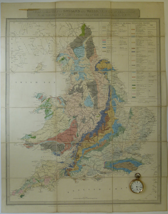
Gardner, J. 1826. Geological Map of England and Wales, Reduced from the Map in 6 Sheets Published by the Geological Society. Gardner, J..
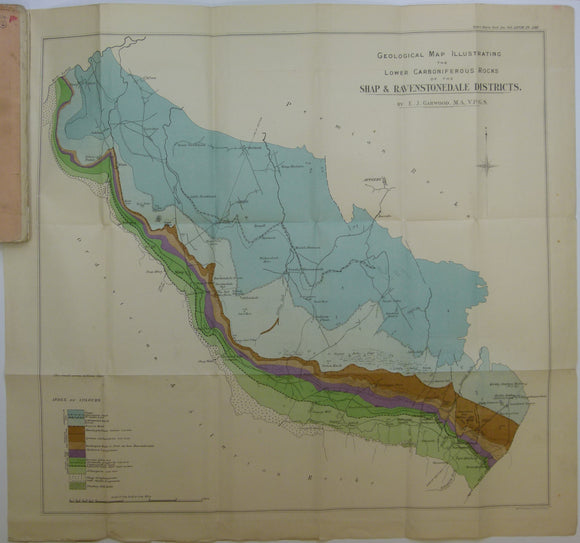
Garwood, E.J. (1912). ‘The Lower Carboniferous Succession in North-West England’ reprint from the QJGS. Geological Society of London.
Geikie, James (1882). [Geological] Map of the Faeroe Islands, in ‘On the Geology of the Faeroe Islands’, extract from the Transactions of the Royal Society of Edinburgh. Royal Society of Edinburgh.
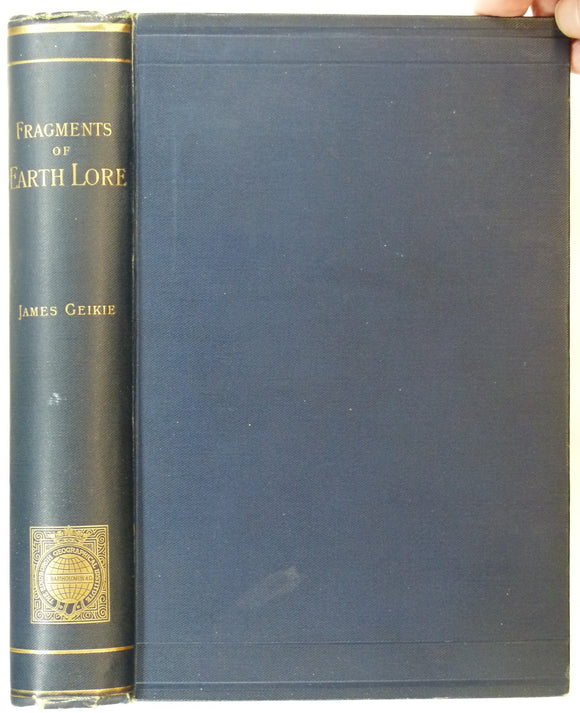
Geikie, James, (1893). Fragments of Earth Lore; Sketches and Addresses, Geological and Geographical. Edinburgh:. John Bartholomew.
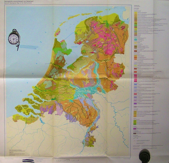
General Geological Map of the Netherlands, 1975. RGD.
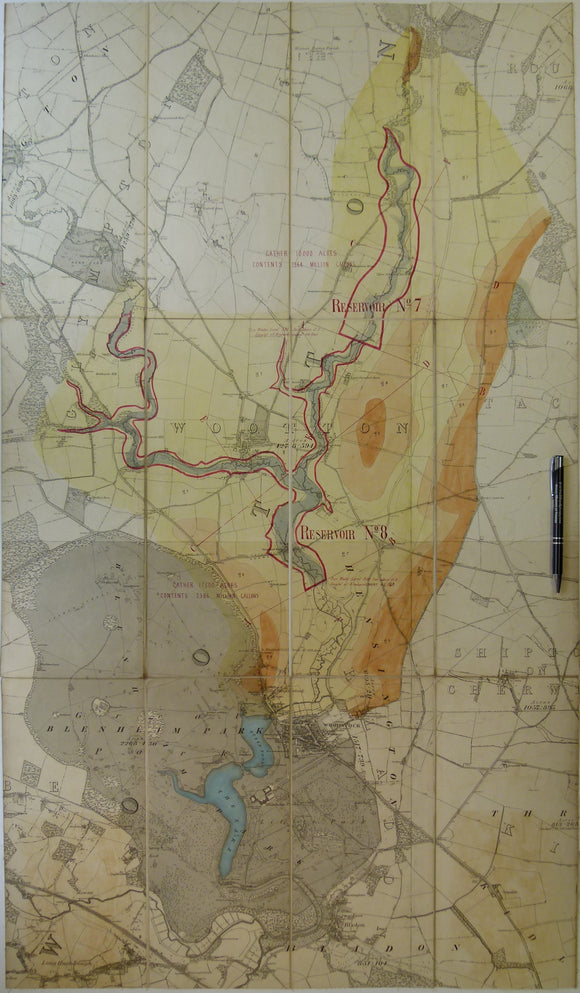
Geological Map of Blenheim area, Oxfordshire. Manuscript
Geological map of England and Wales, 1870. Bacon.
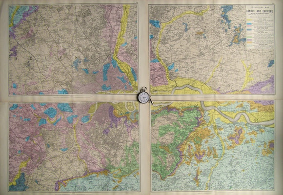
Geological Map of London and Environs, showing the Superficial Deposits,1890. Bacon.
Geological Map of Part of [south] France, 1869, Plate 3, from Mines and Miners; or, Underground Life by L. Simonin
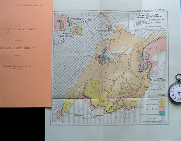
Geological Map of the Glen Orchy District, 1912. Bailey,EB & MacGregor, M, QJGS.
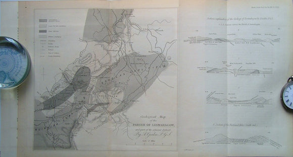
Geological Map of the Parish of Lesmahagow and part of the Adjacent District, 1860. Geikie, A, QJGS.
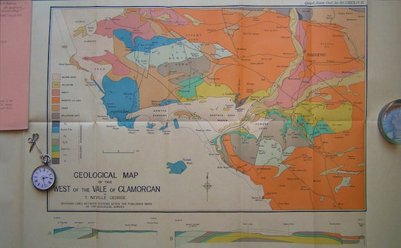
Geological Map of the West of the Vale of Glamorgan,1933. George, Neville QJGS.
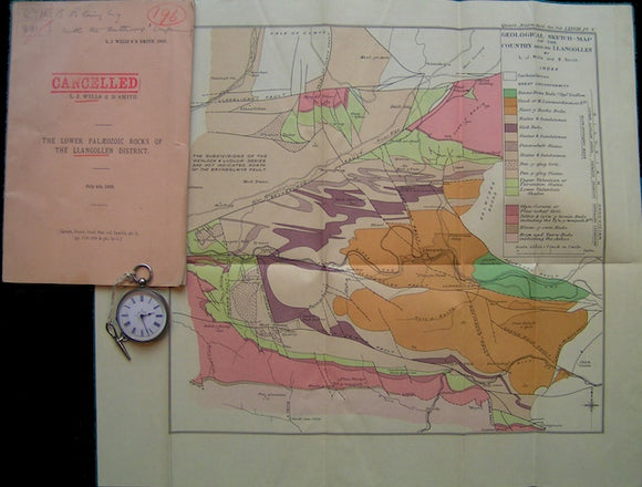
Geological Sketch-Map of the Country around Llangollen, 1922. Wills, LJ & Smith, B. QJGS.
Geologische Karte der Lackenkoglzone und des Quarzphylli-tsudrahmens zwischen Enns-und Taurachtal (Nordliche Radstadter Taurern, 1979
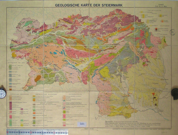
Geologische karte der Steiermark, 1957
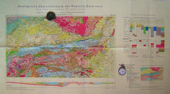
Geologische Ubersichtskarte der Republik Osterreich mit tektonischer Gliederung, 1964
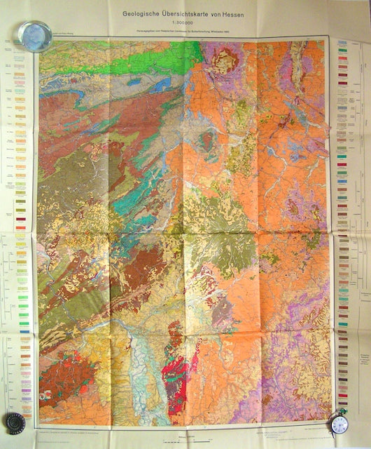
Geologische Ubersichtskarte von Hessen, 1960. Hesse Soil Survey.
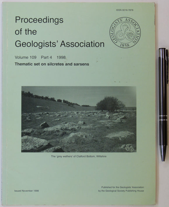
Geologists’ Assoc. (1998). ‘Thematic set on Silcretes and Sarsens, in Proceedings of the Geologists’ Association, v.109,. Geologists' Association.


![Gardiner, C.I. (1914). ‘Geological Map of the Lough Nafooey Area’ [Ireland] in ‘The Ordovician and Silurian Rocks of the Lough Nafooey Area (County Galway)’, extract](http://geolmaps.com/cdn/shop/files/Nafooey_1_{width}x.jpg?v=1705423421)
![Gardiner, C.I. (1914). ‘Geological Map of the Lough Nafooey Area’ [Ireland] in ‘The Ordovician and Silurian Rocks of the Lough Nafooey Area (County Galway)’, extract](http://geolmaps.com/cdn/shop/files/Nafooey_1_580x.jpg?v=1705423421)
![Gardiner, C.I., and Reynolds, S.H. (1912). ‘Geological Map of the Kilbride Peninsula (Mayo)’ [Ireland] in ‘The Ordovician and Silurian Rocks of the Kilbride Peninsula (Mayo)’, extract](http://geolmaps.com/cdn/shop/files/Kilbride_2_{width}x.jpg?v=1705423613)
![Gardiner, C.I., and Reynolds, S.H. (1912). ‘Geological Map of the Kilbride Peninsula (Mayo)’ [Ireland] in ‘The Ordovician and Silurian Rocks of the Kilbride Peninsula (Mayo)’, extract](http://geolmaps.com/cdn/shop/files/Kilbride_2_580x.jpg?v=1705423613)


![Geikie, James (1882). [Geological] Map of the Faeroe Islands, in ‘On the Geology of the Faeroe Islands’, extract from the Transactions of the Royal Society of Edinburgh](http://geolmaps.com/cdn/shop/products/Faroe_Is_2_{width}x.JPG?v=1547576242)
![Geikie, James (1882). [Geological] Map of the Faeroe Islands, in ‘On the Geology of the Faeroe Islands’, extract from the Transactions of the Royal Society of Edinburgh](http://geolmaps.com/cdn/shop/products/Faroe_Is_2_580x.JPG?v=1547576242)


![Geological Map of Part of [south] France, 1869, Plate 3, from Mines and Miners; or, Underground Life by L. Simonin](http://geolmaps.com/cdn/shop/products/P1080644_{width}x.JPG?v=1551269994)
![Geological Map of Part of [south] France, 1869, Plate 3, from Mines and Miners; or, Underground Life by L. Simonin](http://geolmaps.com/cdn/shop/products/P1080644_580x.JPG?v=1551269994)