Free UK postage
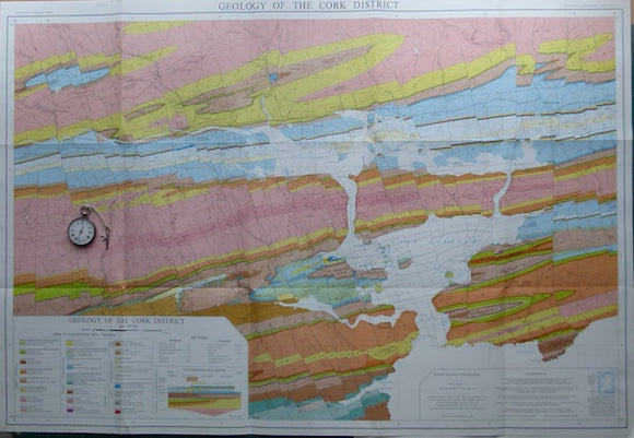
Geology of the Cork District,, 1988, by AJ MacCarthy. Scale 1:40,000. Colour print,. University College, Cork.
George, T. Neville, (1932). ‘The Quaternary Beaches of Gower [S. Wales]’ offprint from the Proceedings of the Geologists Association. v.63,. Geologists' Association.
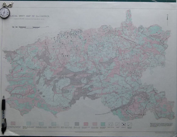
Glacial Drift Map of Co. Limerick,, 1966. Limerick.
Gray, J.M. (ed). (1988). Essex. PGA, v.99, pt.4, pp.249-341. Five papers on the geology of Essex. Geologists' Association.
Griffiths, Richard (1838) ‘On the Syenite Veins which traverse Mica Slate and Chalk , , , in the County of Antrim [Ireland]’, from Transactions. Geological Society of London.
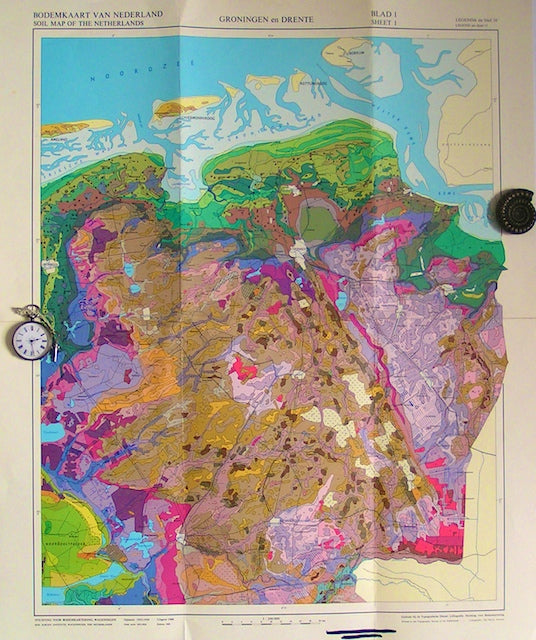
Groningen en Drente, sheet 1, 1960. Soil Survey.
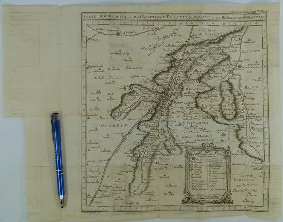
Guettard, Jean-Étienne, (1753). Carte Mineralogique de l’Election d’Éstampes Relative a un Memoire de M. Guettard, extract from Memoire de l’Academie Royale des Sciences. Academie Royale des Sciences.
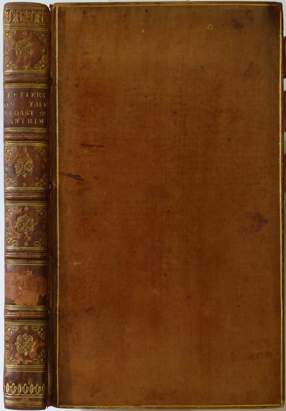
Hamilton, William. 1790. Letters concerning the Northern Coast of the County of Antrim. published by author.
Harris, A.L. (ed), (1985). ‘[Map of] Caledonian Igneous Rocks of Britain and Ireland’ in The Nature and Timing of Orogenic Activity in the Caledonian Rocks of the British Isles; Memoir No. 9. Geological Society of London.
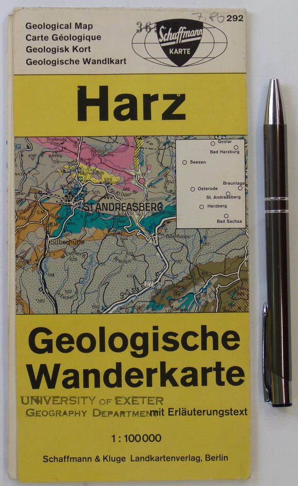
Harz Geologische Wanderkarte (n.d.). Berlin: Schaffmann und Kluge. Colour printed map and section, 59 x 49cm. Schaffman und Kluge.
Henson, FRS, et al (1949). [Map of] Cyprus Geology, in ‘A synopsis of the Stratigraphy and Geological History of Cyprus’. Geological Society of London.
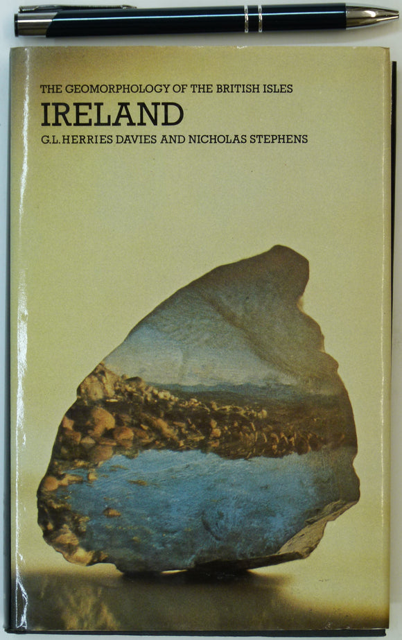
Herries Davies, G.L. & Stephens, Nicholas. 1978. Ireland. In the Series – The Geomorphology of the British Isles. London: Methuen. Methuen.
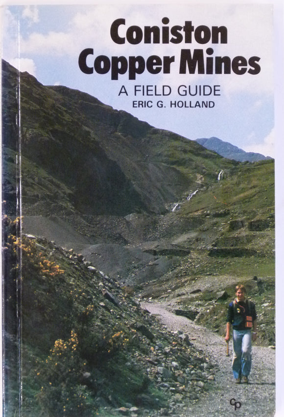
Holland, Eric G, Coniston Copper Mines; a Field Guide. 1981. Milnethorpe: Cicerone Press. Cicerone Press.
House, Michael, (1989). Geology of the Dorset Coast. Geologists’ Association, first edition. 162pp. + 8pp. of b/w plates. PB. Geologists' Association.
Hughes, J.C, (1922). The Geological Story of the Isle of Wight. London: Edward Stanford. First edition. 115pp. Edward Stanford.
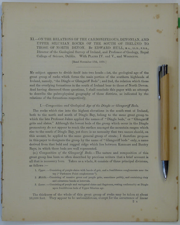
Hull, Edmund. (1879). ‘On the Relations of the Carboniferous, Devonian and Upper Silurian Rocks of the South of Ireland to those of North Devon’, an extract. Royal Dublin Society.
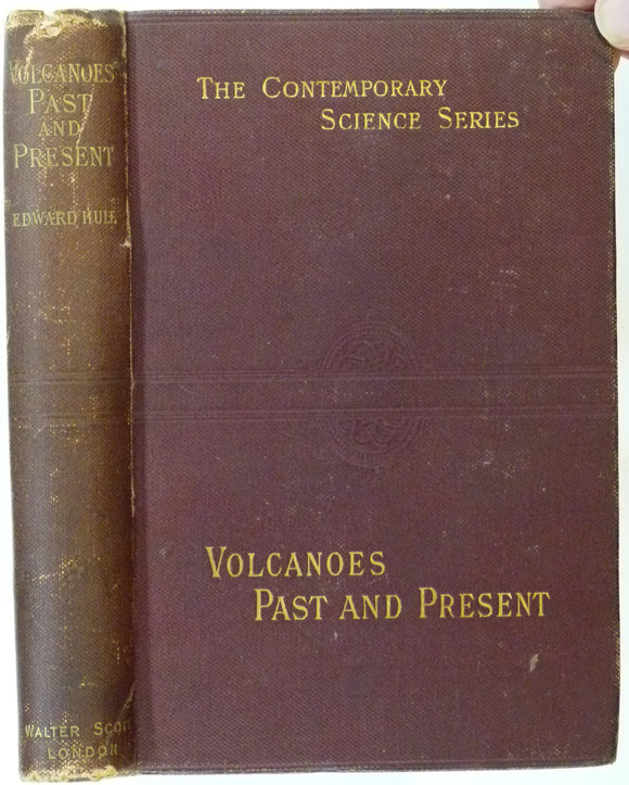
Hull, Edward, (1892). Volcanoes: Past and Present. London: Walter Scott Ltd. 285pp.+ adverts. First edition. Walter Scott Ltd..
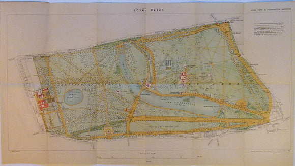
Hyde Park and Kensington Gardens. Ordnance Survey.
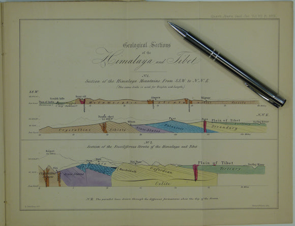
India, Tibet (1851). Strachey, R. On the Geology of Part of the Himalaya Mountains and Tibet. Extract from QJGS. Geological Society of London.
Indian Ocean; [Map of the] Distribution of Oceanic Deposits, John Murray, 1889. In ‘On Marine Deposits in the Indian, Southern and Antarctic Oceans’. Scottish Geographical Society.
Insole, Allan et al, (1998). The Isle of Wight; Guide No.60. Geologists’ Association, first edition. 132pp. PB,. Geologists' Association.
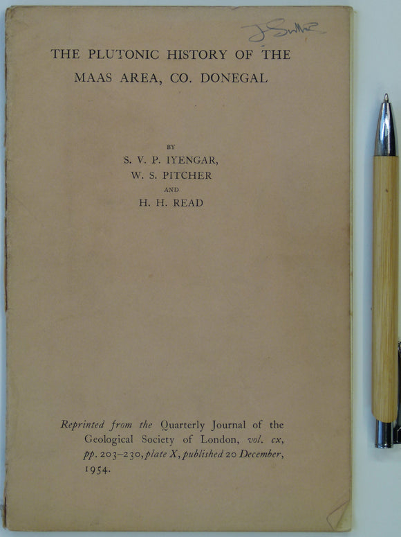
Inyangar, S.V.P., Pitcher, W.S., and Read, H.H. (1954). ‘The Geology of the Maas Area, Co. Donegal’, in ‘The Plutonic History of the Maas Area’, a reprint. Geological Society of London.
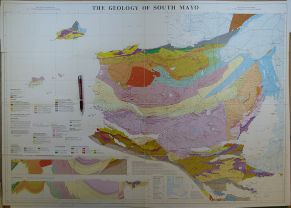
Ireland. The Geology of South Mayo. (1985). University of Glasgow. Colour print, folded, 72 x 101cm. Scale 1:63,360. University of Glasgow.
Johnston, James FW. (1850). Geological Map of New Brunswick [Canada]. Hand coloured lithographed map,. New Brunswick.

![George, T. Neville, (1932). ‘The Quaternary Beaches of Gower [S. Wales]’ offprint from the Proceedings of the Geologists Association. v.63,](http://geolmaps.com/cdn/shop/products/George-Gower_{width}x.jpg?v=1617721372)
![George, T. Neville, (1932). ‘The Quaternary Beaches of Gower [S. Wales]’ offprint from the Proceedings of the Geologists Association. v.63,](http://geolmaps.com/cdn/shop/products/George-Gower_580x.jpg?v=1617721372)


![Griffiths, Richard (1838) ‘On the Syenite Veins which traverse Mica Slate and Chalk , , , in the County of Antrim [Ireland]’, from Transactions](http://geolmaps.com/cdn/shop/products/AntrimGriffiths_{width}x.jpg?v=1612438611)
![Griffiths, Richard (1838) ‘On the Syenite Veins which traverse Mica Slate and Chalk , , , in the County of Antrim [Ireland]’, from Transactions](http://geolmaps.com/cdn/shop/products/AntrimGriffiths_580x.jpg?v=1612438611)


![Harris, A.L. (ed), (1985). ‘[Map of] Caledonian Igneous Rocks of Britain and Ireland’ in The Nature and Timing of Orogenic Activity in the Caledonian Rocks of the British Isles; Memoir No. 9.](http://geolmaps.com/cdn/shop/files/Harris_1_{width}x.jpg?v=1705424303)
![Harris, A.L. (ed), (1985). ‘[Map of] Caledonian Igneous Rocks of Britain and Ireland’ in The Nature and Timing of Orogenic Activity in the Caledonian Rocks of the British Isles; Memoir No. 9.](http://geolmaps.com/cdn/shop/files/Harris_1_580x.jpg?v=1705424303)

![Henson, FRS, et al (1949). [Map of] Cyprus Geology, in ‘A synopsis of the Stratigraphy and Geological History of Cyprus’](http://geolmaps.com/cdn/shop/products/Cyprus_1_{width}x.JPG?v=1547575805)
![Henson, FRS, et al (1949). [Map of] Cyprus Geology, in ‘A synopsis of the Stratigraphy and Geological History of Cyprus’](http://geolmaps.com/cdn/shop/products/Cyprus_1_580x.JPG?v=1547575805)


![Indian Ocean; [Map of the] Distribution of Oceanic Deposits, John Murray, 1889. In ‘On Marine Deposits in the Indian, Southern and Antarctic Oceans’](http://geolmaps.com/cdn/shop/products/IndianO.deposits1889J_1_{width}x.jpg?v=1617639637)
![Indian Ocean; [Map of the] Distribution of Oceanic Deposits, John Murray, 1889. In ‘On Marine Deposits in the Indian, Southern and Antarctic Oceans’](http://geolmaps.com/cdn/shop/products/IndianO.deposits1889J_1_580x.jpg?v=1617639637)


![Johnston, James FW. (1850). Geological Map of New Brunswick [Canada]. Hand coloured lithographed map,](http://geolmaps.com/cdn/shop/products/JohnstonsNewBrunswick1850_{width}x.jpg?v=1617639428)
![Johnston, James FW. (1850). Geological Map of New Brunswick [Canada]. Hand coloured lithographed map,](http://geolmaps.com/cdn/shop/products/JohnstonsNewBrunswick1850_580x.jpg?v=1617639428)