Free UK postage
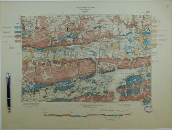
Cork District, Drift, (1903). First edition. Colour print, flat, 45 x 60.5cm. Scale 1:63,360. Base map 1899. Geological Survey of Ireland.
Cox, Ian. Ed. (1957). The Scallop; Studies of a shell and its influences on humankind. London; Shell, 135pp. HB. Shell.
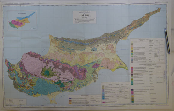
Cyprus (1995) Geological Map of Cyprus. Geological Survey Dept, revised edition. Colour printed map 1:250,000 scale (58 x 96cm) folded. geological survey of Cyprus.
Cyprus, 1963. Geological Map of Cyprus. Geological Survey of Cyprus. 1:250,000
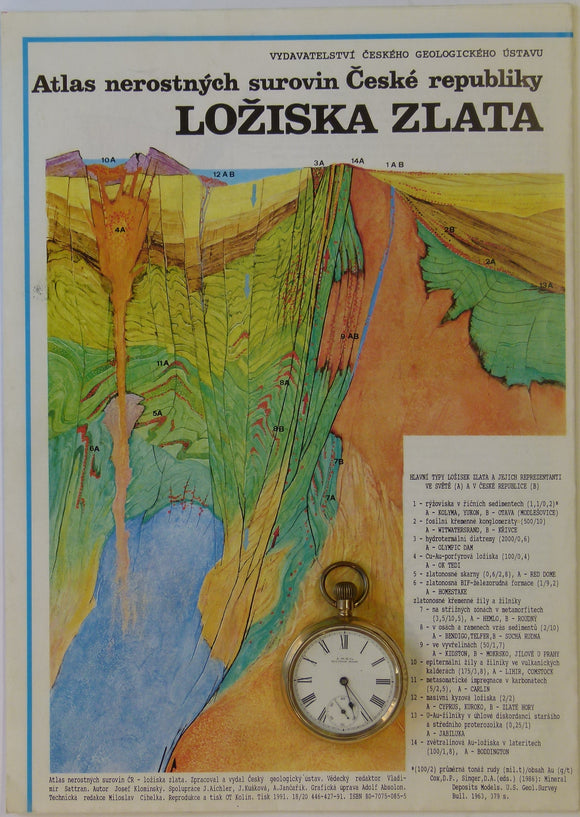
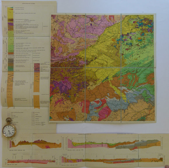
Czech Republic. No date. Mineral Resources Atlas of the Czech Republic. folded colour printed geological poster,
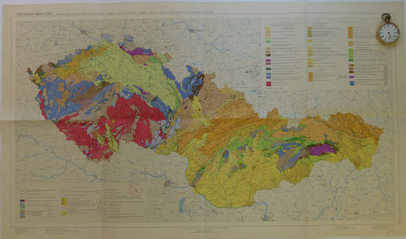
Czechoslovakia. 1968. Tectonic Map of Czechoslovakia. Beily, A. Folded colour printed map at 1:1,000,000
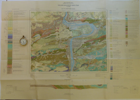
Czechoslovakia. 1983. List 12-243 Praha-sever. Prague. Colour printed geological map, 50 x 88cm at 1:25,000
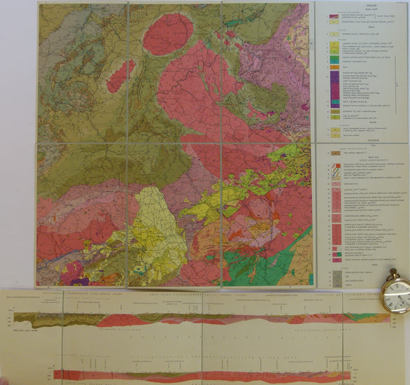
Czechoslovakia. No date. M-33-13 Karlovy Vary-Plauen. Colour printed geological map, 38 x 49.5cm at 1:200,000 scale.
Czechoslovakia. No date. M-33-14 Teplice-Annaberg-Buchholz. Colour printed geological map, 38 x 37cm at 1:200,000
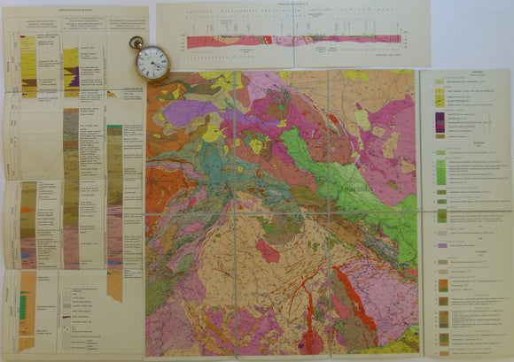
Czechoslovakia. No date. M-33-8 Chabarovice-Dresden. Colour printed geological map, 38 x 49.5cm at 1:200,000
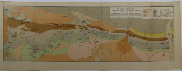
Dixey, Frank, et al. (1917). Two maps – of the Carboniferous Limestone Series between the Ewenny Valley and Ebbw Valley’,. Geological Society of London.
Dreghorn, William, 1967. Geology Explained in the Severn Vale and Cotswolds. Newton Abbot: David & Charles. 192pp. First edition. David & Charles.
Dreghorn, William, 1968. Geology Explained in the Forest of Dean and the Wye Valley. Newton Abbot: David & Charles. 196pp. David & Charles.
Duff, K.L et al (eds), (n.d.). New Sites for Old: a Student’s Guide to the Geology of the East Mendips. Nature Conservancy Council. Geologists' Association.
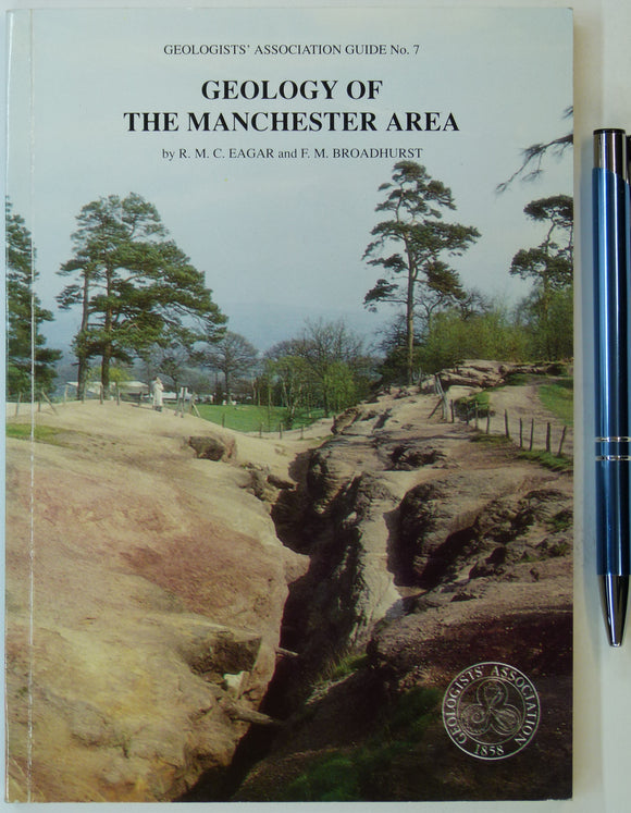
Eager, R.M.C. and Broadhurst, F.M. et al (1991). Geology of the Manchester Region. GA Guide No.7. London: Geologists’ Association. Geologists' Association.
Eiby, G.A. (1967). Earthquakes. London: Frederick Muller. 207pp. Second revised and expanded edition. HB,. Frederick Muller.
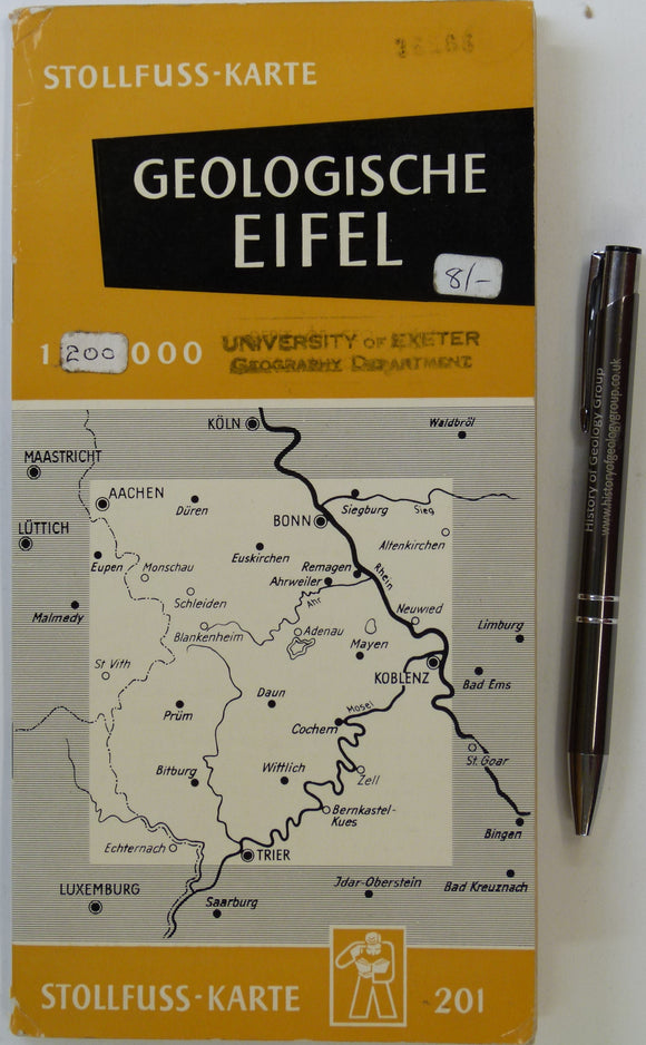
Eifel. Geologische Ubersichtskarte der Eifel und ihrer Umrandung (n.d.). Bonn: Wilhelm Stollfuss Verlag. Colour printed map 1:200,000,. Wilhlem Stollfuss Verlag.
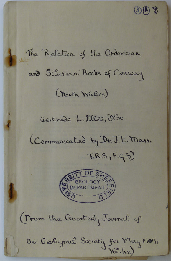
Elles, G.L. (1909). Geological Map of Conway’, fold out b/w printed map, 1:21,120 scale (3”=1 mile),. Geological Society of London.
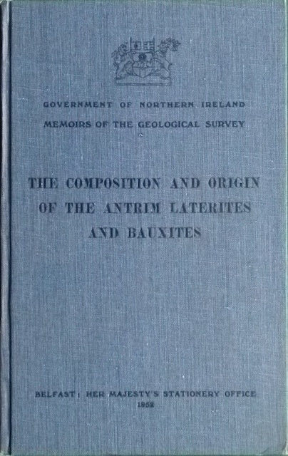
Eyles, V.A. (1952). The Composition and Origin of the Antrim Laterites and Bauxites. Geological Survey of N. Ireland.
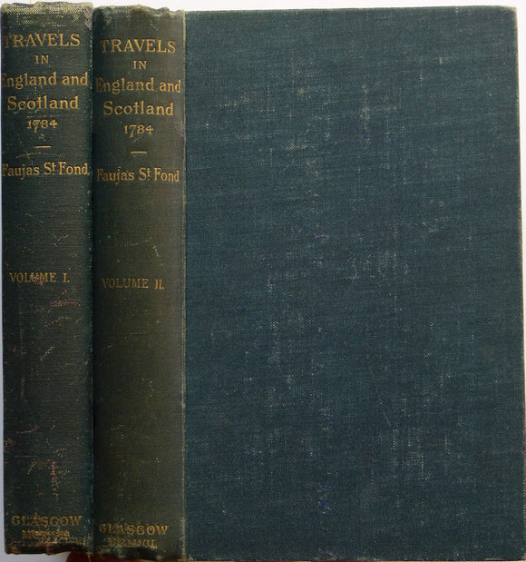
Faujas St.-Fond, B. (1907). A Journey through England and Scotland to the Hebrides in 1794, 1907. Hugh Hopkins.
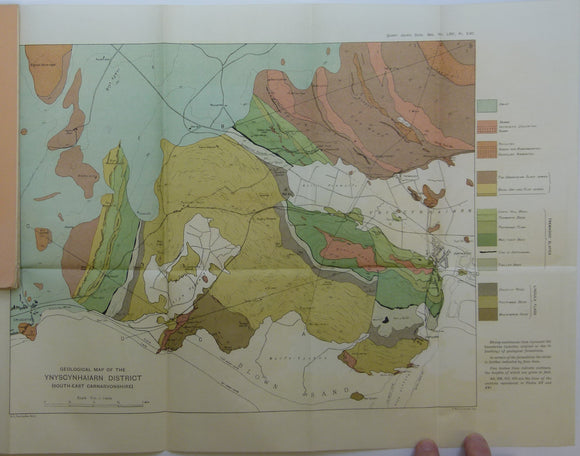
Fearnsides, W.G. (1910). Geological Map of the Ynyscyhaiarn District, South-East Carnarvonshire’, fold out colour printed map. Geological Society of London.
Ford, Trevor D. (2002). Rocks and Scenery of the Peak District. Ashbourne: Landmark Publishing. 96pp. First edition. Landmark Publishing.
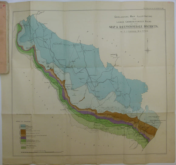
Garwood, E.J. (1912). ‘The Lower Carboniferous Succession in North-West England’ reprint from the QJGS. Geological Society of London.
Gee, E,R. 1987. Geological Map of the Salt Range, Pakistan. 1:250,000 scale,