Free UK postage
De la Beche, H. T. (1832). A Geological Manual, Treuttel and Wurtz, London, 2nd edition. Beche, de la, HT.
De la Beche, Henry T. (1839). Report on the Geology of Cornwall, Devon and West Somerset. Longman et al.
De la Beche, Henry T. 1836. How to Observe Geology. Publ Chas.Knight, London, 2nd edition. De la Beche, HT.
Delisse, M. 1880. ‘[Carte] Agronomie du Département de Seine-et-Marne. Colour printed fold out maps (34 x 40.5cm) at 1:500,000
Deynhausen, v. and v. Dechen, (1825). ‘ [geognostische karte] Der Bleijberg Commern und seine Umbegung’. Hand-coloured engraving. Archiv fur Bergbau.
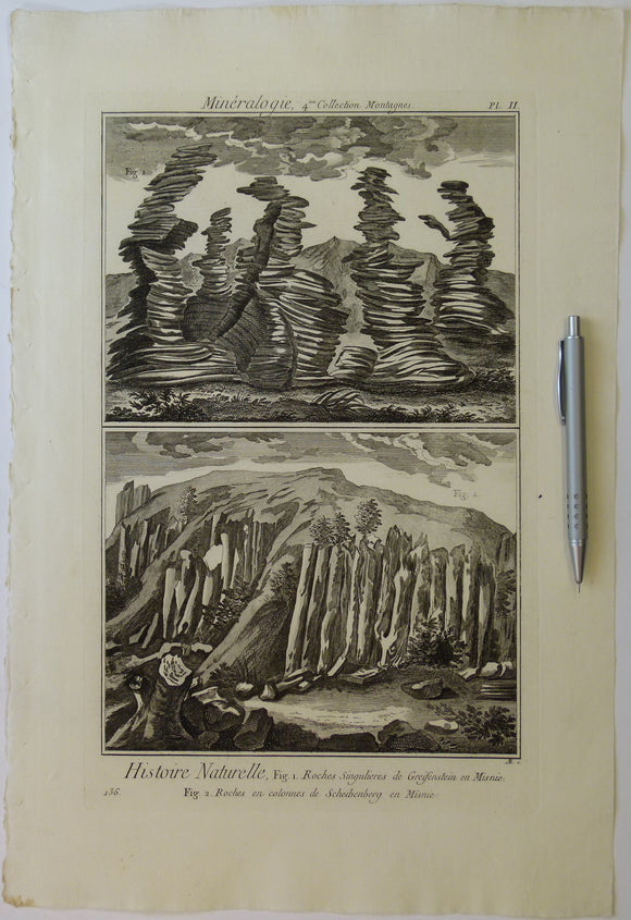
Diderot & d’Alembert (1768) ‘Mineralogy, 4th collection. Mountains, plate 2 (p.136) from Encylopedie, v23. Copperplate engraving
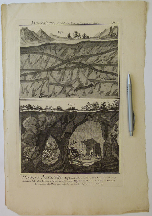
Diderot & d’Alembert (1768) ‘Mineralogy, 7th collection. Veins and Works in Mines, plate 2 (p.157) from Encylopedie, v23. Copperplate engraving
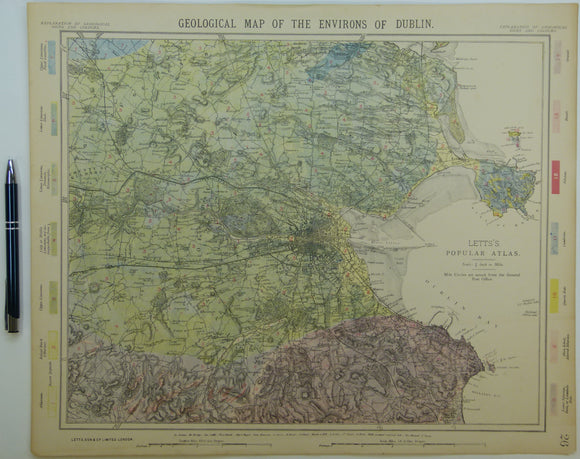
Dublin and environs, 1882. Letts.
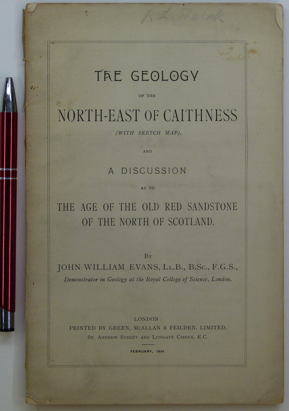
Evans, John W., (1891), geological map (untitled) of North-East Caithness. Fold-out b/w printed geological map. private publication.
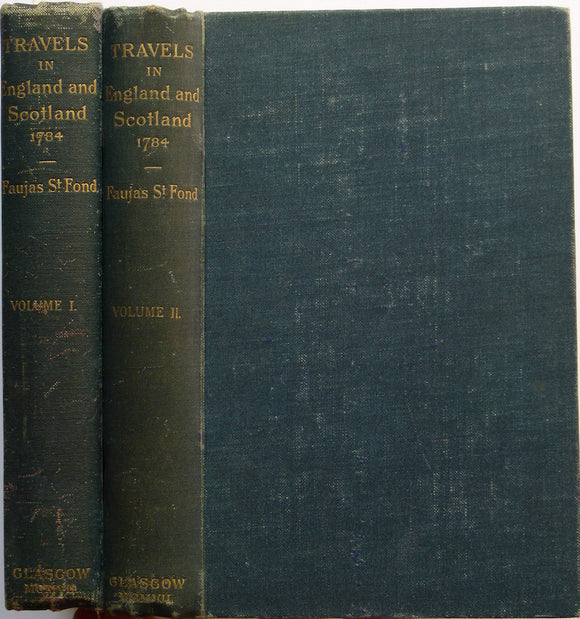
Faujas St.-Fond, B. (1907). A Journey through England and Scotland to the Hebrides in 1794, 1907. Hugh Hopkins.
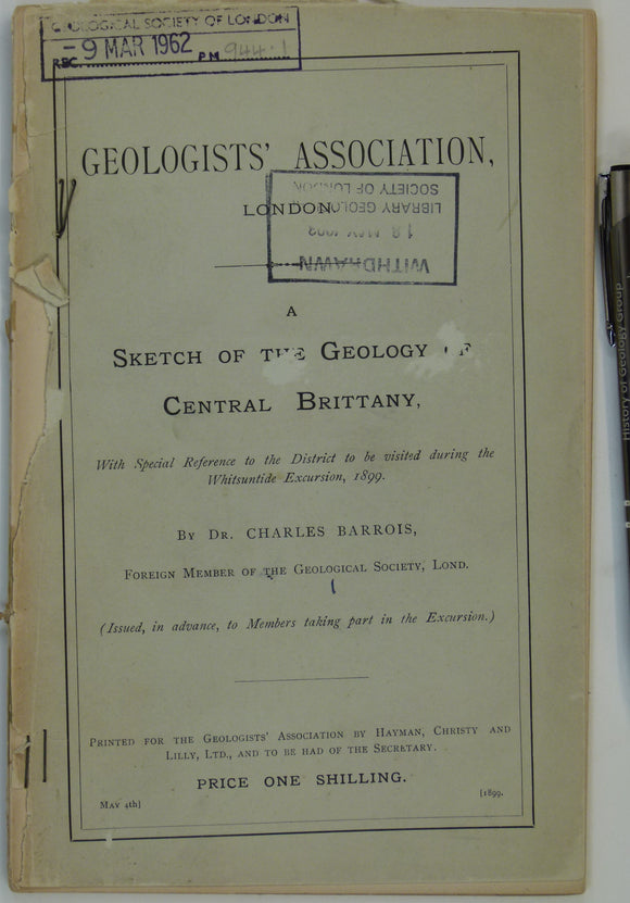
France (1899). Barrois, Charles. A Sketch of the Geology of Central Brittany . London: GA. Preprinted guide for GA Whitsuntide Excursion, 1899. Geologists' Association.
Gardiner, C.I. (1914). ‘Geological Map of the Lough Nafooey Area’ [Ireland] in ‘The Ordovician and Silurian Rocks of the Lough Nafooey Area (County Galway)’, extract. Geological Society of London.
Gardiner, C.I., and Reynolds, S.H. (1912). ‘Geological Map of the Kilbride Peninsula (Mayo)’ [Ireland] in ‘The Ordovician and Silurian Rocks of the Kilbride Peninsula (Mayo)’, extract. Geological Society of London.
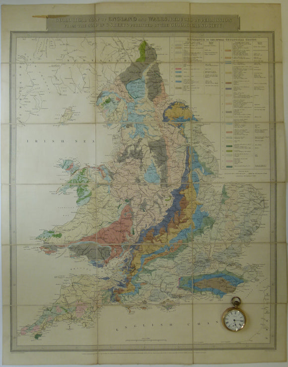
Gardner, J. 1826. Geological Map of England and Wales, Reduced from the Map in 6 Sheets Published by the Geological Society. Gardner, J..
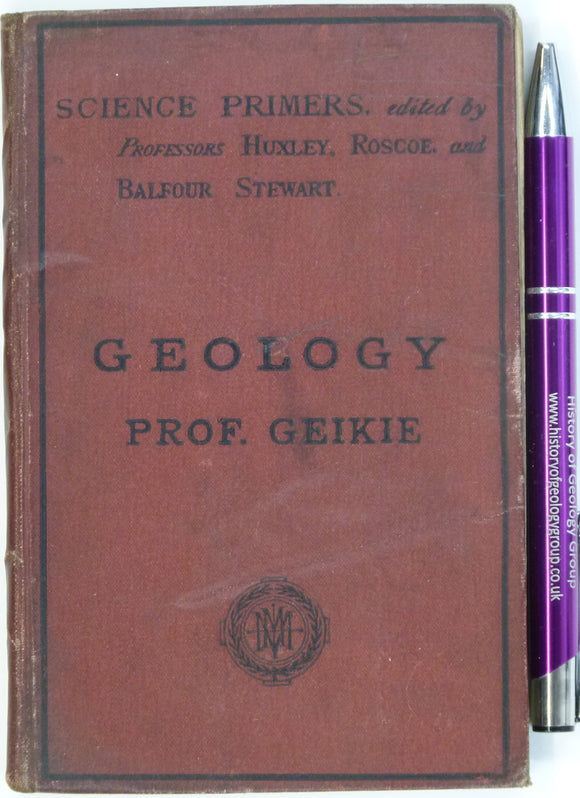
Geikie, Archibald (1876). Geology. London: Macmillan, 128pp + 6pp adverts, 4th edition. Hardback, red cloth covered boards with black lettering. MacMillan.
Geikie, Archibald. (1882). Geological Sketches at Home and Abroad. London: MacMillan & Co. 1st edition. 382 pp. HB. MacMillan.
Geikie, James (1882). [Geological] Map of the Faeroe Islands, in ‘On the Geology of the Faeroe Islands’, extract from the Transactions of the Royal Society of Edinburgh. Royal Society of Edinburgh.
Geikie, James, (1893). Fragments of Earth Lore; Sketches and Addresses, Geological and Geographical. Edinburgh:. John Bartholomew.
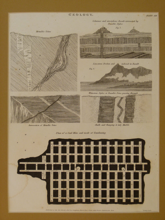
Geological sections. 1818. Engraving by JW Lowry as plate IIII (4) of The Cyclopaedia: or, Universal dictionary of arts, sciences, and literature
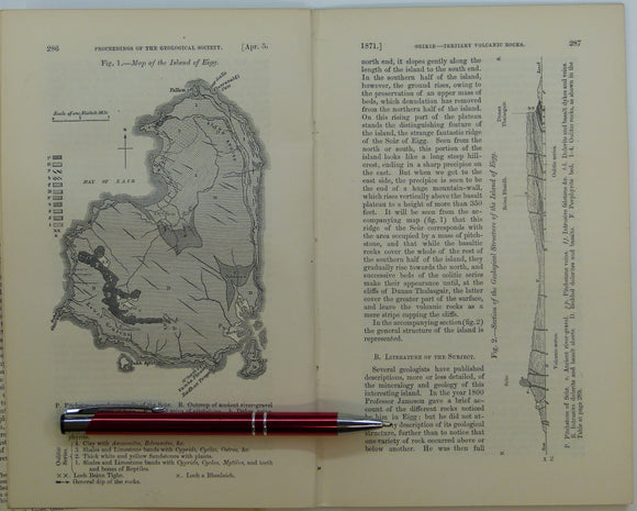
Giekie, Archibald, (1871), ‘Map of the Island of Eigg. b/w geological map, 1:63,360,. QJGS.
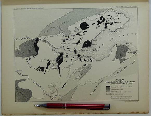
Giekie, Archibald, (1879), ‘On the Carboniferous Volcanic Rocks of the Basin of the Firth of Forth: their Structure in the Field. Royal Society of Edinburgh.
Griffiths, Richard (1838) ‘On the Syenite Veins which traverse Mica Slate and Chalk , , , in the County of Antrim [Ireland]’, from Transactions. Geological Society of London.
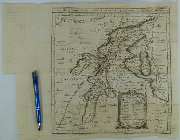
Guettard, Jean-Étienne, (1753). Carte Mineralogique de l’Election d’Éstampes Relative a un Memoire de M. Guettard, extract from Memoire de l’Academie Royale des Sciences. Academie Royale des Sciences.
Hamilton, William. 1790. Letters concerning the Northern Coast of the County of Antrim. published by author.


![Delisse, M. 1880. ‘[Carte] Agronomie du Département de Seine-et-Marne. Colour printed fold out maps (34 x 40.5cm) at 1:500,000](http://geolmaps.com/cdn/shop/products/Seine_Marne_1_{width}x.JPG?v=1547929159)
![Delisse, M. 1880. ‘[Carte] Agronomie du Département de Seine-et-Marne. Colour printed fold out maps (34 x 40.5cm) at 1:500,000](http://geolmaps.com/cdn/shop/products/Seine_Marne_1_580x.JPG?v=1547929159)
![Deynhausen, v. and v. Dechen, (1825). ‘ [geognostische karte] Der Bleijberg Commern und seine Umbegung’. Hand-coloured engraving](http://geolmaps.com/cdn/shop/products/German_13_Bleijberg_{width}x.jpg?v=1662814219)
![Deynhausen, v. and v. Dechen, (1825). ‘ [geognostische karte] Der Bleijberg Commern und seine Umbegung’. Hand-coloured engraving](http://geolmaps.com/cdn/shop/products/German_13_Bleijberg_580x.jpg?v=1662814219)


![Gardiner, C.I. (1914). ‘Geological Map of the Lough Nafooey Area’ [Ireland] in ‘The Ordovician and Silurian Rocks of the Lough Nafooey Area (County Galway)’, extract](http://geolmaps.com/cdn/shop/files/Nafooey_1_{width}x.jpg?v=1705423421)
![Gardiner, C.I. (1914). ‘Geological Map of the Lough Nafooey Area’ [Ireland] in ‘The Ordovician and Silurian Rocks of the Lough Nafooey Area (County Galway)’, extract](http://geolmaps.com/cdn/shop/files/Nafooey_1_580x.jpg?v=1705423421)
![Gardiner, C.I., and Reynolds, S.H. (1912). ‘Geological Map of the Kilbride Peninsula (Mayo)’ [Ireland] in ‘The Ordovician and Silurian Rocks of the Kilbride Peninsula (Mayo)’, extract](http://geolmaps.com/cdn/shop/files/Kilbride_2_{width}x.jpg?v=1705423613)
![Gardiner, C.I., and Reynolds, S.H. (1912). ‘Geological Map of the Kilbride Peninsula (Mayo)’ [Ireland] in ‘The Ordovician and Silurian Rocks of the Kilbride Peninsula (Mayo)’, extract](http://geolmaps.com/cdn/shop/files/Kilbride_2_580x.jpg?v=1705423613)


![Geikie, James (1882). [Geological] Map of the Faeroe Islands, in ‘On the Geology of the Faeroe Islands’, extract from the Transactions of the Royal Society of Edinburgh](http://geolmaps.com/cdn/shop/products/Faroe_Is_2_{width}x.JPG?v=1547576242)
![Geikie, James (1882). [Geological] Map of the Faeroe Islands, in ‘On the Geology of the Faeroe Islands’, extract from the Transactions of the Royal Society of Edinburgh](http://geolmaps.com/cdn/shop/products/Faroe_Is_2_580x.JPG?v=1547576242)


![Griffiths, Richard (1838) ‘On the Syenite Veins which traverse Mica Slate and Chalk , , , in the County of Antrim [Ireland]’, from Transactions](http://geolmaps.com/cdn/shop/products/AntrimGriffiths_{width}x.jpg?v=1612438611)
![Griffiths, Richard (1838) ‘On the Syenite Veins which traverse Mica Slate and Chalk , , , in the County of Antrim [Ireland]’, from Transactions](http://geolmaps.com/cdn/shop/products/AntrimGriffiths_580x.jpg?v=1612438611)