Free UK postage
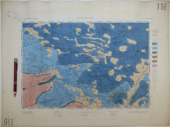
Ireland sheet 116, Portumna, 1” scale. 1863, first edition. Covers Killimore, Eyrecourt. Hand-coloure. Geological Survey of Ireland.
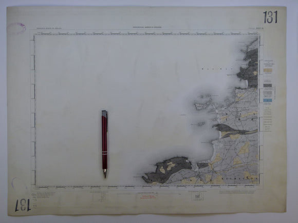
Ireland sheet 131, Mullagh, 1” scale. 1882. Covers Atlantic coast: Donegal Point, Mal Bay – 80% sea. Hand-coloured. Geological Survey of Ireland.
Ireland sheet 132, Ennis, 1” scale. 1882. Covers Milltown Malbay. Coloured 1905. Hand-coloured. Geological Survey of Ireland.
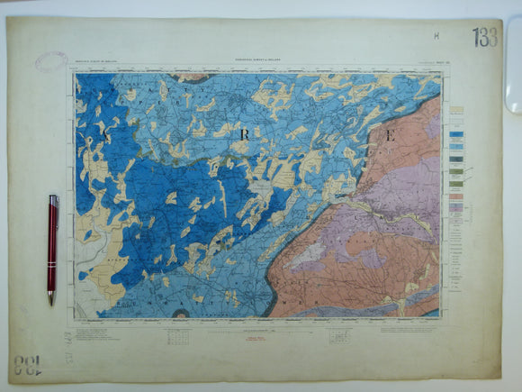
Ireland sheet 133, Sixmilebridge, 1” scale. 1882. Covers Newmarket in Fergus, Tulla. Hand-coloured. Geological Survey of Ireland.
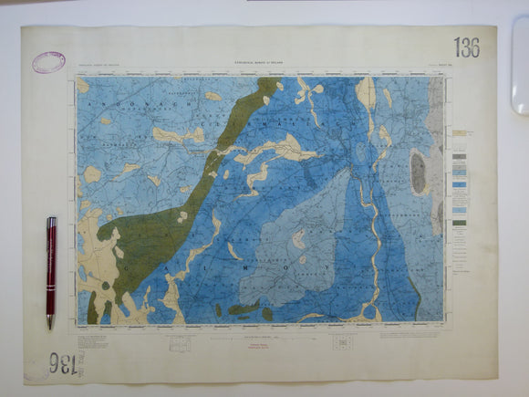
Ireland sheet 136, Durrow, 1” scale. 1878. Covers Ballinakill, Rathdowney. Hand-coloured. Geological Survey of Ireland.
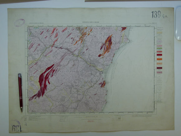
Ireland sheet 139, Arklow, 1” scale. 1861. 35% Irish Sea. Base map not dated. Coloured 1908. Hand-coloured. Geological Survey of Ireland.
Ireland sheet 139, Arklow, 1” scale. 1861. Base map not dated. Coloured 1908. Hand-coloured engraving. Geological Survey of Ireland.
Ireland sheet 14, 1". Cushendall, 1913. Partly hand coloured engraving, 36.5 x 53cm,. Geological Survey of Ireland.
Ireland sheet 140, Loophead, 1” scale. 1882. 95% Atlantic Ocean. Base map not dated. Coloured 1908. Hand-coloured. geo.
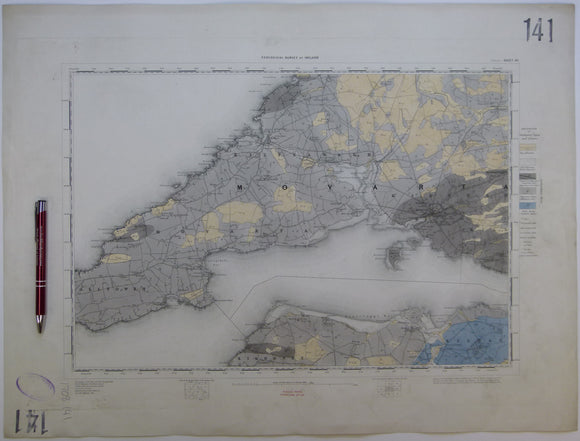
Ireland sheet 141, Kilrush, 1” scale. 1881. 35% Atlantic Ocean. Base map not dated. Coloured 1909. Hand-coloured. Geological Survey of Ireland.
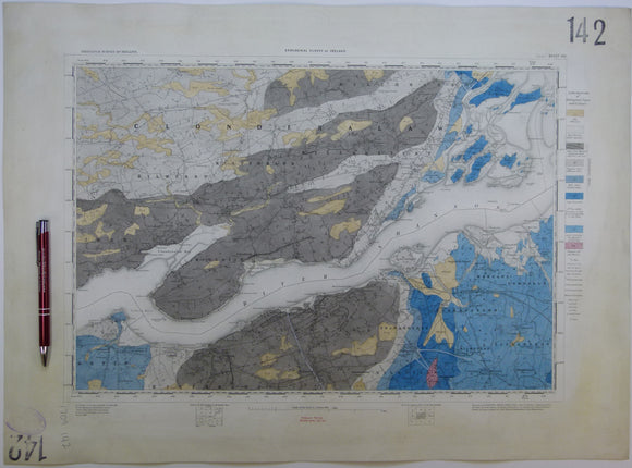
Ireland sheet 142, Foynes, 1” scale. 1881. Covers lower Shannon River, Tarbert. Hand-coloured. Geological Survey of Ireland.
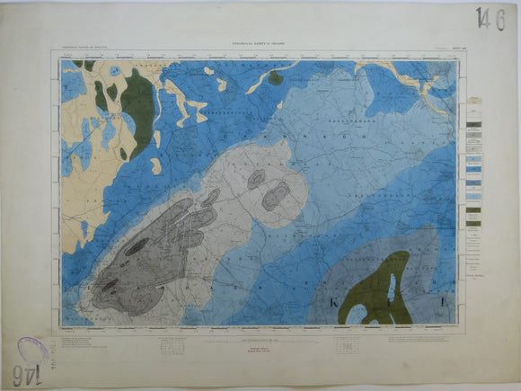
Ireland sheet 146, Ballingarry, 1” scale. 1878. Base map not dated. Coloured 1910. Hand-coloured engraving. Geological Survey of Ireland.
Ireland sheet 150, Kerry Head, 1” scale. 1859. First edition. 90% Atlantic Ocean. Hand-coloured. Geological Survey of Ireland.
Ireland sheet 151, Listowel, 1” scale. 1881. Includes mouth of the Shannon, south side. Base map not dated. Hand-coloured. Geological Survey of Ireland.
Ireland sheet 152, Newcastle, 1” scale. 1882. Includes Abbeyfeale, Dromtrasna Colliery. Hand-coloured. Geological Survey of Ireland.
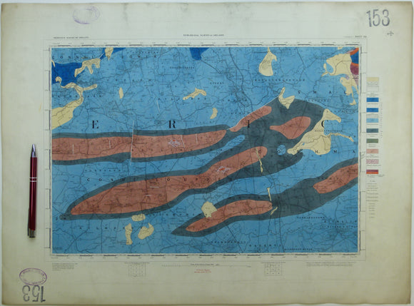
Ireland sheet 153, Rathkeale, 1” scale. 1860, first edition. Covers Ballingarry, Kilmallock. Hand-coloured. Geological Survey of Ireland.
Ireland sheet 155, Cashel, 1” scale. 1879. Base map not dated. Hand-coloured engraving, flat, 43 x 58cm. Geological Survey of Ireland.
Ireland sheet 156, Callan, 1” scale. 1879. Base map not dated. Covers Fethard. Hand-coloured engraving. Geological Survey of Ireland.
Ireland sheet 160, Brandon Head, 1” scale. 1859, first edition. Base map not dated. 80% Atlantic Ocean. Hand-coloured. Geological Survey of Ireland.
Ireland sheet 162, Tralee, 1” scale. 1883. Includes CastleIsland, Clannaruddery Mountains. Hand-coloured. Geological Survey of Ireland.
Ireland sheet 163, Newmarket, 1” scale. 1882. Base map not dated. Hand-coloured engraving,. Geological Survey of Ireland.
Ireland sheet 164, Charleville, 1” scale. 1882. Base map not dated. Hand-coloured engraving,. Geological Survey of Ireland.
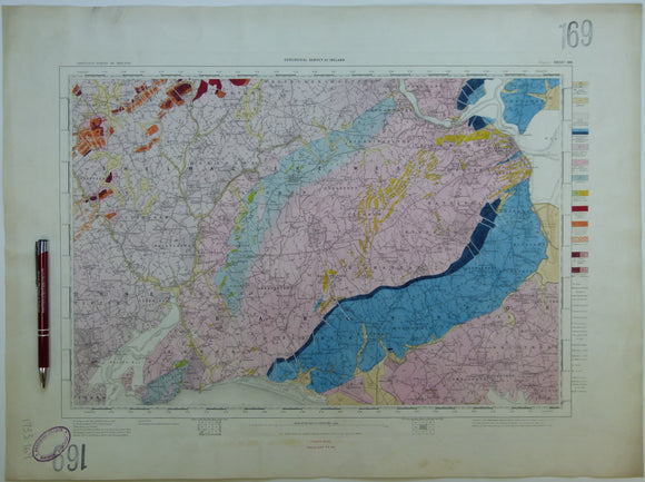
Ireland sheet 169, Wexford, 1” scale. 1878. Includes Bannow Bay in SW corner. Hand-coloured. ge.
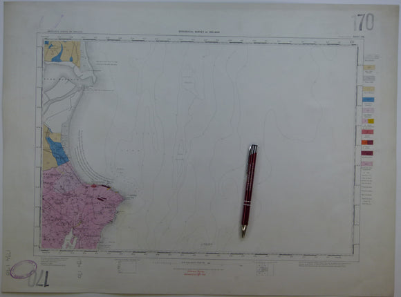
Ireland sheet 170, Rosslare Point, 1” scale. 1873. Includes 90% Irish Sea. Hand-coloured. Geological Survey of Ireland.