Free UK postage
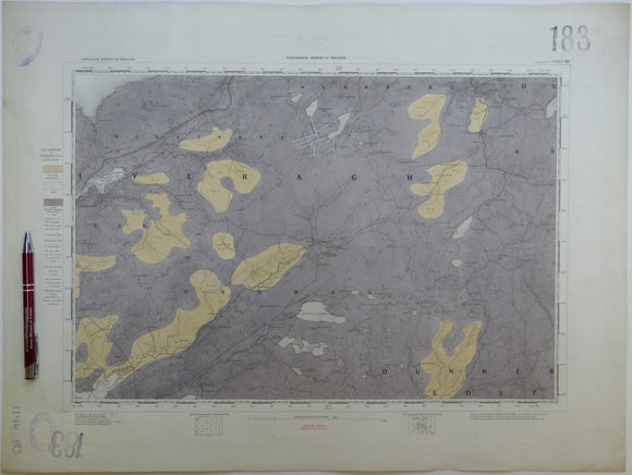
Ireland sheet 183, Cahersiveen, 1” scale. 1879. No settlements inland from coast. Hand-coloured. Geological Survey of Ireland.
Ireland sheet 184, Kenmare, 1” scale. 1859. First edition. Covers Muckrose Lake, Macgillycuddy’s Reeks. Hand-coloured. Geological Survey of Ireland.
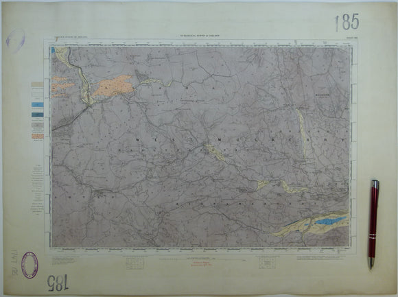
Ireland sheet 185, untitled – Sullane River, 1” scale. 1880. Few settlements. Base map not dated. Hand-coloured. Geological Survey of Ireland.
Ireland sheet 186, Blarney, 1” scale. 1879. Few settlements. Includes line of CM&D Extension Light Railway. Hand-coloured engraving. Geological Survey of Ireland.
Ireland sheet 186, Youghal, 1” scale. 1880. Base map not dated Includes Ardmore and Castlemartyr. Hand-coloured. Geological Survey of Ireland.
Ireland sheet 189, untitled – Mine Head [land], 1” scale. 1879. 85% sea. Hand-coloured. Geological Survey of Ireland.
Ireland sheet 190, Bolus Head, 1” scale. 1881. 85% sea. Hand-coloured. Geological Survey of Ireland.
Ireland sheet 191, Kenmare River [sea inlet], 1” scale. 1881. 30% sea. Hand-coloured. Geological Survey of Ireland.
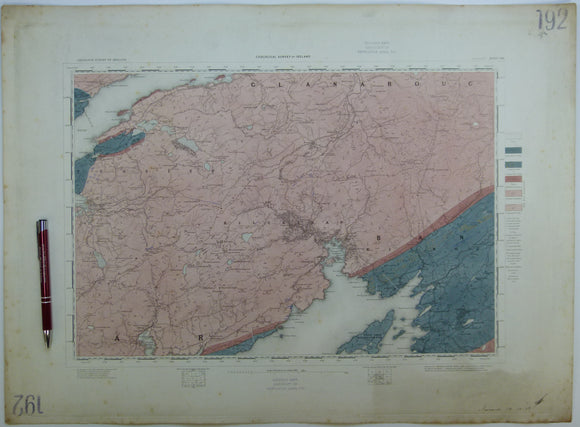
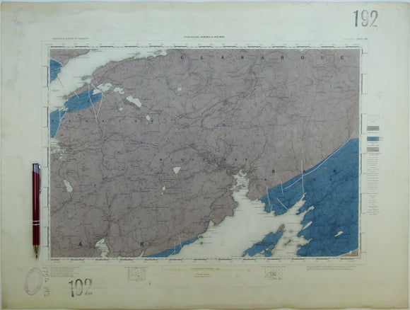
Ireland sheet 192, Glengarrif, 1” scale. 1858. First edition. Base map not dated. Hand-coloured. Geological Survey of Ireland.
Ireland sheet 192, Glengarrif, 1” scale. 1891. Base map not dated. Coloured 1904. Hand-coloured. Geological Survey of Ireland.
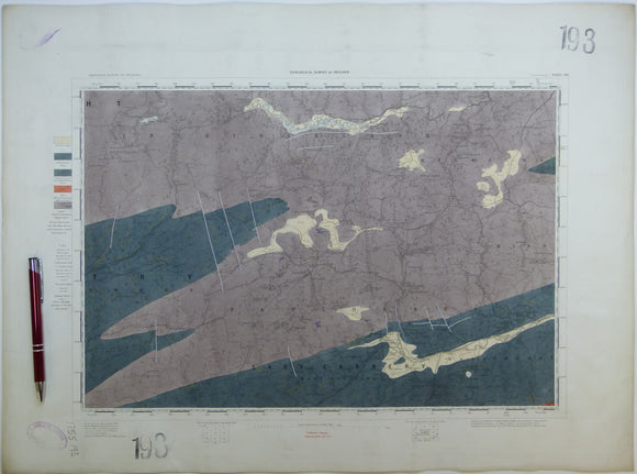
Ireland sheet 193, Dunmanway, 1” scale. 1879. Base map not dated. Coloured 1908. Hand-coloured. Geological Survey of Ireland.
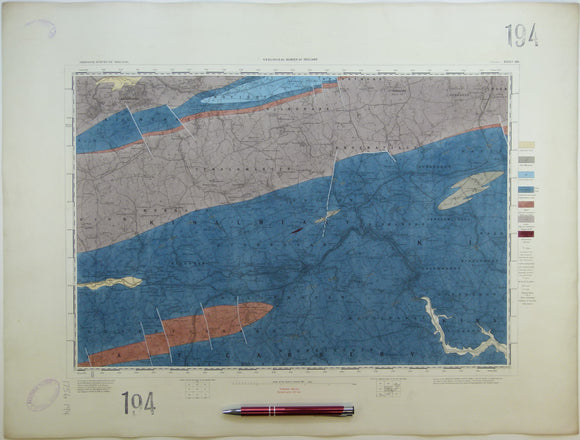
Ireland sheet 194, Bandon, 1” scale. 1891. Base map not dated. Coloured 1904. Hand-coloured. Geological Survey of Ireland.
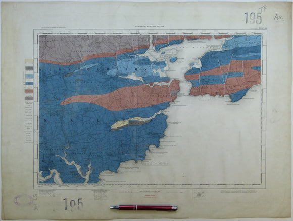
Ireland sheet 195, Ballycottin, 1” scale. 1879. Base map not dated. Coloured 1908. 90% sea. Hand-coloured. Geological Survey of Ireland.
Ireland sheet 195, Queenstown, 1” scale. 1891. Includes Cork Harbour. Hand-coloured. Geological Survey of Ireland.
Ireland sheet 197, Dursey Head, 1” scale. 1881. Base map not dated. Coloured 1906. 98% sea. Hand-coloured
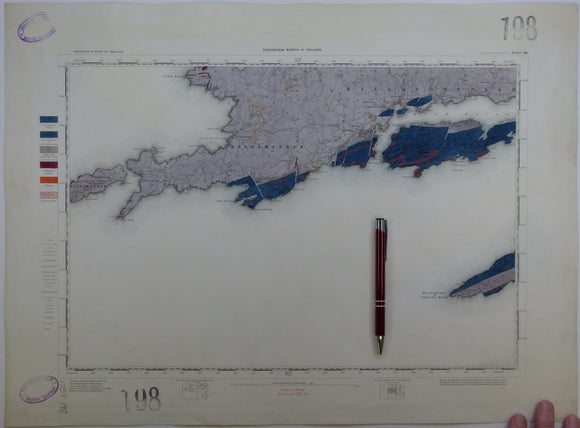
Ireland sheet 198, Castletown Bearhaven, 1” scale. 1881. 55% sea. Hand-coloured. Geological Survey of Ireland.
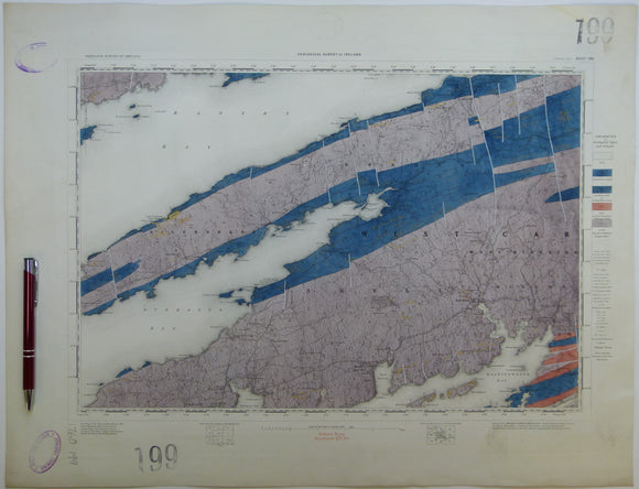
Ireland sheet 199, Bantry Bay, 1” scale. 1881. Includes Dunmanus Bay, Skull Harbour. Hand-coloured. Geological Survey of Ireland.
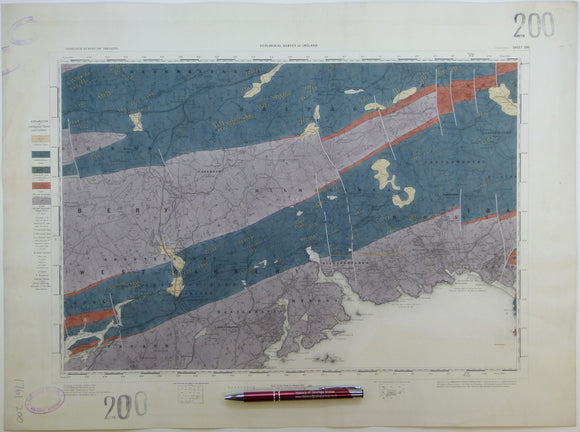
Ireland sheet 200, Skibbereen, 1” scale. 1881. Includes Glandore Bay, Ross Carbery. Hand-coloured. Geological Survey of Ireland.
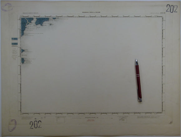
Ireland sheet 202, Old Head of Kinsale, 1” scale. 1857. First edition. Base map not dated. 95% sea. Hand-coloured. Geological Survey of Ireland.
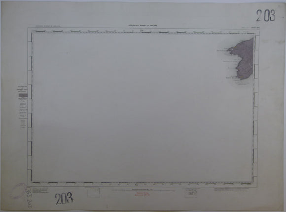
Ireland sheet 203, Mizen Head, 1” scale. 1881. Base map not dated. Coloured 1905. 95% sea. Hand-coloured. Geological Survey of Ireland.
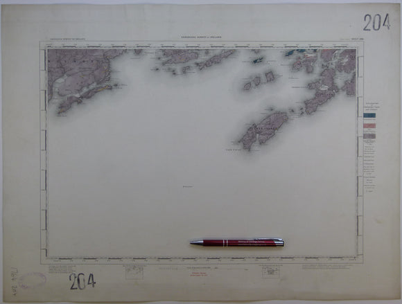
Ireland sheet 204, Cape Clear, 1” scale. 1881. Base map not dated. Coloured 1904. 80% sea. Hand-coloured. Geological Survey of Ireland.
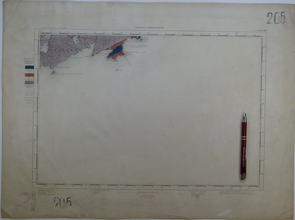
Ireland sheet 205, Toe Head, 1” scale. 1881. Base map not dated. Coloured 1907. 90% sea. Hand-coloured. Geological Survey of Ireland.
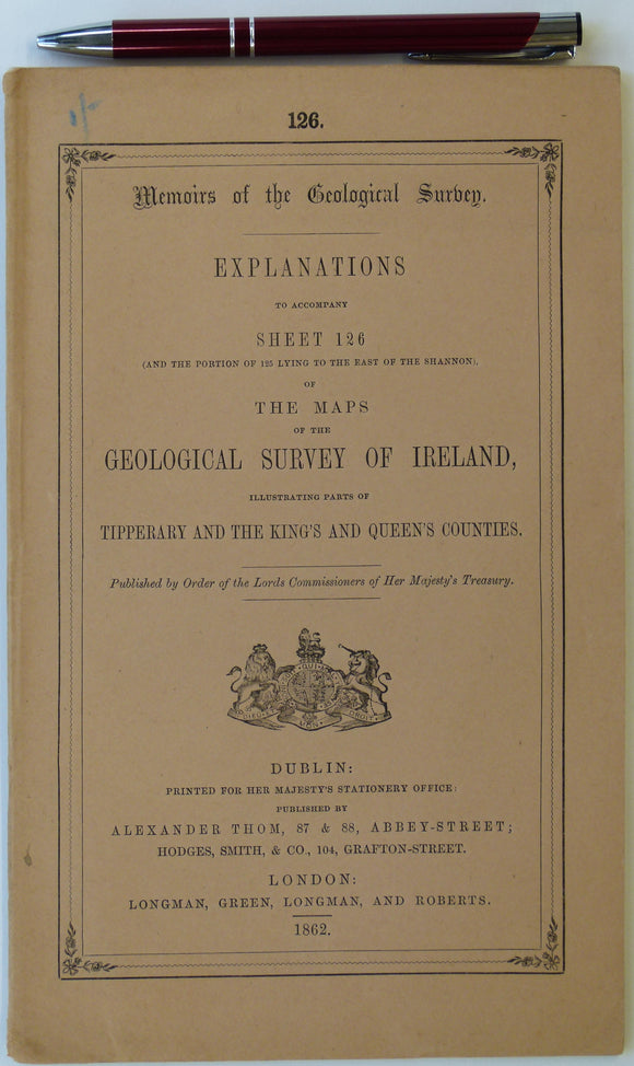
Ireland sheet memoir 126/125, (Roscrea/ Maryborough) 1862. Explanations - Sheet 126 (and the portion of 125 lying east of the Shannon). Near fine condition. Geological Survey of Ireland.
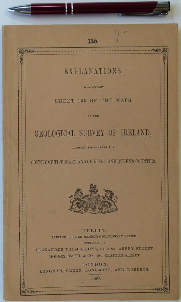
Ireland sheet memoir 135, (Ennis) 1860. Explanations - Sheet 135 - illustrating parts of Tipperary and King’s and Queens’s Counties. Near fine condition. Geological Survey of Ireland.


![Ireland sheet 189, untitled – Mine Head [land], 1” scale. 1879. 85% sea. Hand-coloured](http://geolmaps.com/cdn/shop/products/Ireland189_1_{width}x.jpg?v=1610129677)
![Ireland sheet 189, untitled – Mine Head [land], 1” scale. 1879. 85% sea. Hand-coloured](http://geolmaps.com/cdn/shop/products/Ireland189_1_580x.jpg?v=1610129677)


![Ireland sheet 191, Kenmare River [sea inlet], 1” scale. 1881. 30% sea. Hand-coloured](http://geolmaps.com/cdn/shop/products/Ireland191_1_{width}x.jpg?v=1610129879)
![Ireland sheet 191, Kenmare River [sea inlet], 1” scale. 1881. 30% sea. Hand-coloured](http://geolmaps.com/cdn/shop/products/Ireland191_1_580x.jpg?v=1610129879)