Free UK postage
Ireland sheet memoir 154, (Tipperary) 1861. Explanations - Sheet 154 - illustrating parts of Tipperary and the King’s and Queens’s Counties. Near fine condition. Geological Survey of Ireland.
Ireland sheet memoir 155, (Cashel) 1860. Explanations - Sheet 155 - illustrating part of the County of Tipperary. Very good condition. Geological Survey of Ireland.
Ireland sheet memoir 156, (Callan) 1858. Descriptions - Sheet 46 NW - illustrating part of the Maps of the GSI. Very good condition. Geological Survey of Ireland.
Ireland sheet memoir 158/159, (Enniscorthy/ Blackwater) 1882. Explanatory Memoir - Sheets 158/159 – of the District of Enniscorthy. Very good condition. Geological Survey of Ireland.
Ireland sheet memoir 36, (Belfast) 1970. Geology of Belfast and the Lagan Valley (One-inch geological sheet 36). As new condition. Geological Survey of Ireland.
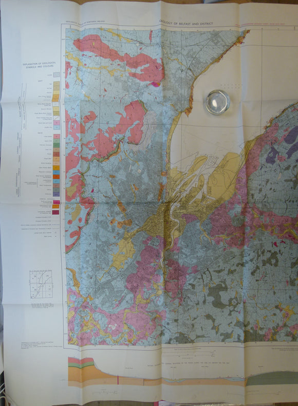
Ireland. Geology of Belfast and District: Special Engineering Geology Sheet, Solid and Drift. (1971). Geological Survey of Northern Ireland. Colour print,. Geological Survey of N. Ireland.
Japan, Korea, Taiwan (1911).Geological Map of Japanese Empire. Tokyo: Imperial Geological Survey, Feb 1911. Colour lithograph in four quarter. Japanese Geological Survey.
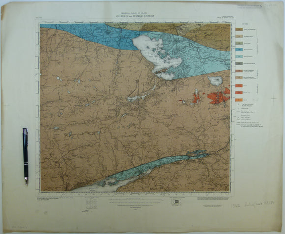
Killarney & Kenmare District, (1913). First edition. Colour print, flat, 56 x 68.5cm. Scale 1:63,360. Base map 1910. Geological Survey of Ireland.
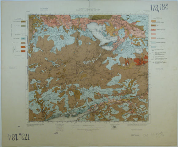
Killarney & Kenmare District, Drift, (1913). First edition. Colour print, flat, 56 x 68.5cm. Scale 1:63,360. Base map 1910. Geological Survey of Ireland.
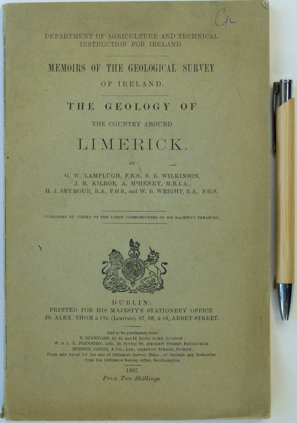
Lamplugh, G.w., et al (1907). The Geology of the Country Around Limerick. Dublin: HMSO for Dept of Agriculture and Technical Instruction for Ireland. 119pp. Dept of Agriculture, Ireland.
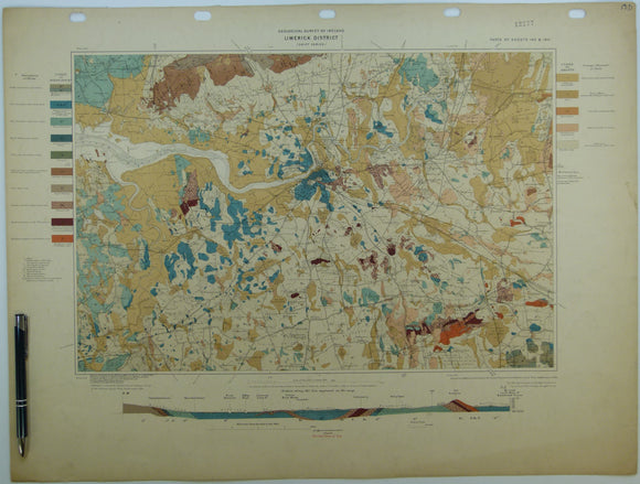
Limerick District, Drift, (1904). First edition. Colour print, flat, 46 x 60.5cm. Scale 1:63,360. Base map 1899. Geological Survey of Ireland.
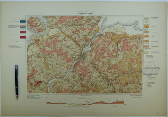
Londonderry District, Drift, (1908). First edition. Colour print, flat, 46 x 66cm. Scale 1:63,360. Geological Survey of Ireland.
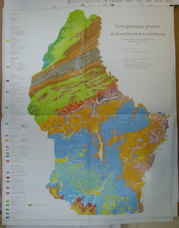
Luxemburg (1966). Carte Géologique Genérale du Grand-Duchéè de Luxembourg. Service Géologique de Luxembourg. Colour printed map, 89.5 x 70cm. 1:100,000. Geological Survey of Luxemburg.
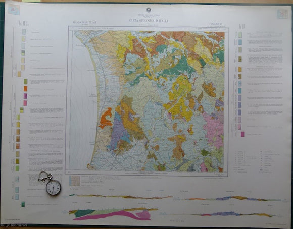
Massa Marattima, sheet 119, Carta Geologicad’Italia, 1969. 119 Massa Marattima.
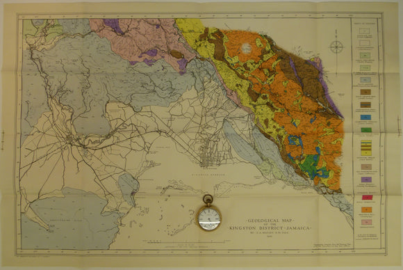
Matley, Charles A (1945). Geological Map of the Kingston District, Jamaica. Colour printed map (50 x 76 cm) at 1:63,360
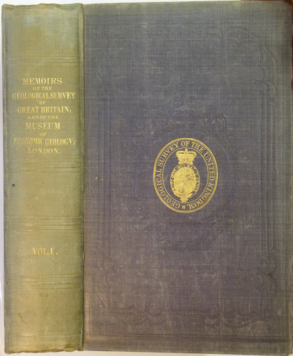
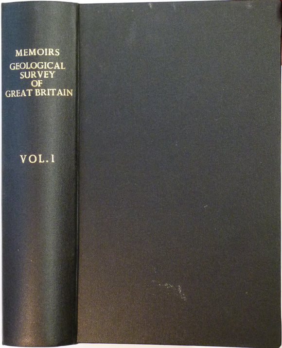
Memoirs of the Geological Survey of GB, v1, 1846. incl. De la Beche, On the Formation of the Rocks of South Wales & SW England. Geological Survey of England & Wales.
Memoirs of the Geological Survey of GB, v1, 1846. incl. On the Denudation of South Wales and the Adjacent Counties of England. Geological Survey of England & Wales.
Memoirs of the Geological Survey of GB, v1, 1846. includes 'Formation of the Rocks of South Wales and South Western England'
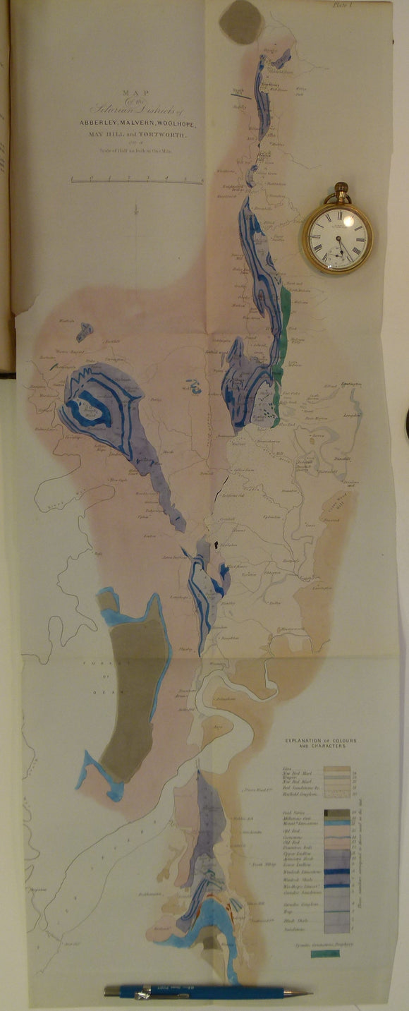
Memoirs of the Geological Survey of GB, v2, pt1, 1848. Incl. J.Phillips, The Malvern Hills. Geological Survey of England & Wales.
Memoirs of the Geological Survey of GB, v2, pt2, 1848. incl. De la Beche on the Coals suited to the Steam Navy. Geological Survey of England & Wales.
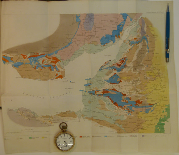
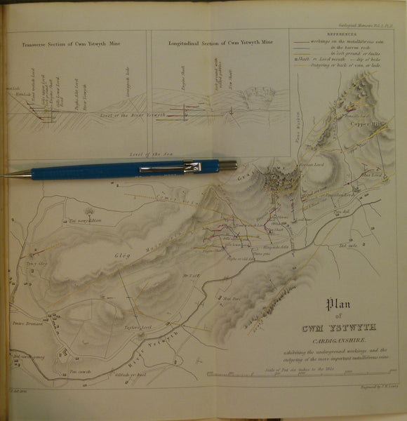
Memoirs of the Geological Survey of GB, v2, pt2, 1848. Incl. On the Mining District of Cardiganshire and Montgomeryshire. Geological Survey of England & Wales.
Memoirs of the Geological Survey of GB, v3, 1881. 2nd edition. ‘The Geology of North Wales’. Geological Survey of England & Wales.
Memoirs of the Geological Survey of GB, v3, 1881.2nd edition.‘The Geology of North Wales’. Geological Survey of England and Wales.
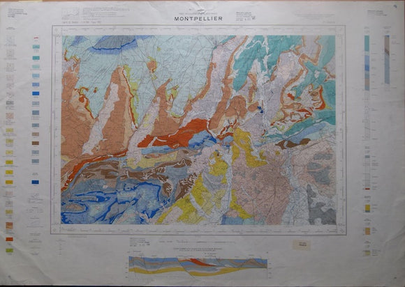
Montpelier, sheet 27-43, Carte Geologique de la France, 1971. Bureau de Researches Geologiques et Minieres.