Free UK postage
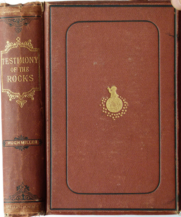
Miller, Hugh (1873). Testimony of the Rocks, or Geology in its Bearings on the Two Theologies, Natural and Revealed, 1873. William P. Nimmo.
Miller, Hugh (1911). The Old Red Sandstone; or New Walks in an Old Field, 1911. J.M. Dent.
Miller, Hugh, (1874). First Impressions of England and Its People, 1874. William P. Nimmo.
Murchison, R I. 1867*. ‘The Geological Structure of the Parish of Harting [NW Sussex]’, 13pp. in The History of Harting. published by author.
Murchison, R.I. (1859). Siluria. The History of the Oldest Fossiliferous Rocks and their Foundations; with a brief sketch of the Distribution of Gold over the Earth. John Murray.
Nicholson, H. Alleyne (1886). Natural History, Its Rise and Progress in Britain, as Developed in the Life and Labours of Leading Naturalists. London: W&R Chambers, 312pp. Chambers.
Nicol, James. (1863). ‘On the Geological Structure of the Southern Grampians’, extract. QJGS.
Nicol, James. (1869). ‘On the Origin of the Parallel Roads of Glen Roy, extract. QJGS.
Owen, Richard (1881). ‘Address to the Biological Section of the British Association’ reprint from the BAAS. British Association.
Pettus, John (1670) Repro. Fodinae Regalis. Or the History , Laws and Places of the Chief Mines and Mineral Works in England, Wales, and the English Pale in Ireland. Institute of Mining and Metallurgy.
Phillips, John (1853). The Rivers, Mountains and Sea-Coast of Yorkshire with Essays on the Climate, Scenery, and Ancient Inhabitants of the County. London: John Murray, 302pp,. John Murray.
Phillips, William. 1818. A Selection of Facts from the Best Authorities Arranged so as to form An Outline of the Geology of England and Wales, With a Map and Sections of the Strata. William Phillips.
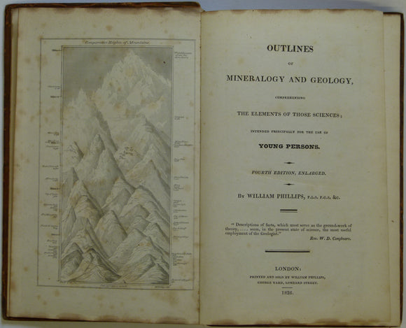
Phillips, William. 1826. Outlines of Mineralogy and Geology, Comprehending the Elements of those Sciences. Phillips, William.
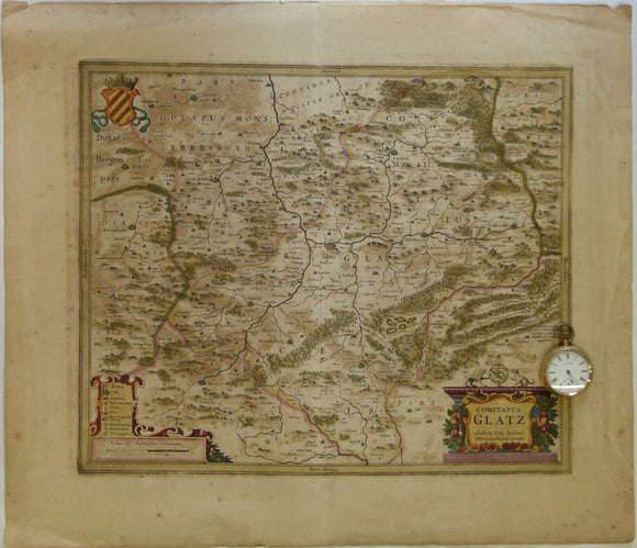
Poland. 1639. Comitatus Glatz. Authore Iona Sculteto. Henricus Hondius execudit, Amsterdam. Hand coloured engraving at 1:100,000 approx
Portlock, J.E. (1843). Report on the Geology of the County of Londonderry and of parts of Tyrone and Fermanagh. Longman et al.
Prestwich, Joseph, (1886/88). Geology: Chemical, Physical and Stratigraphical. Oxford: Clarendon Press, first edition. 2 volumes. Clarendon Press.
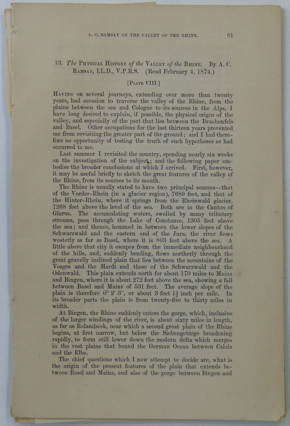
Ramsey, A.C, (1874). ‘the Physical History of the Valley of the Rhine’, extract from Transactions of the Geological Society. v.30, pp 81-95. Geological Society of London.
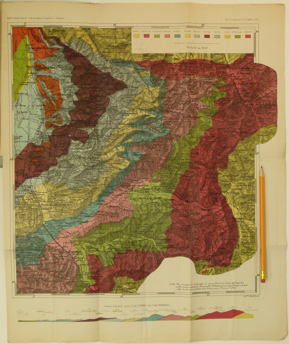
Sacco, Frederico, 1888. Untitled geological map of Villalvernia area (approx. 60km N of Genoa) in Liguria. Colour printed folded map
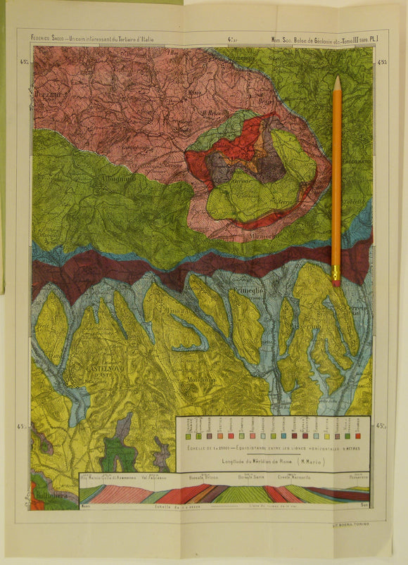
Sacco, Frederico, 1889. Untitled geological map of Castelnovo d’Asti (now Castelnuovo don Bosco) area (approx. 20km E of Turin)
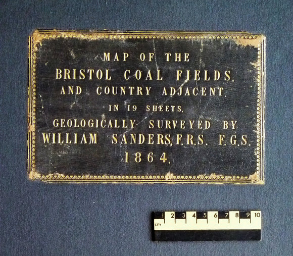
Sanders, William (1864). Map of the Bristol Coal Field and Country Adjacent in 19 Sheets, Geologically Surveyed. Hardback atlas, Rare. self published.
Schmidt, F. (1882). 'Sketch Map of the Silurian (and Cambrian) System in the Eastern Baltic Provinces of Russia. Geological Society of London.
Section No. 10 (1861). Six sections covering Slieverdagh Coalfield, Earl’s Hill Colliery, Boulea Collieries, Johnstown, Hollyford Mines, Marlow. Illustrates one inch maps 136, 145, 148 & 156. Geological Survey of Ireland.
Section No. 11 (1862). Four sections covering the Devil’s Bit Mountains, the Sleivebloom Range, Knockshigowna Hill. Illustrates one inch maps 126, 127 & 135. Hand-coloured. Geological Survey of Ireland.
Section No. 12 (1862). Five sections covering Slievenaman, Mt Argula, Freagh & Brandon Hills to Coolhill Castle, Coal Measures at Moneyfelim R., to Old Red Sst. near Goresbridge. Illustrates maps 147, 156 & 157. Hand-coloured. Geological Survey of Ireland.


![Murchison, R I. 1867*. ‘The Geological Structure of the Parish of Harting [NW Sussex]’, 13pp. in The History of Harting](http://geolmaps.com/cdn/shop/products/Murchison_Harting_1877_1_{width}x.JPG?v=1534782434)
![Murchison, R I. 1867*. ‘The Geological Structure of the Parish of Harting [NW Sussex]’, 13pp. in The History of Harting](http://geolmaps.com/cdn/shop/products/Murchison_Harting_1877_1_580x.JPG?v=1534782434)