Free UK postage
Sacco, Frederico, 1889. Untitled geological map of Castelnovo d’Asti (now Castelnuovo don Bosco) area (approx. 20km E of Turin)
Sanders, William (1864). Map of the Bristol Coal Field and Country Adjacent in 19 Sheets, Geologically Surveyed. Hardback atlas, Rare. self published.
Schmidt, F. (1882). 'Sketch Map of the Silurian (and Cambrian) System in the Eastern Baltic Provinces of Russia. Geological Society of London.
Section No. 10 (1861). Six sections covering Slieverdagh Coalfield, Earl’s Hill Colliery, Boulea Collieries, Johnstown, Hollyford Mines, Marlow. Illustrates one inch maps 136, 145, 148 & 156. Geological Survey of Ireland.
Section No. 11 (1862). Four sections covering the Devil’s Bit Mountains, the Sleivebloom Range, Knockshigowna Hill. Illustrates one inch maps 126, 127 & 135. Hand-coloured. Geological Survey of Ireland.
Section No. 12 (1862). Five sections covering Slievenaman, Mt Argula, Freagh & Brandon Hills to Coolhill Castle, Coal Measures at Moneyfelim R., to Old Red Sst. near Goresbridge. Illustrates maps 147, 156 & 157. Hand-coloured. Geological Survey of Ireland.
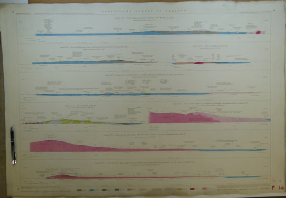
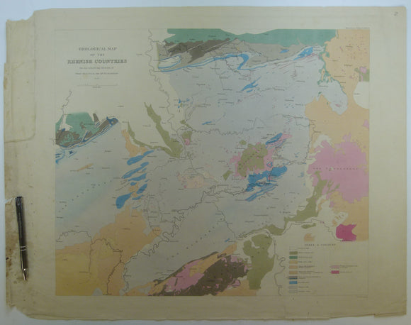
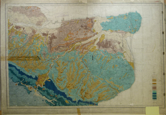
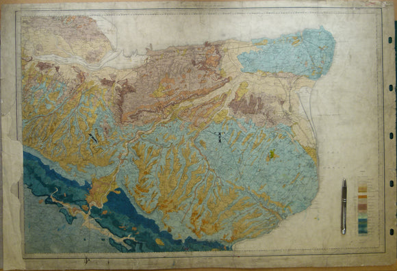
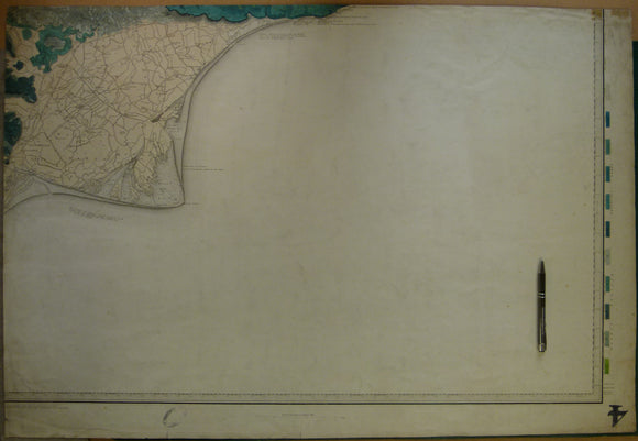
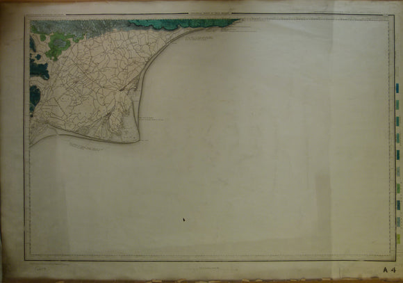
Section No. 13 (1862). 2 Two sections covering Comeragh Mtns, Suir R. to Poulakerry, 2. Boolyglass, over Brandon Hill to R Barrow, near Graiguenamanagh. Illustrates maps 156, 157, 167 & 178. Hand-coloured. Geological Survey of Ireland.
Section No. 14 (1862). Eight short sections in Dublin area from Hill of Howth to Blackrock. Illustrates one inch maps 102 & 112. Hand-coloured. Geological Survey of Ireland.
Section No. 15 (1862). Three sections covering Sybil & Slea Heads, Mt Brandon, Tralee Bay, Caherconree Mtn to Castlemaine Hbr. Illustrates maps 160, 161, 171 & 172. Hand-coloured. Geological Survey of Ireland.
Section No. 16 (1862). continuous section from Knockadoon Head by Youghal over the Knockmealdown Mtns to Galty Mtns. Illustrates one inch maps 156, 166, 177 & 188. Hand-coloured. Geological Survey of Ireland.
Section No. 17 (1864). Four Sections in Galway Bay region. Illustrates one inch maps 114, 123, 124 & 125. Hand-coloured. Geological Survey of Ireland.
Section No. 18 (1864). Three sections covering Scarriff, over Slieve Aughta to Dunsandle, Cashlaundramlahan to Toberdatan, Marble Hill to Dalystown. Illustrates maps 115, 116, & 124. Hand-coloured. Geological Survey of Ireland.
Section No. 19 (1866). Continuous section from Toe Head, by Bantry to Gilgarvan. Illustrates maps 184, 192, 200 & 205. Hand-coloured. Geological Survey of Ireland.
Section No. 20 (1865). Continuous section across Kenmare Valley, Macgillycuddy’d Reeks, and Slievemish Mtns near Tralee. Illustrates maps 162, 173 & 184. Geological Survey of Ireland.
Section No. 3 (1860). Covers Maryborough, Castlecomer Coalfield, Barrow valley, Bagnalstown. Hand-coloured engraving, iIllustrates maps 127, 128, 137 & 147. Geological Survey of Ireland.
Section No. 32 (1892). Continuous section across Kenmare Valley, Macgillycuddy’d Reeks, and Slievemish Mtns near Tralee. Illustrates maps 162, 173 & 184. Hand-coloured. Geological Survey of Ireland.
Section No. 9 (1861). Five sections covering Silvermines, Arra Mountains, Cratloe Mountains, Slieve Bernagh, Ennis. Hand-coloured engraving. Illustrates maps 132, 133, & 134. Geological Survey of Ireland.
Sedgwick, A. and Murchison, R.I. (1842). ‘Geological Map of the Rhenish Countries’ from Transactions of the Geological Society,. Geological Society of London.
Sheet 2, Old Series 1". Essex, Burnham and Kent, Sheerness, 1868, first edition. Hand-coloured. Geological Survey of England & Wales.
Sheet 2, Old Series 1". Essex, Burnham and Kent, Sheerness, 1883. Hand-coloured and issued 1907. Geological Survey of England & Wales.
Sheet 3 drift, Old Series 1". East Kent, Dover, Margate, Canterbury, Isle of Sheppey. 1889. Geological Survey of England & Wales.
Sheet 3 drift, Old Series 1". East Kent, Dover, Margate, Canterbury. hand coloured, 1889. Geological Survey of England & Wales.
Sheet 4, Old Series 1". Kent, Romney Marsh, Rye. 1863, first edition. Hand-coloured. Geological Survey of England & Wales.
Sheet 4, Old Series 1". Kent, Romney Marsh, Rye. 1863, first edition. Hand-coloured engraving. Geological Survey of England and Wales.